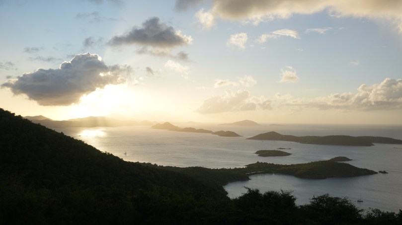
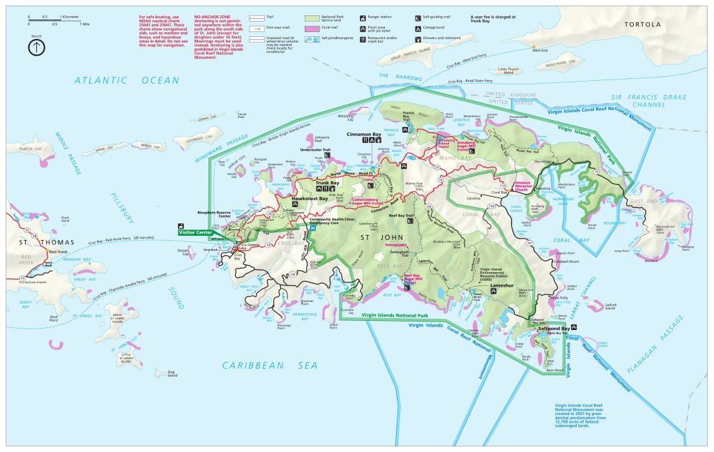
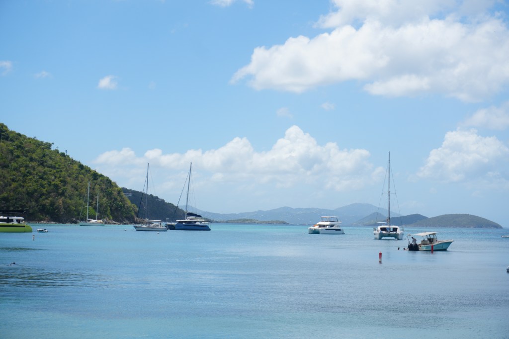
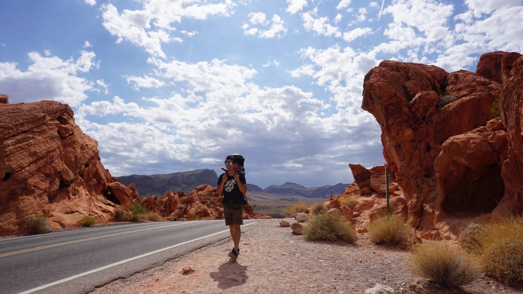
Of all 63 national parks of the United States, Virgin Islands National Park is one of the most remote. Located on Saint John, an island in the Caribbean Sea, Virgin Islands National Park covers nearly 15,000 acres of lush tropical forests, white sand beaches, mesmorizing snorkeling and a thriving wildlife scene. The national park covers approximately 60% of the island of Saint John and is protected under the national parks system.
Our last big trip to a national park was years ago when we took on Utah’s Mighty 5 National Parks. Six years and two more kids later, we felt like we finally had the gumption to go on another big adventure.
In the last week of March we embarked on two flights and arrived in Charlotte Amalie, the capital of the Virgin Islands on St. Thomas Island.
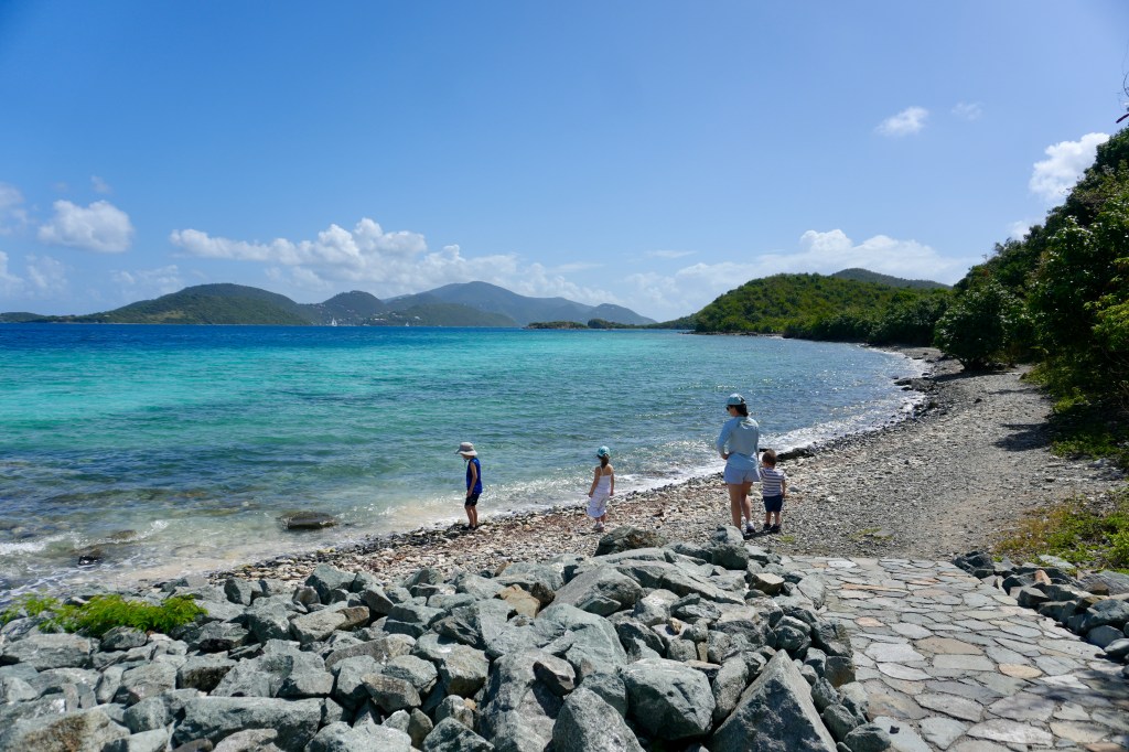
From here we took a ferry across the Pillsbury Sound to reach St. John. Upon arrival, the warm and humid air hits you in a pleasant way after a long winter. Colorful homes are situated in all layers of the island, giving you a sense of the mountainous terrain to be traveled ahead. Influenced by its Danish colonial background, the cars drive on the left hand side of the road. The people are nice and the bugs are out at night. We made it. We stayed in the Cruz Bay area, where several local markets, made it easy to get food and supplies for the week.
As beautiful as the islands are, the Virgin islands bear a dark history of Danish colonialism. In the 1600s, Denmark fought and cliamed St. Thomas and St. John for its West Indies colony. Their plan was to grow cotton and sugar, powered by a labor force of indentured Europeans. This proved to be not viable, based on supply and demand. Supplied by a Danish fort in Ghana, slaves were sold to the Virgin island colonies. Over the 200 years, 85,000 slaves were sent to the Virgin islands.
After years of rebellion and reckoning, the United States purchased the Danish West Indies after world war 1 in 1917. The Virgin Islands National Park was established in 1956.
In the last week of March, the weather in the Virgin Islands was sunny, with lows of 78 degrees high of 81 degrees. We explored mostly the northern end of Virgin Islands National Park.
Day 1 – Maho Bay – North Shore
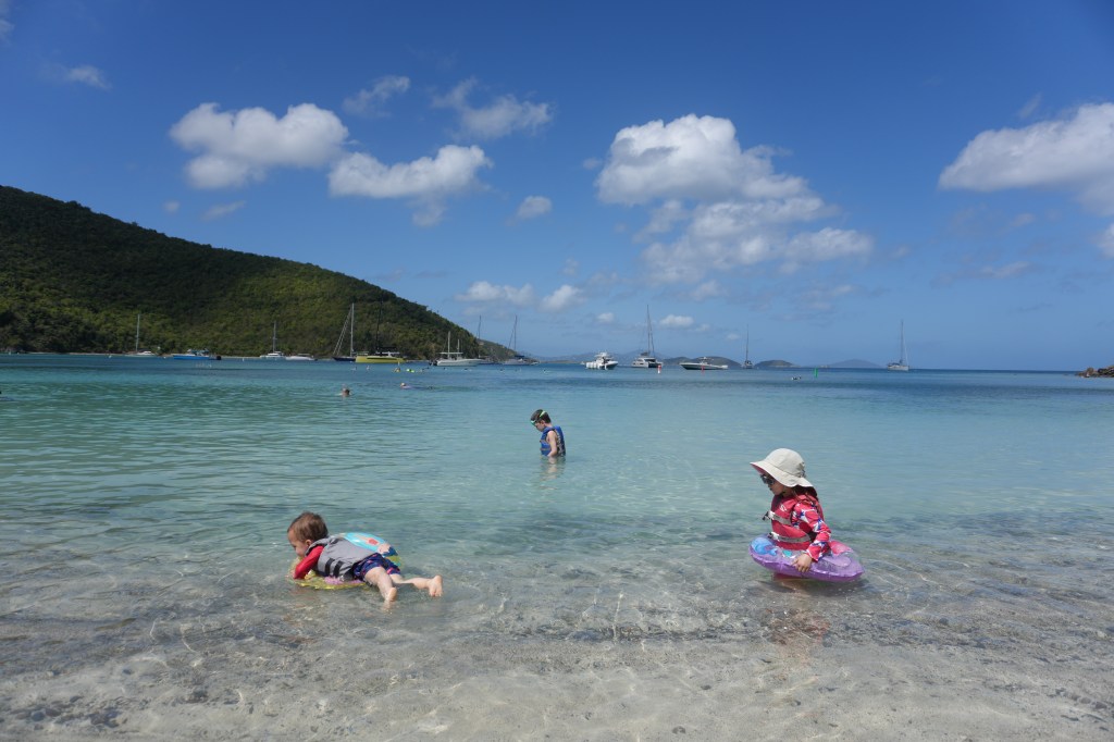
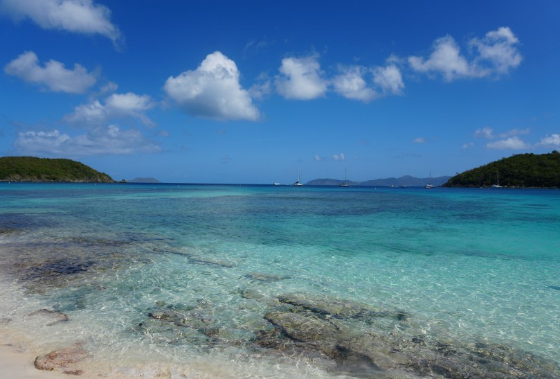
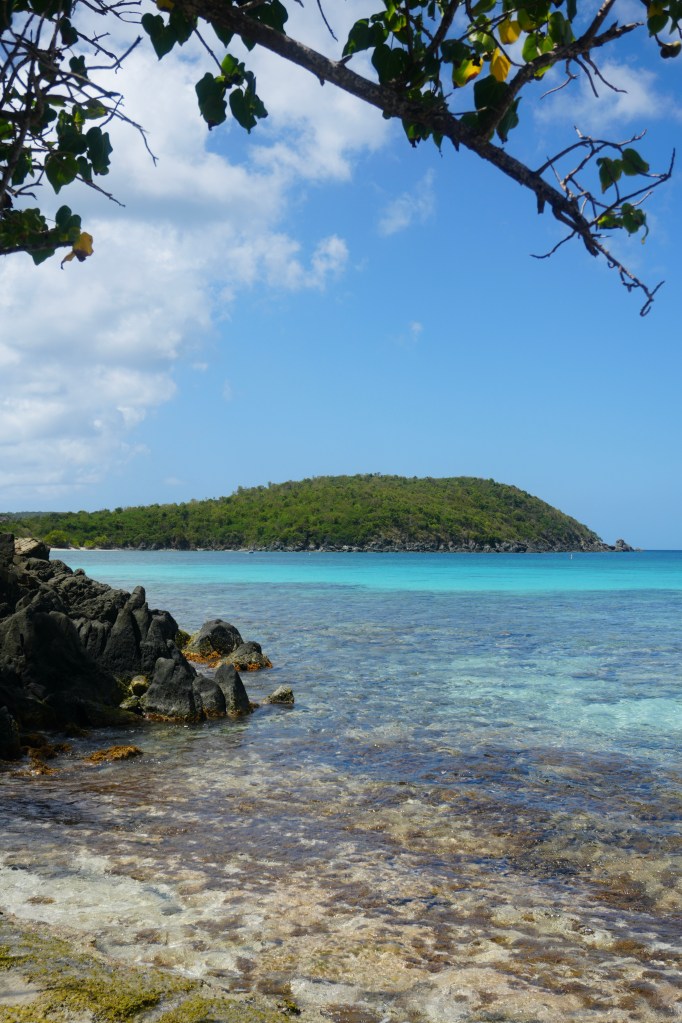
Maho beach features 0.3 miles of white sandy beach, and is known for its larger areas of seagrass, attracting sea turtles. The calmer waters of Maho bay make it a popular destination for families. There are several food and drink vendors across the street offering snorkel gear and kayaks. This spot was a good introduction to the national park, it showed us what was in store for the rest of the island.
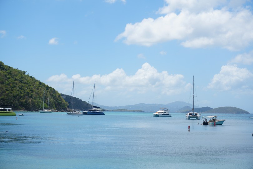
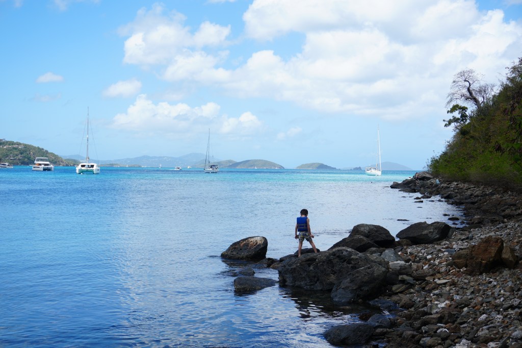
Day 2 Hawks Nest Bay
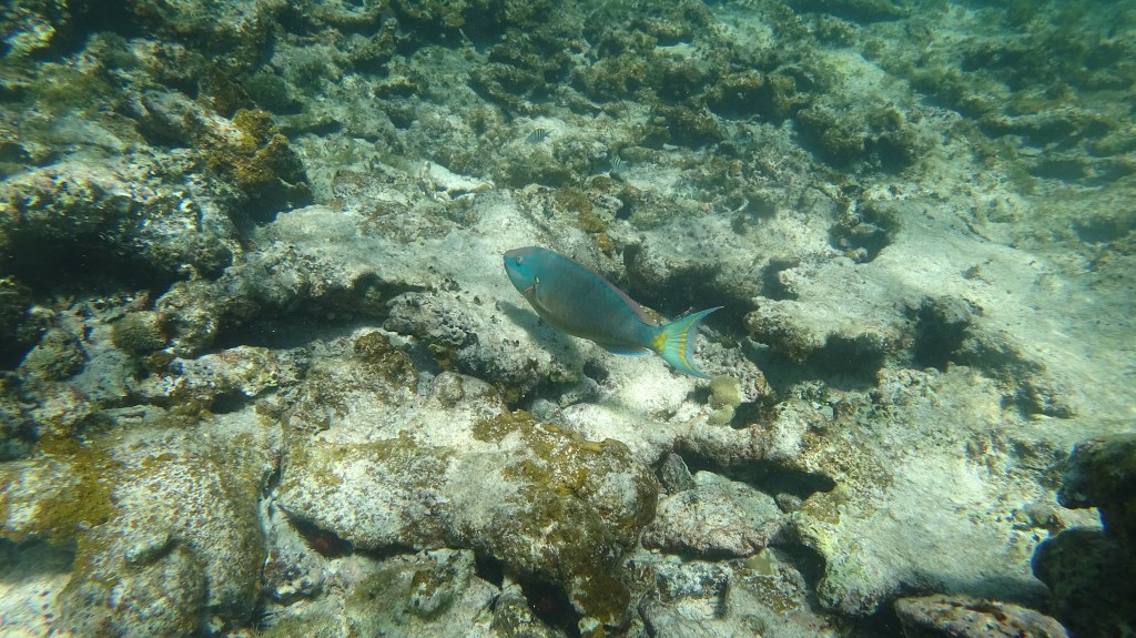
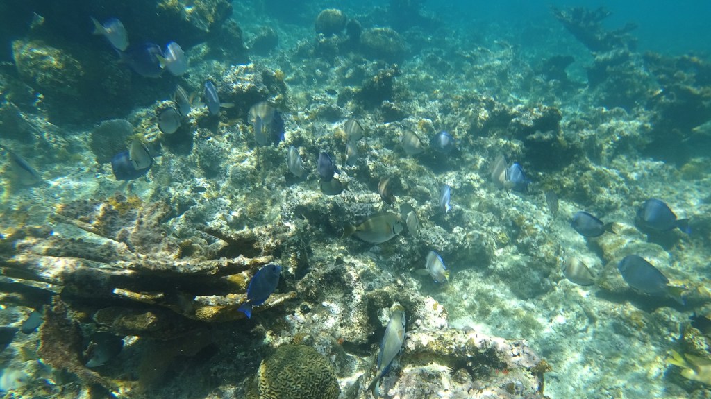
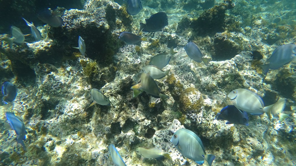
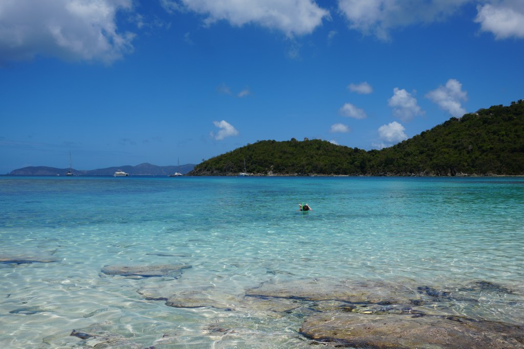
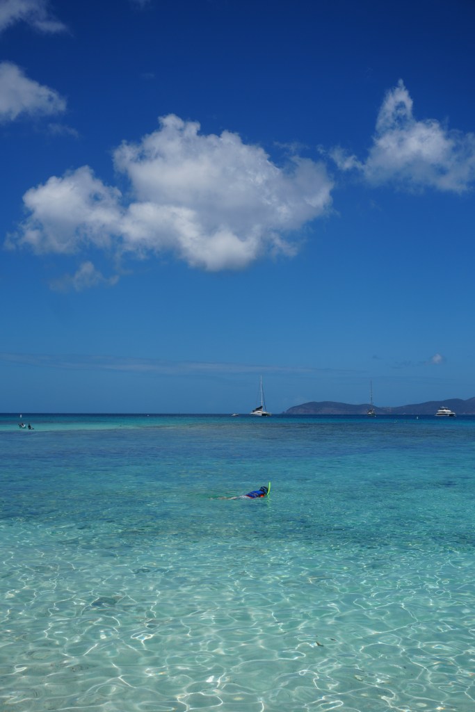
Hawks Nest Bay was one of our favorite spots. It is one of the closest access points to the entrance which led me to believe that it would be crowded. Surprisngly, it turned out to be a very peaceful spot with excellent snorkeling. The stretch of beach was also home to many small hermit crabs that scuttled around. Hawks nest was where I was able to first begin to understand the rich wildlife and amazing network of the coral reefs.
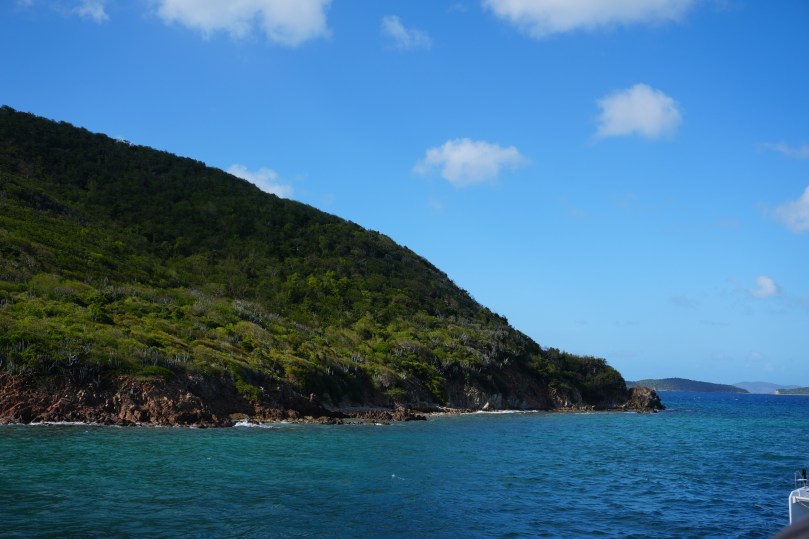
Day 3 Hike to Waterlemon Cay (Leinster Bat Trail) – high 82, low 77 occasional showers
With a forecast predicting heavy showers throughout the day, we decided to venture out to the waterlemon cay to bay hiked the Leinster Bay trail. This was an easy 0.8 mile flat hike along the coast. It is one of the few flat hikes in the national park and perfect for little kids as well. This hike takes you through some shady areas, with beautiful flowers, and wildlife along the way. The hike along the coast certainly makes you feel small as we gazed out to the vast sea. The pelicans, sea turtles and hermit crabs were all out to play. Most people hike the Leinster Bay Trail to get access to Waterlemon Cay (boasting some of the best snorkeling on St. John.)
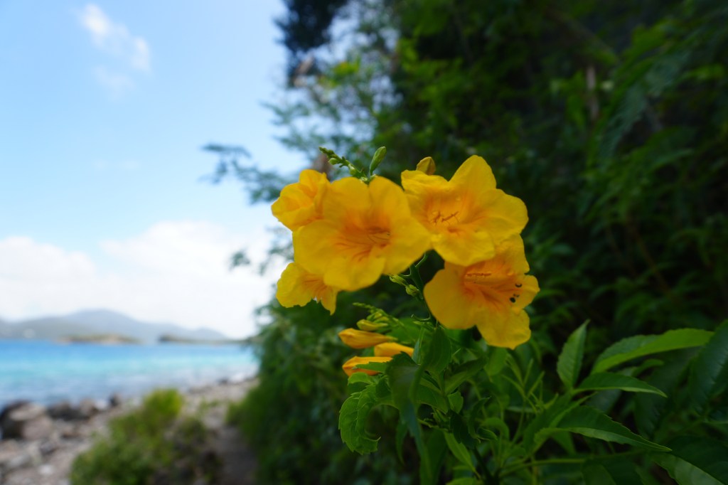
Pictured above: The yellow flower of Tecoma Stans (aka: Ginger Thomas, Yellow Elder) is the official flower of the US Virgin Islands. Interestingly, it is not a native flower, however the species has been highly successful in the caribbean.
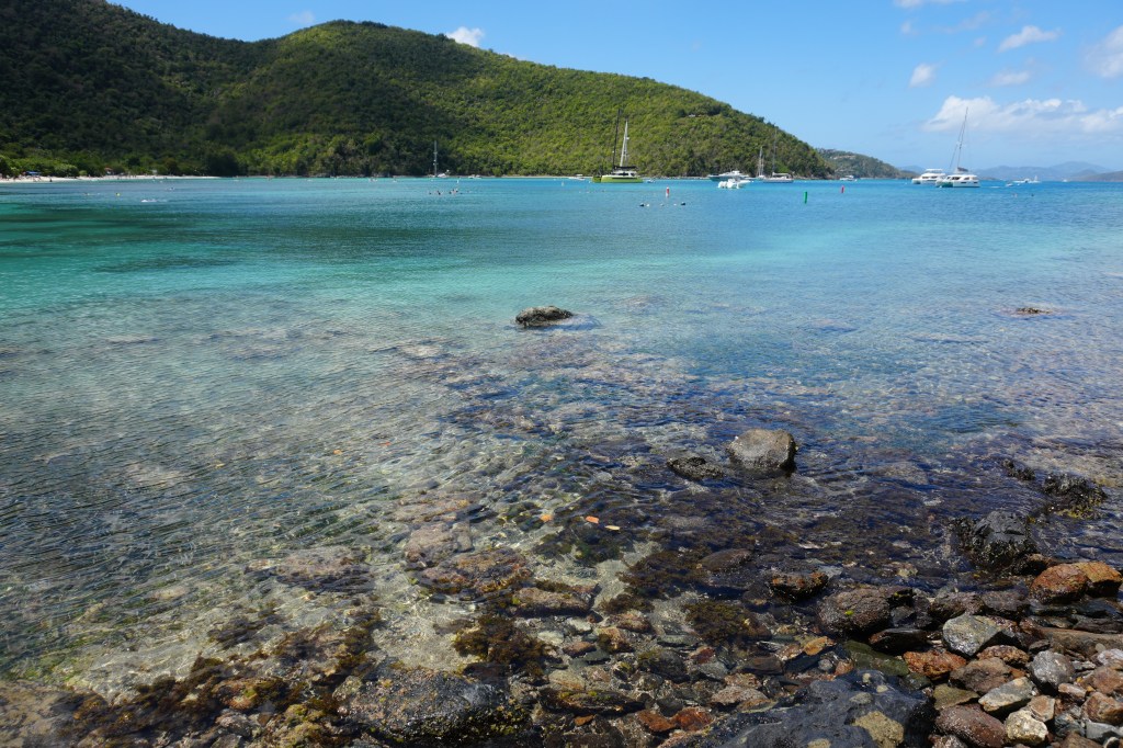
Day 4 – Trunk Bay – High 81F, low 77F windy
Probably one of the busiest beaches in the beach, Trunk Bay is known for it’s snorkeling and an underwater snorkel trail. With a larger opening to the sea, the water was choppier here and it looked like good generate enough swells for some surfers on certain days. This area of the park had plenty of food, drink, rentals chairs, and sports equipment for rent.
We live on such a beautiful planet, and Virgin Islands National Park is a prime example of that beauty. Please remember to respect the land, water and reefs when you pay a visit to this spectacular national park.
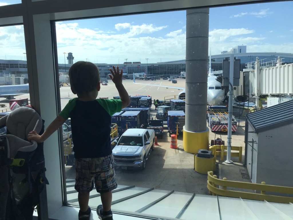
My wife and I were finally in a spot where we could take a solid 10 days off (Sep 15-25) together with our 23 month old son for a family vacation before I started my new job. We contemplated several different destinations. We were considering Maine (Acadia National Park), Western Canada to the rockies or even Ireland. We ultimately decided that this was the perfect opportunity to take on the “Mighty 5″ National Parks of Utah (Zion, Bryce Canyon, Capitol Reef, Canyonlands and Arches National Park). I was initially concerned about the amount of car time our toddler would have to put up with. Looking at the map, we would tally over 800 miles of driving broken up over 10 days. He has proven to us however on past trips to Shenandoah, Yellowstone and the Great Smokies that he was a road warrior.
Minh plays with his bulldozer while taking in the vegas views
Day 1: Richmond, VA to Las Vegas
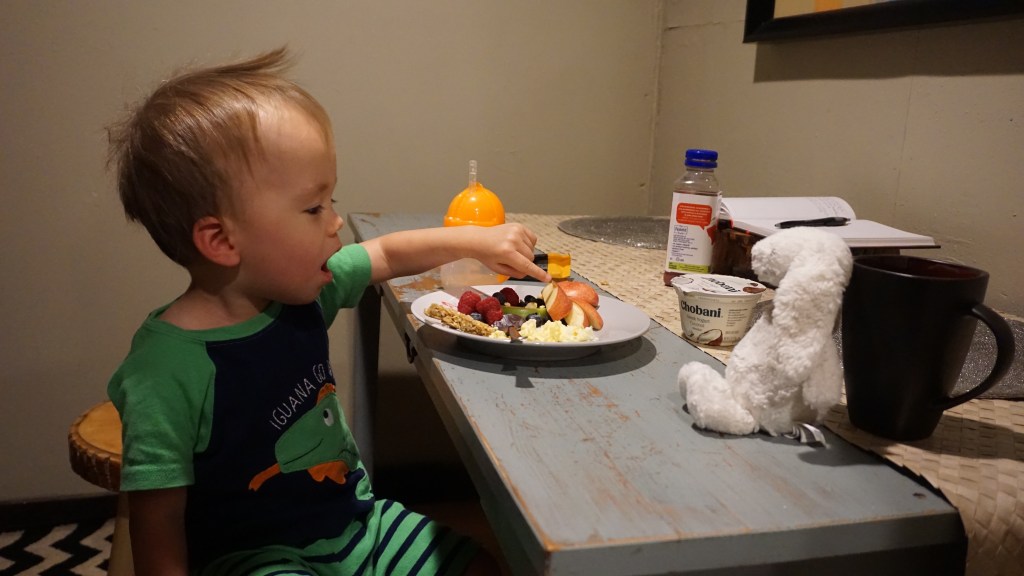
Our journey started in Las Vegas, after a long travel day from Richmond, Virginia with a layover in Charlotte, North Carolina, we were exhausted. Minh did surprisingly well on the both legs of the flight. I don’t think we could have done it without “Bob the Train”, his favorite TV show. For the most part, we don’t allow him to watch tv, tablets or phones during the day, we save them for long travel times in the car or plane. As a result, he is able to stay occupied for hours because it is still novel to him. We packed along toys on the plane as well such as cars, bulldozer, play doh and of course plenty of snacks. We arrived in Vegas at midnight eastern time zone, but Minh was wide awake once we stepped into the Venetian, the lights, sounds and bustle of people even at this hour was enough to get him riled up. I’m surprised he was able to fall asleep that night!
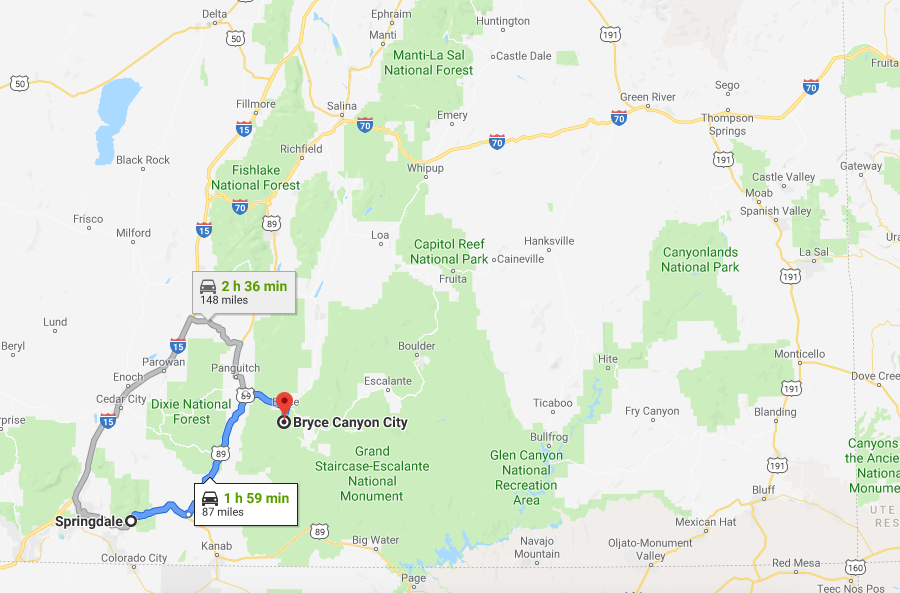
Day 2: Las Vegas, Nevada to Springdale, Utah (159 miles)
This leg of the trip was what I called the “HOT” segment. The drive along interstate 15 was easy enough, but it was a scorcher through the desert at 103 F. While the desert is a beautiful place, I find that its desolation and unforgivingness leaves me with a sense of loneliness and unease. At these moments, I compare deserts to forests. While both are magnificent; one of them provides, and the other taketh away….
We made a short detour to the Valley of Fire State Park (Nevada’s oldest state park). The park is named after red sandstone which were formed from shifting sandstone formations 150 million years ago. Under the harsh sunlight, these formations give the illusion that they are literally on fire. Stare long enough, and the rock formations started to look like faces trapped in stone….creepy. We wanted to go on a decent hike of 2 miles however the extreme heat cautioned against this idea. Thankfully, Valley of Fire is a driver friendly park and we were able to hop from point of interest to the next.
We arrived in the town of Springdale, Utah (pop 529) that night, all of us were pretty exhausted. We stayed at a peaceful air bnb with an unexpectedly green and lush backyard for our son to run around. It was clear that the owners worked diligently to keep the garden and lawn flourishing. Water barrels and a irrigation systems seemed to be all placed carefully. It was odd to see so much green in the desert, but it was certainly welcoming. I made a trip to the general store that night to pay an arm and a leg for milk and breakfast items for our crew the next day. On the way back, I saw that there was a grocery store, “Sol foods”, that was open late…..awesome. I didn’t really care at this point. We were in Zion and we had the next two full days to explore it.
Day 3: Zion National Park
The next morning, a combination of the climate, altitude change and allergies seemed to hit us all at once. We were congested and drowsy to say the least. We decided that we were going to take it easy and spend the day on short hikes and get a good idea of the layout of Zion. For those that wish to drive into the park, be warned that even in shoulder season, parking spaces in Zion are pretty much full by 8-9am! Instead, an excellent shuttle bus system runs through the town of Springdale (every 15 minutes or so) and will take you directly into the park. We hitched a ride in front of our street, along with many other hikers in one of the shuttles. Minh really seemed to like the bus system and he proceeded to sing “the wheels on the bus go round and round” for all to hear.
We started our adventure at the visitor center to discuss trail conditions, special highlights, get maps and hear recommendations. When traveling with a toddler, I am not ambitious about what we attempt to accomplish. My main concern out here was safety and letting him have a good time. We took on the Kayenta trail, a mild hiking trail that wasn’t heavily populated. We later went back for ice cream and lunch in front of Zion National Park Lodge. Minh was getting used to the hiking. We had our bearings, and we were ready for the Narrows the next day.
Day 4: Zion National Park (The Narrows) and travel to Bryce Canyon City (87 miles)
Temperature High: 70 F, Low 57
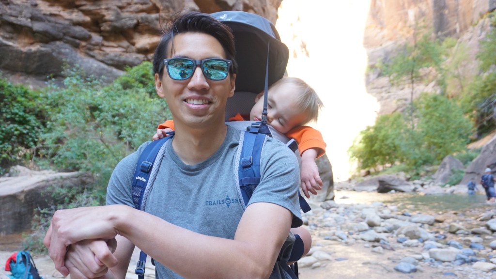
We needed to get an early start today. Sarah and I woke up at 5:30am to pack all of our belongings and load the car and prepare breakfast while Minh slept. Once he awoke, we all eat a hearty breakfast and drove into the park at 7:30am. It was cold and dark. Sunrise was at 7:07am although we were heading to the bottom of the canyon and I didn’t expect sunlight to reach us until noon. At this early part of the day, parking was still available. We made our first stop, just outside outside the park at Zion Outfitter, a canyoneering and camping equipment store to rent canyoneering boots and socks for the hike in the narrows.
“The Narrows” is Zion’s most popular attraction and hike. It is the narrowest section of Zion Canyon where the North Fork of the Virgin River flows. There are two ways to approach “the Narrows”.
1. 3.6 mile bottom-up hike from Temple of Sinawava to Big Springs. This is the most popular approach and the easiest. This is what we would be attempting.
2. You could also hike the Narrows from top-down. A 16 mile hike from Chamberlain’s Ranch back to the Temple of Sinawava. This approach requires a permit, as well as careful planning because it is a 2 day excursion.
Please be careful carrying your child in the packs. The water can be deep in many areas. Make sure you have plenty of help around you.
Careful weather planning is needed before attempting the Narrows. As you can imagine, the area is incredibly dangerous during times of rain as it is susceptible to flash flooding.
This hike was one of the main reasons we wanted to come to Utah. It lived up to the hype and every step of the way was gorgeous. The water is clear and the light reflecting from the canyon walls spectacular. Minh enjoyed this segment greatly! We decided not to hike the whole 3.6 miles mostly for safety reasons. On all of these hikes, I carried Minh in a Deuter Comfort Active pack that we purchased specifically for this trip. I love this pack. It is comfortably for the passenger as well as the carrier. It is lightweight and the passenger sits closely to your back to prevent that torsional force on the spine. I saw a few others with kids on their back. It is very important to practice extreme caution when hiking with a toddler. Always 3 points of contact for me, and also making sure I had firm footing. Trekking poles are a must. We finished our hiking at approximately noon and head back to the parking lot to return all of our gear. Minh was tired and thankfully slept all the way to Bryce Canyon town.
Day 5: Bryce Canyon National Park
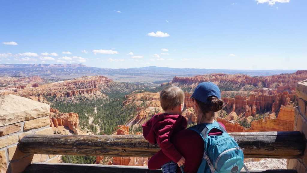
Minh points to Thor’s Hammer in the distance, one of the most recognized sights in Bryce Canyon.
We awoke in the town of Bryce Canyon to clear skies and cool temperatures in another air bnb. This was probably my favorite place that we stayed at because we had a beautiful backyard all to ourselves with a small playground and trucks to play with. Behind us was a wooded area where plenty of deer roamed. They even crossed through the backyard to welcome us. Similar to Zion, a bus shuttle system takes visitors throughout the park. I have heard from many visitors that Bryce was their favorite park of the mighty 5. I could easily see why. The views are unlikely any other. The canyons are filled with thousands of hoodoos (a tall thin spire of rock that protrudes from the ground). Many of the locations are drive up views, but the hiking trails into the canyons are amazing. We took on the Queens Garden trail that meets up with the Navajo Loop trail to get back to the top, the purpose was to see Wall Street and Thor’s Hammer. Bryce did not disappoint.
Wall street
Hoodoos for miles
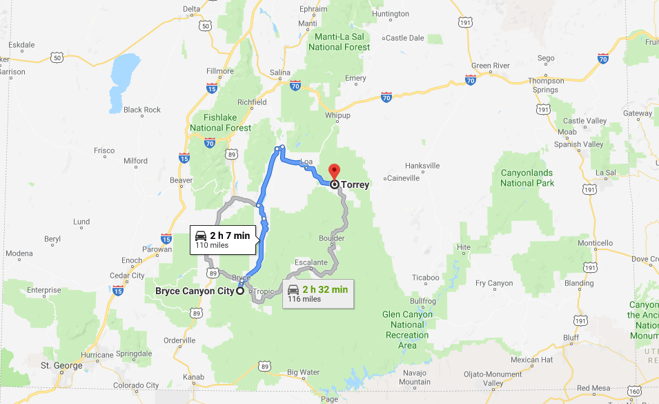
Day 6: Bryce Canyon City to Capitol Reef National Park (109 miles)
We head out the next morning to the town of Torrey, Utah (population 243). We arrived at approximately noon and head straight out to see Capitol Reef National Park only a short drive away. Out of the might five national parks, Capitol Reef is considered by many to be “in the middle of nowhere” as it is far from the interstate. This park is definitely the least visited of the mighty five although I actually preferred the peace and quiet out there. This was our easy day. The Fruita valley is where we spent a good portion of our time, exploring the beautiful apple, apricot, pear orchards. Minh loved picking fruit from the tree, I think the idea of it was still novel and amazing to him. We stopped by the Gifford house and enjoyed some berry pie on the picnic tables outside. We head back to Capitol Reef resort to settle for the night. Surprisingly, the view outside our door was one of the best we had during our tripping.
Day 7: Capitol Reef to Moab, Utah (136 miles)
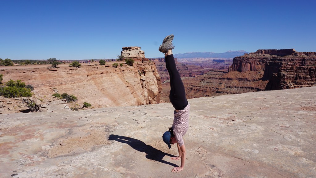
We woke up this morning to complete a hike in Capitol Reef, our goal this morning was to see Hickman bridge before we made the drive to Moab. The Hickman bridge trail is an easy 1.7 mile hike out to the natural bridge and back. Overall the hike is very pleasant and moderate in difficulty. One thing we noticed on these trails, were the “beware of aggressive wasps” signs. As we approached the bridge, Sarah actually got bit by one! These were certainly aggressive and they went after her for sure. Interestingly enough, no one else nearby including Minh and I were being swarmed by these wasps. Aside from the wasp incident, this trail was awesome. We packed up into the car and made the 2.5 hour drive to Moab, Utah. Thankfully Minh slept for most of this leg. We arrived in the town of Moab to reunite with Minh’s grandparents for the last few days of the trip. He was certainly thrilled to see them. I also believe that he was more cooperative as he is surrounded by more adults. 4 to 1, he didn’t stand a chance. Moab was the biggest town by far, that we’ve been in for several days. Population greater than 5000. Amazingly, 3 million visitors come to Moab each year to engage in every outdoor activity possible.
Day 8: Canyonlands National Park
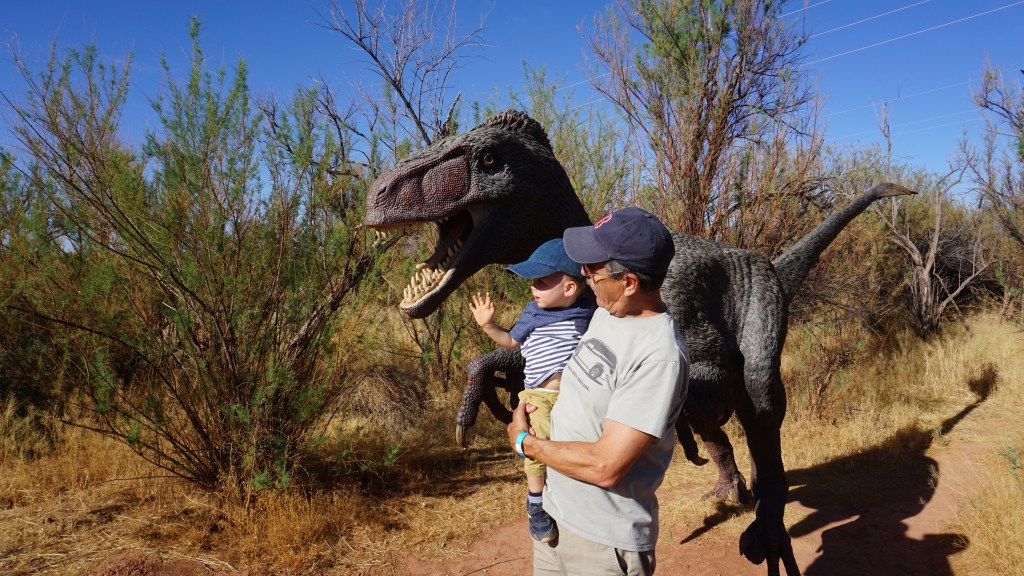
The next morning, we head out to explore Canyonlands National Park, the fourth of the might five on our list. I was amazed at just how different each of the parks could be, even though they were in the same geographic region. Canyonlands made me feel the smallest. The awesome thing about Canyonlands is the fact that you are able to get up close and personal with alot of these canyons. Just outside, the national park is Dead Horse Point State Park which actually boasts some of the most impressive views on the entire trip an absolute must detour. We also allotted some time at the end of the day to go to Moab Giants, a dinosaur park for kids that features full sized dinosuars along a 0.5 mile trail through the desert, a 3D prehistoric aquarium that Minh loved, and dinosaur playground. As a giant dinosaur fan, this was also a must visit for us.
Day 9: Arches National Park
One of the most popular of the mighty five is Arches. It is only 1 mile north of Moab and bordered by the Colorado River in the Southeast. It is home to over 2000 natural sandstone arches. The most famous of which is probably the “Delicate Arch” which is featured on probably every postcard and tshirt. We were actually able to get in some good hiking at Arches to see the thin Landscape Arch and Minh had the opportunity to play in a giant sandbox. If you only had an hour in Arches, I would go to the “The Windows”. From this parking lot, you are able to access several arches all in one spot. Including the famous “windows”, “turret” arch and the “double arch”. All of which are within sight of each other.
Probably pointing at a bulldozer
The best sandbox
Day 10 Arches National Park to Salt Lake City (233 miles)
On our last morning, Sarah and I rose early to get in Arches National Park to see the sunrise. We decided to go the “windows”, a popular spot that opens up to several fantastic arches. I was surprised when there were actually far less people who were willing to wake up at this hour than expected. In retrospect, the hours between 6:30am and 8:30am are probably the golden hours of the park. The trails are empty and the colors spectacular. The cool temperatures also allow for optimal hiking conditions. We were both surprised that even at 8:30am, we were able to get some prime locations all to ourselves. We head back to back up the cars and then made the long drive to Salt Lake City for our flight home the next day.
Looking back on this trip, I was amazed at the distance we were able to travel with our little boy. It actually didn’t feel tiring at all, because we were fueled by the thrill of new sights and we had clear objectives each day. Above all else, I am grateful that we were able to travel safely without any accidents or injuries. There are certainly risks involved when traveling with a child on a road trip like this through the desert. Medical centers are few and far between so make sure that you are prepared. I’ve compiled a list of essentials that I think anyone going on such a trip such strongly consider bringing.
Also, for anyone considering making the “mighty five” road trip, I would also highly recommend allocating time to seeing some of the state parks. Many of these parks in the area offer spectacular views and are less crowded than the national parks.
Essentials:
– medical kit with “epi pen”
– abundant supply of water (national park services recommend drinking 1 gallon of water per day, this is actually twice the amount recommended during a typical day in the city).
– sun protection (sunblock, sunglasses!)
– satellite messenger if hiking in remote areas
– hard copy maps or GPS (signal strengths are variable out in the desert)
– multi purpose tool (ex. swiss army knife)
– carry two sets of car keys! (we helped a couple at canyonlands when they locked themselves out of the car)
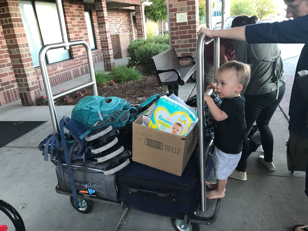
I normally wouldn’t log this trip as an expedition, but with a 19 month with us, it sure felt that way. My friend was getting married in Nasheville and he suggested that I head out a week early to explore the Great Smoky Mountains National Park as well as the surrounding Gaitlinburg area before the wedding. Gaitlinburg is listed at 6 hours and 41 minutes from Richmond, and I have always been looking for an excuse to go to the smokies. We felt like the distance might have been quite a stretch for our 19 month old son, but he has always been quite a good lil traveler so we decided to brave the roads instead of the airplane. He had never travelled such a distance by car before and I had no idea how he would tolerate it. So we ended up allotting a 12 hour travel window for us with scheduled 2 hour breaks in between so he could run and stretch his legs.
Roanoake River
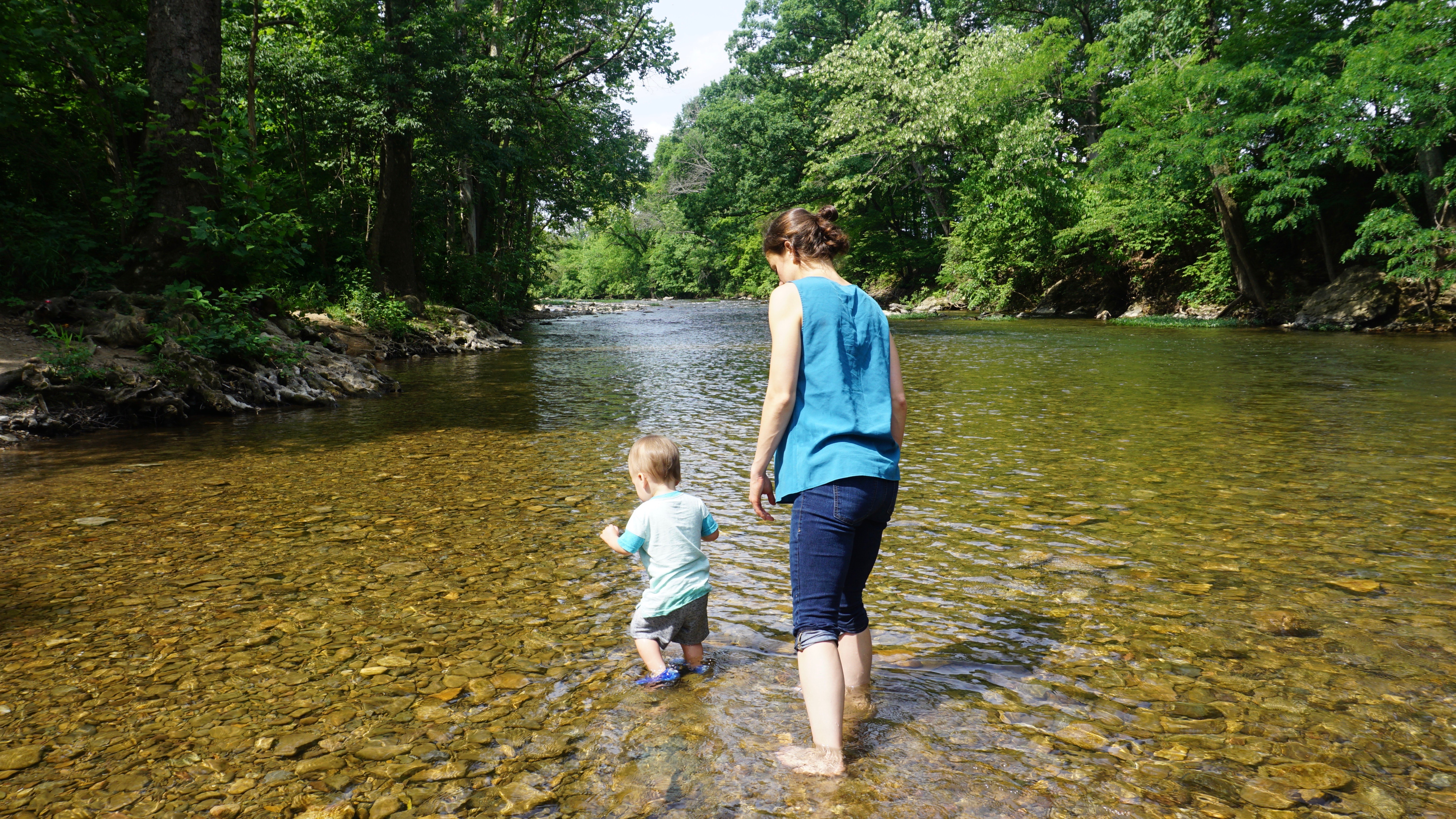
Departure: 6:30am. The first leg of the trip went very well. We were able to get in 2.5 hours before our first stop in the town of Roanoake, Virginia. We stopped at Greenhill Park, and it was the absolute perfect pit stop. For a toddler, this park was like an oasis. It had it all, a playground, picnic tables, shaded areas, and even the roanoake river coursed through the park for fishing and cooling off. The bend of river that traveled through the park was very clear and shallow. It was perfect to wade and search for fish and crayfish. Our son loved this spot a little too much and as expected, it was a battle to get him back into the car…fortunately, the weather was merciful and by mid-day it was still surprisingly comfortable.
cabin views
Soon enough we were on 81 south again, as the interstate rolled gently through the hills towards Tennessee. We covered a couple of hours before we stopped again in Bristol, VA/Tennesee for lunch. We finally finished the leg to our cabin at about 4:30pm (a total travel time of 10 hours) 2 hours ahead of schedule! We actually stayed just outside Gaitlinburg in a town called Sevierville, Tennessee (population 16,716). We were all excited to stretch our legs, jump on the bed a few times, and get outside and take in some of the beautiful views. It did not take us long to get settled into our new home for the next 5 days and 4 nights. Our son instantly fell in love with the place and of course the air hockey table. We all rested easily that night, in a cabin up in the clouds after a long day of travel – we were pretty worn out.
Gaitinburg
Black bear.
smoky mountains
The next morning, we woke up early to head into the national park. The drive was a short and easy 20 minutes into the park. Out of all 60 national parks in the United States, the Great Smoky Mountains is the most visited park with more than 11.6 million visitors in 2016. This is likely due to the fact that it is one of the few parks on the east coast and it is also free admission. I was surprised to see the level of commercialization of the surrounding area. The town of Gaitlinburg is essentially one big tourist trap, with everything from “Ripley’s Believe it or not” to go carting! I personally found this to be off-putting but many people seemed to love it. I guess I always imagined the national parks as one of the few special places on earth protected to bring us closer to the outdoors. They are meant to inspire future generations to learn about the environment and the importance of different ecosystems. Instead, in Gaitlinburg, there are endless shops and stores that sell meaningless t-shirts and merchandise… all of which will likely end up in a landfill within a couple of months. While, Gaitlinburg can be very entertaining for children, it feels out of place so close to a national park.
The ascent up to Laurel Falls.
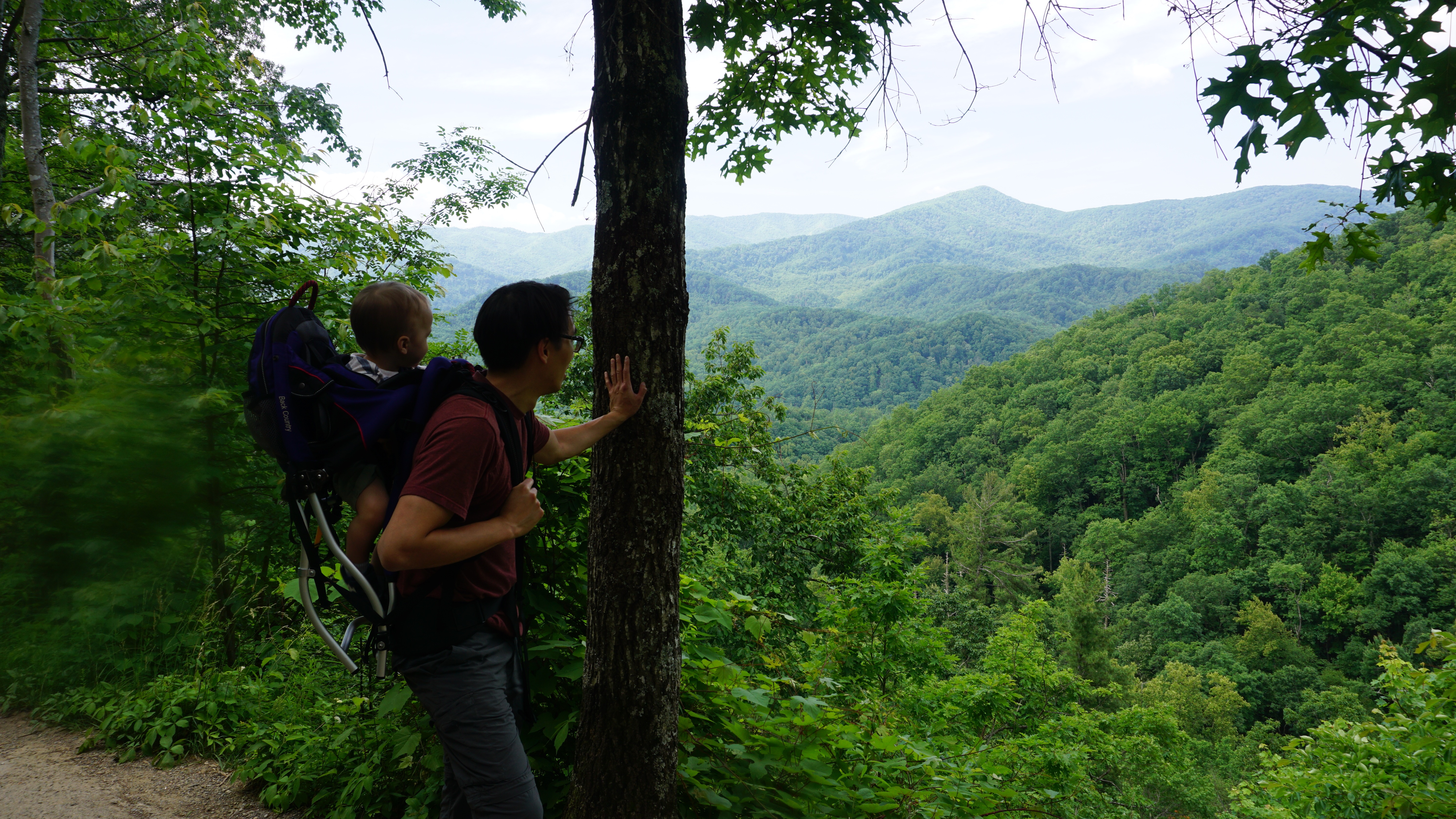
The park itself is very nice and actually very similar to Shenandoah National Park. We chose our hikes carefully…..something feasible with a 27lb 19 month old on your back. We arrived early in the park and were fortunate enough to get a parking spot at Laurel Falls. It was an easy one with only 314ft elevation gain over 2.4 miles. Our son particularly liked the Sugarlands visitor center where he finally got to meet a black bear (the goal of his trip). He even posed next to it for some pictures. He always seems to enjoy visitor centers at parks, whether they be state or national. They offer a quick run through of the key faun and flora in the park. We later head into Gaitlinburg to tour the town and find some dinner.
fog
on top of clingman’s dome
Now that we knew what we were up against, we wanted to rise early and get to Clingman’s Dome, the highest point in the park and in Tennessee. It is located in the heart of the park at an altitude of 6643 ft. Fortunately with a child, the parking lot brings you within one mile of the observation deck, where you make a steep ascent to be amongst the clouds. The temperature at this altitude was 52 degrees farenheit, a stark contrast from the 82 degree weather back at our cabin! Visibility fluctuates rapidly at this altitude as well, and we hunkered down in our CRV until the sun started to show. Interestingly, at this altitude, there was an information cabin and gift shop. We bought a sweater and a stuffed bear and hung around the parking lot until the sun came out. We caught our break when we caught a glimpse of Fontana Lake on the North Carolina side over a mile away. The climb up is steep with numerous benches along the way for visitors to take breaks. The landscape is pretty amazing with the distinct douglas fir trees that painted the horizon. The clouds moved fluidly over the mountains and created an ocean of moving shadows over the mountain range.
breakfast views
Up in the clouds
We would spend the next few days at the cabin, relaxing and taking in the surrounding views and listening to the sounds of the mountain range. We did occasional trips back out to Sevierville for supplies and food, but the pickings were slim. Of course, a trip to Tennessee would be incomplete without a visit to a local distillery for some bourbon. We picked up a couple of bottles from the King’s Family distillery as gifts for friends and family back home. All in all, our lil toddler loved the trip. The Great Smokies itself is a beautiful park. Perhaps one day, we might return to take on the most popular and strenuous hikes like Mt Leconte or Andrews bald, but I seriously doubt that we would be back in this area with so many more National Parks left to visit. I was surprised at how well he did in the car, and this gives me hope for future trips.
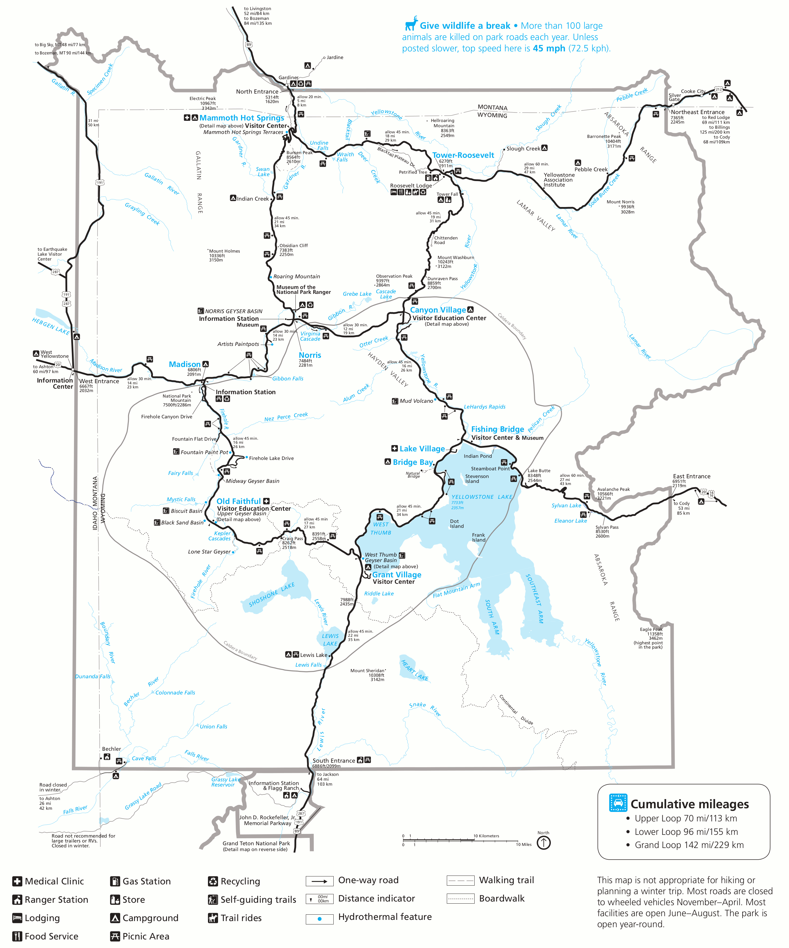
In 1872, President Ulysses S. Grant, signed into law, the establishment of the first national park in the United States…Yellowstone National Park. This massive national park covers a whopping 3,468.4 square miles; larger than the states Rhode Island and Delaware. 96% of the park is in Wyoming, 3% in Montana and approximately 1% in Idaho. The stories of Yellowstone and its spectacles are well known to people from all over the world – Old Faithful, the roaming bison, the brilliant springs, and the massive waterfalls.
Minh is thrilled once we reached Gardiner, Montana. The gateway city to the north entrance of Yellowstone National Park.
I wanted to see for my own eyes, the landscapes, wildlife and magic, that inspired a country, to begin protecting and celebrating these areas known as National Parks. In today’s turbulent political climate, it seems as if our country has forgotten about these places, and we are unfortunately heading in the complete opposite direction. More and more wilderness areas are under threat each day, as efforts to seek new resources take priority. At this rate, who knows how much of our planet will be left in 40 years. I wanted to get away from work, politics and the debates and go explore the wild west for myself.
A photographer captures a moment in the black sand basin of Yellowstone National Park
Sarah and I were fortunate enough to be able to rearrange our schedules to have 8 days (5/19-5/26) off together to explore Yellowstone and the Grand Tetons in Wyoming. We realized this was an ambitious trip, considering the fact that we were bringing our 7 month old boy along; but we were eager to adventure as a new family. I quickly learned that traveling with a baby, turned simple trips…into expeditions. We carefully thinned out our luggage so that we could make room for all of Minh’s clothing, toys, food and milk. He did remarkably well over both legs of the flight (Richmond to Atlanta then Atlanta to Bozeman) and then the three hour drive to Yellowstone National Park. We stopped frequently along the way to make sure he could eat, crawl around, and get some fresh air. I actually preferred the slower pace of traveling with a baby. It helped removed us from from our hectic daily routines and pace of life back in Richmond. Minh taught us to slow down and take everything in. We often found ourselves parked next to the road feeding and playing with him in the back seat or trunk. We took in the serene, roadside skylines of Montana and Wyoming without much care for anything else.
Yellowstone, a geothermal wonderland
When planning a trip to Yellowstone, the lodging options are both varied and abundant. We were traveling with a baby so we knew that we wanted to be in the actual park. This would help cut down our travel time each morning and allow us to see as much of the park as possible. For those traveling with some more flexibility, there are several good options to explore, such as small towns just outside Yellowstone (ex. Gardiner and West Yellowstone) or even camping options within the park. We booked one of the last spots in the northern section of Yellowstone at the Canyon lodge. Despite traveling during shoulder season to avoid the crowds, all of the lodges seemed very busy. I could not imagine what it would be like during the summer (peak season).The next morning, we were eager to explore the raw and rugged spaces of Yellowstone in broad daylight. There certainly is a palpable pulse in the earth of Yellowstone. This massive park is centered over the largest super volcano on the continent. The landscape never lets you forget that you are treading over a sleeping giant of a volcano. From the steaming hot springs, bubbling mud pits to the spitting of geysers, this place is certainly alive……..and mighty.
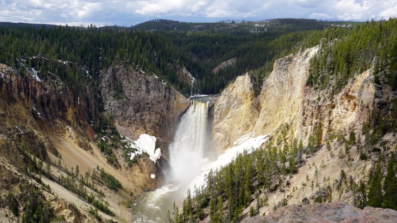
The Grand Canyon of Yellowstone National Park
Yellowstone landscape
As the first national park to be created, Yellowstone certainly makes you feel as if you are at the heart of it all. I’m glad that we packed for all different types of weather, because at 7500ft, things could change really quickly. In the early morning hours, the park is draped in a blanket of fog which clears usually by about 9:00am. We had sunny days for all of our time at Yellowstone which was very lucky considering the forecast predicting light rain and cloudy skies. In true mountain fashion, we were hit with a snow flurry as we were leaving the park. I was surprised to learn that it is not uncommon to get snowfall as late as July!I was also surprised to learn that it took me quite some time to get used to the high altitude. Strenuous activities tired me out faster than usual and I had a very mild headache the first 24 hours. The decrease oxygen concentration is certainly noticeable in my opinion and it is not recommended for people with pre-existing coronary artery disease to travel at such heights. This lower oxygen content could put the coronary arteries of the heart in a dangerous scenario of supply and demand mismatch, leading to worsening ischemia and therefore angina. So if you have pre-existing coronary artery disease, congestive heart failure, or pulmonary hypertension make sure you get cleared by your physician before. (my only medical plug in for this article).
Road warrior
Bison of Yellowstone
Mormon row, Grand Teton National Park
Yellowstone is divided into villages which are centered around main attractions such as Yellowstone Lake, Old Faithful, Grand Canyon of Yellowstone and Mammoth Hot Springs. As a result of this set up, I feel like Yellowstone has a more “touristy” feel, than most national parks. During peak season, cars are lined up back to back and alongside the roads, with frequent stops as visitors often pull to the side for photos of bison or landscapes. One could always take the beaten path and venture into backcountry Yellowstone, for a more secluded experience. With Minh coming along, we actually wanted the “tourist” experience, with access to bathrooms, restaurants and drive-up landmarks to visit. I don’t think he’s quite yet ready for backcountry Ontario canoe camping ;).
We spent the next 4 days and nights exploring all quadrants of this magnificent land. We started each day at the Canyon Lodge for an early, hearty breakfast. We would then drive to the farthest part away from the lodge and then starting working our way back at each site. Although the main attractions (Old Faithful, Grand Prismatic Spring etc) were spectacular sights to see, I think my favorite parts of the park were the lesser known attractions such as the mud volcano and the mouth of the Yellowstone River as it opened up in to the grand canyon of Yellowstone. These were areas where you could get away from the crowds and listen to the breathing of earth below us.
Tetons
Mormon row is one of the most photographed sites of the Tetons
Jenny Lake, Grand Teton National Park
Idaho
The second leg of our adventure took us to Jackson Hole, Wyoming where we spent the next two nights at the Lodge at Jackson Hole. This was our home base for exploring the Grand Tetons and surrounding Jackson area. We were skeptical that we would actually see the tetons because of the predicted rain for the next two days. Still hopeful, we packed our lunches and head out to explore Grand Teton National Park. A short 30 minute drive from Jackson Hole, the teton range certainly has a different vibe than yellowstone. It had more of a national park “feel” that I was used to. The crowds were not as intense and the pace a little slower.
Miraculously, and I don’t know how, but we were blessed with unexpected sunshine that cut it’s way through the clouds and parted a view for us to the teton range. We watched in marvel as more and more of the Tetons emerged into fire before us. The sunshine stayed with us for the rest of the day. Unlike yellowstone, Grand Teton National Park is not situated over a super volcano. As a result, the landscapes are less raw, and more majestic, it appears a bit more hospitable to wildlife but I’m not a geologist or biologist. Within the first few hours in the park, the locals felt like showing off, we caught sight of a mother grizzly and her cubs, moose, elk, antelope and of course bison. We spent the day driving from site to site and sitting in the back of our car, playing with Minh and watching the sun, and clouds revolve through the most gorgeous landscapes.
Ross Creek Cabin Number 5
Montana sunset
Antelope in the backyard
Before we knew it, our time out west was drawing to a close. We had one last night left in Belgrade, Montana ahead of us before we went home. The drive from Jackson Hole to Bozeman, Montana was one of my favorite parts of the trip. The drive through Idaho was spectacular. We climbed high into the mountains before traveling through some of the flattest land I’ve ever seen. The 4 hour drive brought us just outside Bozeman where we would spent the night at Ross Creek Cabins, a set of charming small cabins run by a very nice couple, Steve and Karen. I highly recommend this place for anyone looking to exploring Bozeman and the surrounding areas. As we sat by the campfire reflecting on the past 7 days, we both realized that this was the first time that we were going to see a sunset out west! We put Minh to bed every night around 7:00pm so we haven’t seen a single one prior. As we sat there watching the orange and purple hues collide, with a gentle dry breeze across our face, I just thought one thing……I love this land.
There are 60 National Parks in the United States. How many have you been to?
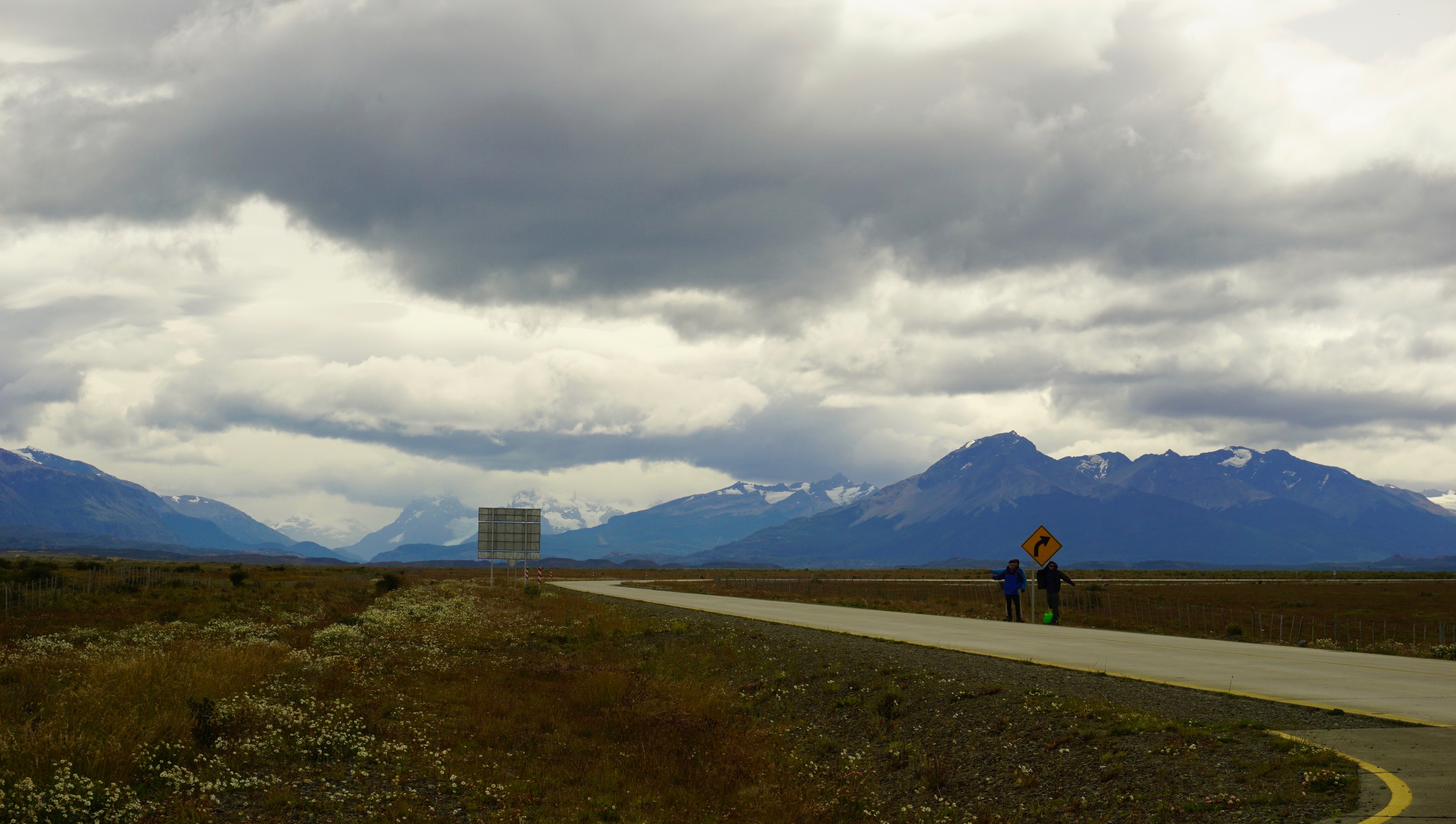
At the very end of the world, in the most southern tip of South America, exists the land of wind, fire and ice known as Patagonia. This landscape of spectacular mountains, deserts, glaciers and alpine meadows spans across both Argentina and Chile, from the western pacific coast to the eastern atlantic coast. Curiously, the name Patagonia translates roughly to “land of the big feet”. It originated from the word “Patagão” (or Patagoni) – a name Magellan gave to the natives of this new land he encountered on his expedition in 1520. The Patagoni he described were actually the Tehuelche people, who in general, were much taller than the average European. Their large footprints found in tracks led the first explorers to believe that this was a mystical land of giants. The footprints were in fact large because of the leather skinned guanaco boots that they all wore during the cold winters.
View from the small Puerto Natales airport, staring into Patagonia
Patagonia is a land of secrets and wonder – even the story behind its name I found fascinating. It has long been at the top of my list of places to visit and finally on January 20, 2017 (inauguration day), we left Virginia to explore this untamed land.Traveling to Patagonia was no easy feat. After a 2 hour drive to Washington DC, we flew 5 hours to reach Panama City, and then 6 hours to Santiago, Chile. From there, it was a 3.5 hour flight to reach Puerto Natales followed by a 2 hour drive to reach Patagonia Camp. We broke up our traveling with a day’s rest in Santiago on both legs of our journey.
Map of Torres Del Paine National Park
I will never forget the flight to Puerto Natales Airport in Patagonia. The harsh winds created fierce turbulence and a hair-standing landing. Upon opening the cabin doors, our faces were hit with the howling winds and cold air of Patagonia. All around us in this desolate airport at the end of the world, were mountains as far as the eye could see…mountains, fields and emptiness. We would now have five full days to explore this mysterious land.
We grabbed our luggage amongst the dozens of hikers from all over the world and hit the road to Patagonia Camp (our base camp and home for the next 5 days). From here, we could rest and relax and plan our excursions into Torres Del Paine National Park each day. I hope to one day write a review about our experience at Patagonia Camp, but for now, all I can say is that it was simply an unforgettable experience with fantastic staff members.
Patagonia Camp sits on Lake Torro
Drinking some mate, before a day of hiking
Sketching in the field log
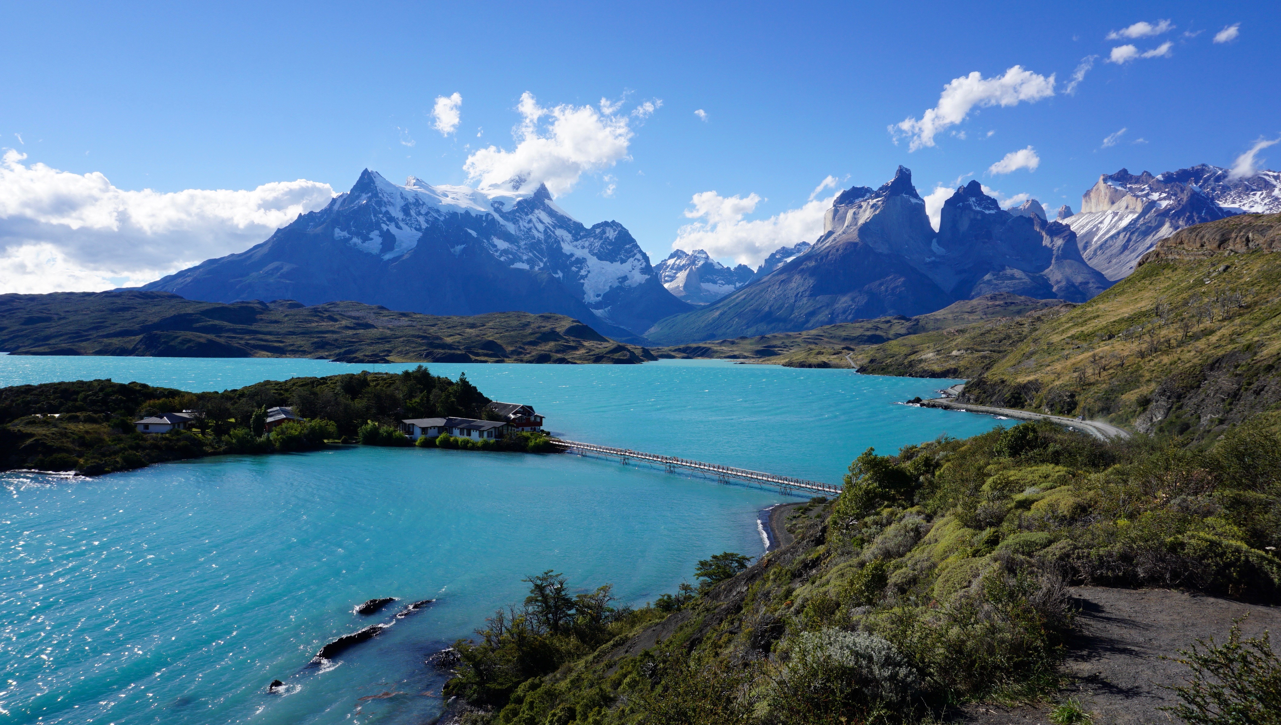
Torres Del Paine National is one of the most popular attractions in Chilean Patagonia. It is one of the 11 protected areas of the Magallanes Region and Chilean Antarctica. The park’s 2422 square kms of mountains, glaciers, lakes, and rivers attract thousands of visitors each year. The centerpiece of the park are the Paine (pronounced PIE-nay, meaning “blue”) mountains and more specifically the Towers of Paine (Torres Del Paine: spanish translation). These are three distinct granite peaks in the Paine mountain range that many consider to be the 8th wonder of the world.
Lago Pehoe
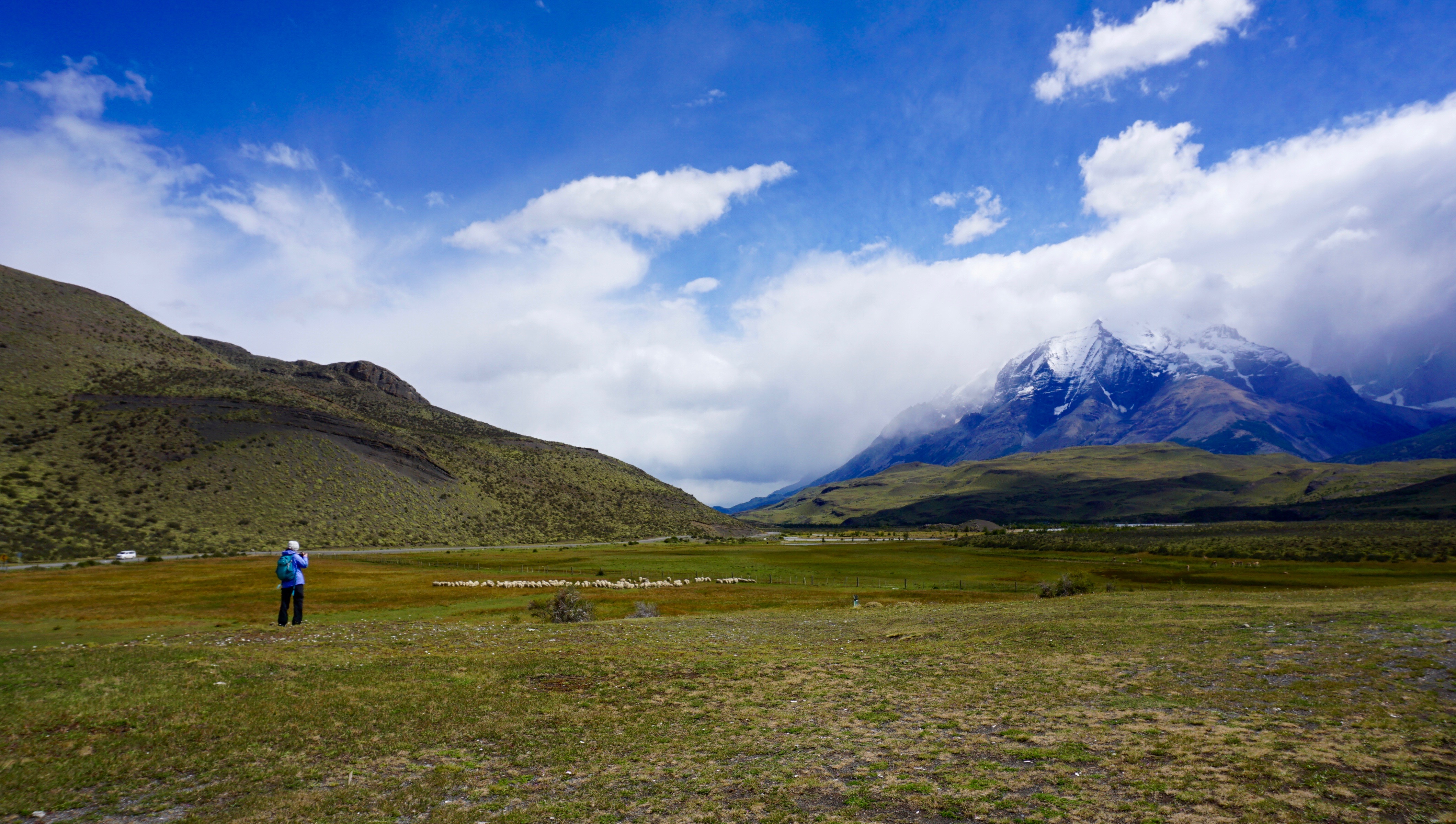
Our first full day in Patagonia was spent on an easy 8.5km hike through pre-Andean xerophilous scrubland. There was plenty of wildlife to see; guanacos, flamingos, condors and grey foxes. The most elusive animal in Patagonia is at the top of the food chain. The puma. I found this to be an unusual terrain for this predator, but clearly it was very successful. The fields were scattered with guanaco skeletons that were picked clean by condors after the pumas have had their fill. I was most in awe at how different everything was from any other place that I had been. The terrain, the geology, the wildlife, climate, and of course the flora.
Guanaco skeleton
pictographs
Calafate bush
One of the symbols of Patagonia is the evergreen shrub know as Calafate (box-leaved barberry, berberis microphylla). It is a plant native to southern Chile and Argentina They were scattered through the fields during our hike and we were able to taste its edible blue-black berries. These berries were used frequently by the locals to produce all sorts of goods, such as jams, flavoring and even beer. Legend says that anyone who eats a Calafate berry will one day find their way back to Patagonia.
We continued our trek through the scrubland and explored caves with prehistoric paintings that dated over 6500 years old. We came back to camp that evening and met many of the other visitors. They were really from all over the world, Denmark, Canada, Britain and the USA. Most who come to Patagonia, travel here to hike the trail to the base of the towers, in the heart of the park. And some talented hikers showed us their watercolor creations of the towers once they reached the base. We were definitely excited for what lay ahead.
In Patagonia, the unpredictable weather makes trip planning essential, and you should always a back up option in mind if your primary objective does not follow through. In this sense, I felt that Patagonia camp did an excellent job of laying out potential options for the next day’s event. They were checking on the weather constantly to decide which trails when be optimal of the next days travel. This was of course a land where you can have all four seasons in one hour. The variability in weather was also drastic even in the smallest distances throughout the park. For instance, it could be pouring rain in the west end of the park and bright sunshine and clear skies on the east end over the mountain ranges. We had originally planned to go to the base of the towers on the second day, however storms had washed away the bridge access. We decided to shoot for the French Valley as the second option, however once we arrived, the ferry (which had been out of commission for the past 3 days) was full.
Patagonian horses
mountain dance
lunch in the forest
We went to our third option the Lazo-Weber trail. A 12km hike with a little bit more elevation climb than our first day but not incredibly strenuous. We hiked this trail in the opposite direction from west to east. This particular day ended up being one of our most beautiful days in the park. We were able to get great angles of the paine mountains and had amazing lookouts at the lagoons and meadows. This hike allows for one of the best views at Almirante Nito (8759ft), Los Cuernos (8530ft) and Cerro Fortaleza (9514ft) and the Paine Grande (10006ft). Our hike took us through meadows, forests and mountain tops. One of the most memorable moments for me was eating lunch inside a quiet forest, to shield us from the harsh winds. At the end of the 12km, was a small Patagonian ranch where we sat, ate lunches and drank.
On Day 3, we were itching to get into the heart of the park. We woke up early and head to the ferry to finally reach the segment on the “W” trail known as the french valley. It was a strenuous day of hiking, but the breath taking views, kept us pushing forward.
The French Valley – Patagonia, Chile
As we approached the glacier, we scaled rocks up melting glacier waters and crossed several wooden bridges. This is when things started to get interesting. At several parts of this trail, we were just basically fording through ankle deep glacier water. Once inside the French Valley, we found a quiet spot to eat lunch and gaze in awe at this magnificent glacier. We sat, ate, and listened to the cracking the glacier, as it continued it’s melt and freeze cycle in the summer time. After lunch, we filled our bottles with some of the best tasting glacier water I’ve ever had and caught the ferry to the mainland.
crossing bridges to the French Valley
ice cold glacier water
calafate beer
french valley
Before we knew it, our time in Patagonia was coming to an end. I can see how someone could easily spend several months here and still not see everything they wanted to. Although we were disappointed about not being able to see the base of the towers, we were grateful for so many things. Most importantly, no one got hurt and the weather was absolutely perfect. It had rained 50 days straight shortly before our arrival so we knew we were incredibly lucky. We visited during the Patagonian summer, and although we had incredible views. Some tour guides suggested to come back in the fall when the park is much quieter and the scenery is even more colorful with the fall foliage. The winds were also apparently less intense. It was not in our fate to see the base of the towers this go around, but I hope that the story of the Calafate berry holds true – maybe one day, we will find ourselves back to this amazing land.
It is part of the human spirit to be curious. Our desire for exploration has helped define us as a species. When traveling through new lands, the rush of having your senses engaged in something new and unpredictable is hard to describe. For this reason, I often wonder if I will ever canoe trip the same routes again. While returning to a familiar park may offer comfort and reassurance, the allure of paddling new waters and trekking unfamiliar lands is always stronger. This need for exploration brought our latest trip to the great, Canadian, province of Quebec.
Richmond to Maniwaki, Quebec
Quebec, similar to Ontario, is a paddler’s dream. It is Canada’s largest province, (almost 3 times the size of Texas), and is 12% fresh water by surface area, holding 3% of the world’s renewable fresh water. The parks in Quebec, however are far less visited than Ontario’s, allowing for even more of a remote excursion. For our trip, we decided to venture into Réserve Faunique La Vérendrye (La Vérendrye Wildlife Reserve). The park covers a massive 12 589 square km, with over 4000 lakes to explore. One could spend months at a time exploring this park without ever retracing your path. I was excited to bring along my good friend Min, who has been with me on countless trips in Virginia but never to the Canadian shield.
Breakfast with the locals
Our drive was 14 hours straight up north to the town of Maniwaki, Quebec in the provincial riding of Gatineau, Population 3930. On the last leg of our road trip, we found ourselves cruising through the back country roads of Quebec on a nearly empty gas tank. We arrived at 11:15pm with only 4 miles left in the gas tank…. (Rule of the northern road: never let the tank drop below half)….we got lucky. After a long day of last minute packing, wrapping up phone calls and e-mails from work, and a worthy drive, we were finally free from human society. We all slept soundly that night. A shot of whiskey with the local First Nations people helped too.
The next morning, we enjoyed a nice breakfast at a mom and pop diner and made a quick stop at Canadian Tire to pick up some last minute supplies before making our way off the grid and into Le Domaine.
Min charts our course over the next 5 days
Day 1: Le Domaine to Campsite (distance traveled 15km)
The wonderful sight of racked canoes, maps and photos on cabin walls, and sapphire blue waters greeted us when we reached Canot Camping La Verendrye. The staff was very helpful in helping us choose a suitable route. We sorted through the laminated maps and decided on Circuit 15, a short 45km loop.
Approaching the big waters of Lac Poulter
When we originally set the date for this trip, we were well aware, that we were going during peak black fly and mosquito season. I just don’t think any of us knew how bad it would actually be. As we started to unload our gear, we were greeted with swarms of black flies. We scrambled for our bug jackets and finished the gear load-out in our newly christined bug jackets, spotted with a little bit of our own fresh, blood. We left the Canot Camping beach at approximately 12:30pm and battled headwinds to get to our campsite. With an odd number crew, we would have one person paddling solo. Brian braved the first leg. This proved to be quite the challenge in the windy open waters. We lashed the canoes together for the second half of the trip to keep him from straying into the wind.
beach campsite
gransfors
life in the bug shelter
The portages in this park were short with the longest being approx 400m. Nevertheless, the black flies made us pay; we suffered heavy bug bite casualties. We realized that in order to have any peace from the bugs, we would need to choose our campsites wisely. We searched for a site that faced the wind and as far away from dense vegetation and moving water as possible. We were lucky enough to come across one of the pristine beach sites that La Verendrye is known for.
Freedom
Campsite 15-15
Campsite 15-15
We pulled our canoes up on the sandy beach and felt the powerful and liberating, gusts of wind against our faces as we emerged from our bug jackets. It seemed to keep the bugs at bay…for the moment. We left ourselves plenty of daylight to set up basecamp. Our most important piece of gear on this trip was Brian’s treasured Eureka Bug Shelter. It is basically a tarp with a fully enclosed meshed area that can be pegged to the ground, allowing us to live in a bug free zone and carry out basic camp chores. The last time we used the bug shelter was on Little Joe Lake in Algonquin Park (2014). We each set out to accomplish our camp chores, filtering water, chopping firewood, setting up tents, and unpacking bedding.
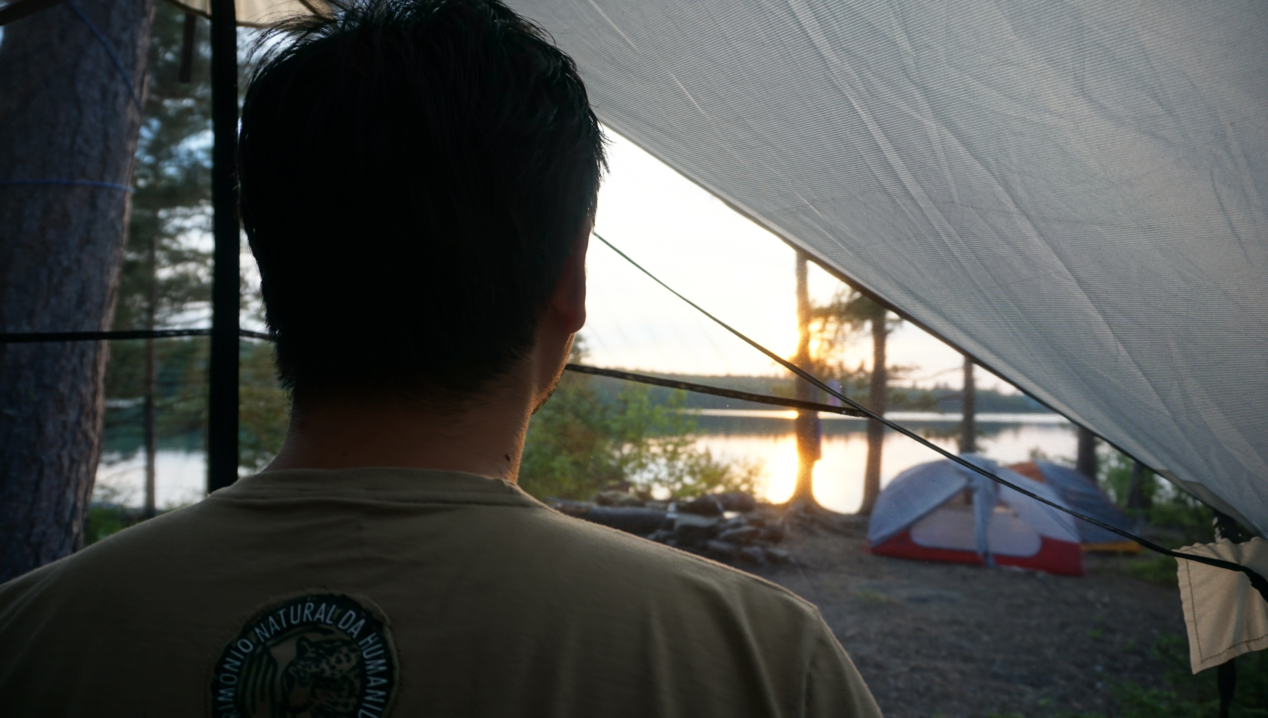
First Verendrye sunset
Min had the tall order of preparing meals for the trip. He has never let me down in the past and he certainly did not this time. He had elaborate menus arranged for us, ranging from pastas, variety of meats, corn breads and dried fruits. We ate like kings and slept early that night to the familiar cries of the loon, officially signifying our return to the northern land. We had made it.
wannigan and sleeping gear
Day 2: Campsite “15-15”
We awoke leisurely the next morning. Our objective this trip was to take things slow and simply enjoy the wilderness around us. Instead of moving to a new campsite, day after day. We found that 2 nights per campsite suited our tempo. It felt luxurious. We cooked meals, boiled coffee, and looked over the maps. The bugs limited our activity to mostly the bug shelter, so we turned it into the most comfortable place that we could. We dug a small hole to have a modest fire to keep us company.
camp furniture: bench
bfast
cooking eggs
Min made quick work of some pine with handy axe work to give us a bench to sit on. It certainly felt like a home away from home. While the flies and mosquitoes buzzed at the bug shelter, we were able to sit and relax and enjoy good conversation. We discovered that interestingly, every night, at approximately 9:30pm, the bug activity just suddenly stopped….no more buzzing, no more swatting at each other. After this time, we were free to enjoy the night without the jackets. We took this opportunity to brush our teeth, bathe in the freezing waters by moonlight and enjoy a large campfire by the stars. Life was good in La Verendrye.
Day 3: The Best Day
In my mind, Day 3 will go down as one of my favorite days of camping ever. It was my turn to paddle solo, and it was going to be a monster day. 26km ahead of us to the next campsite through some big waters. We set off early in the morning, having packed down the bug shelther the night before. The water was still calm when we launched and we made amazing time. Once we reached the main lakes, it was once again a battle upwind. we paddled against chop and waves to gain only feet at a time. At the halfway mark we came across an unusual set of small island rocks in the center of the lake. In the heart of the wind, we pulled ashore and lashed together the canoes. It was time to refuel.
Middle of Lac Poulter
island eggs
We needed to get food and water back into our sun beaten bodies. We hungrily devoured tuna wraps with onions, with generous helpings of dried fruit and plenty of water. Food had never tasted so good. We could feel our bodies recharging and our spirits lifted. We pushed on afterwards towards the second half of the trip. We all dreaded the 3 short portages that waited ahead for us. As we continued to paddle, the unmistakable sound of white water became louder and louder. We had reached “Les Rapides”, the short white water section of our trip.
This left us with two options: Portage around the rapids, or run it. No brainer. Running the short white water segments was exciting and the reward was two fold….we got to skip all portages. We estimated that we were able to shave at least 1.5 hours by running the rapids. This spirit boost was what we needed to finish the final leg of the journey to our next campsite. 26km done.
Min sneaks in a quick rest before approaching “Les Rapides”
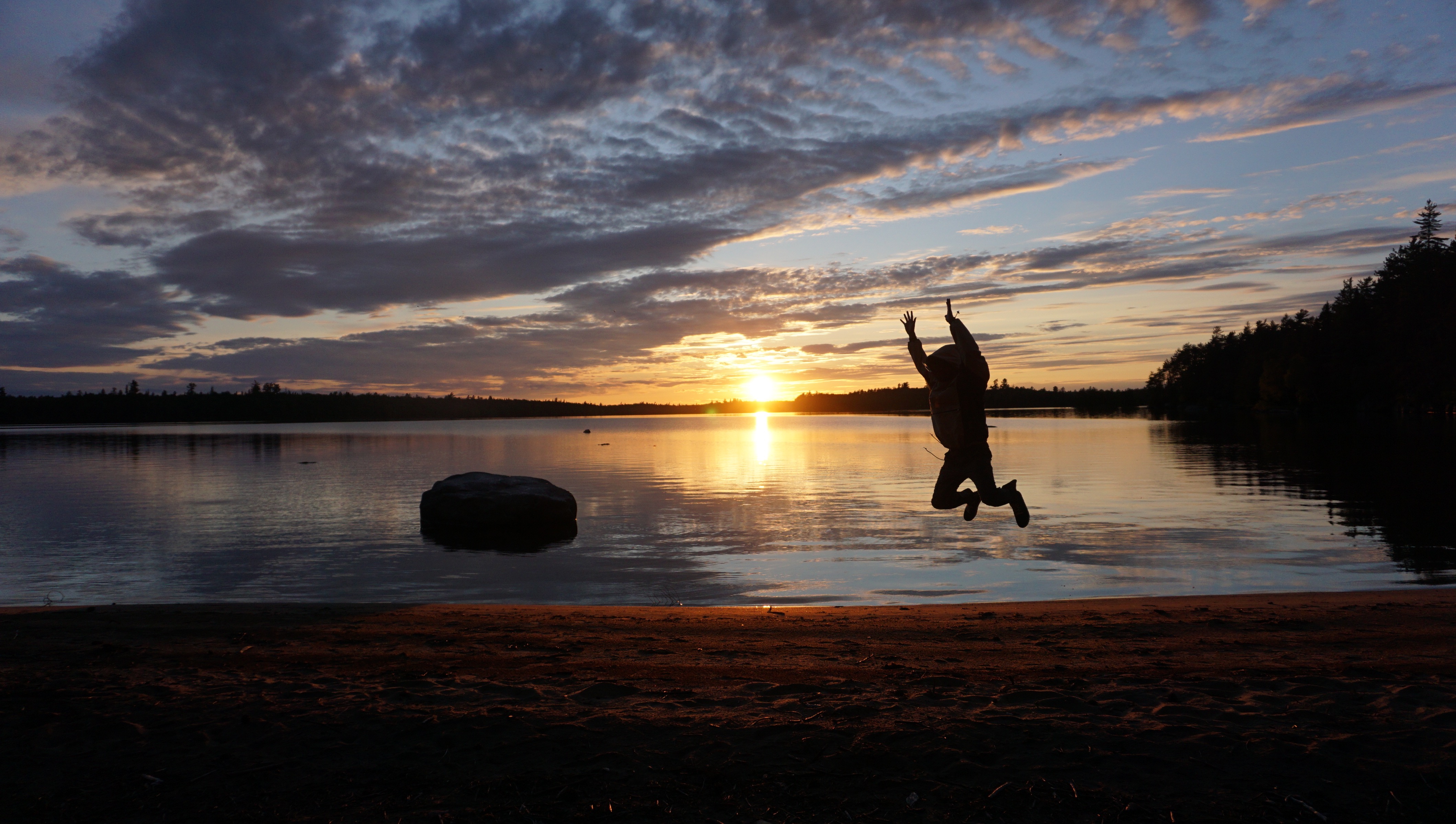
Northern lights signify the beginning of summer
We didn’t speak much as we set up camp. We had only been out in the wilderness for 3 days but it our actions felt deliberate and well coordinated. It was clear that we were getting acclimated to our surroundings. This campsite was at a higher elevation with much less vegetation, the wind broke through camp easily and kept the bugs at bay. We were all exhausted and passed out for a nap shortly after dinner. I awoke around midnight to do some night fishing with Brian. While collecting some water by the shore, the unmistakable emerald hue of the northern lights danced over the forest canopy. We stood there and watched in awe. I have never considered myself much of a religious man, but I do believe that such moments are simply too beautiful for coincidence. They truly touch the spirit. We paddled 26km that day, ran whitewater, found a killer camp site, fished and were treated to a beautiful display of the northern lights. It was the best day of camping.
Day 4: Campsite “10-53”
One thing is certain when you’re out on a camping trip. It will reset your circadian rhythm. Having just come off a night float rotation, it took only a couple of days for me to be fully adjusted. Out in the wilderness, there are no alarm clocks, you simply obey the sun in the sky. When it rises, you rise. We woke to the early cries of loons and the sun beating on our tents. It was a relaxing day of swimming, fishing, photography and paddling. Life out here is pretty simple, and I certainly love it. No busy schedules out here, no pagers, no phone calls, no e-mails. When you’re thirsty, go filter water. You’re hungry? Get the fire going and heat up some food. Dirty? Go swim in the lake. That afternoon we paddled out and fished on different islands. None of us claim to be great fisherman and only had a few bites here and there. Nevertheless it was still a great time. Maybe one day we will land that giant northern pike.
Fishing
Campsite
Day 5: Paddle out
I guess all good things must eventually come to an end. Before we knew it, our time in La Verendrye had approached it’s end. After 5 days in the sunshine, it was time to head home. The water was calm that day as we packed up the remaining bits of gear and tied up the wannigan. It was a good half a day of paddling to reach the Le Domaine beach. We arrived at approximately noon where we met with some fellow canoeists. We chatted briefly and shared our experiences of the circuit. These experiences are what make canoe camping so special. The launch sites are always filled with interesting people from all over the continent, who have traveled great distances to enjoy the same beauty.
Our time in La Verendrye felt far too short and we were able to explore only a fraction of this gigantic wilderness area. I am truly glad we decided to come here and canoe in French Canada. I don’t think any of us could have asked for anything more: no rain, no accidents, and a spectacular viewing of the northern lights on the first day of summer. I will always remember this land for the incredible scenery, the blue waters and the magnificent sunsets. Au revoir La Verendrye.
In July 2015, we set out to explore the turquoise waters and white quartzite mountains of Killarney Provincial Park. The landscape inspired countless works by Canada’s Group of Seven Artists. This is a video of our trip. Filmed on several different cameras: Sony Nex5, Nikon 5200, GoPro Hero 2, Iphone 5 and 6.
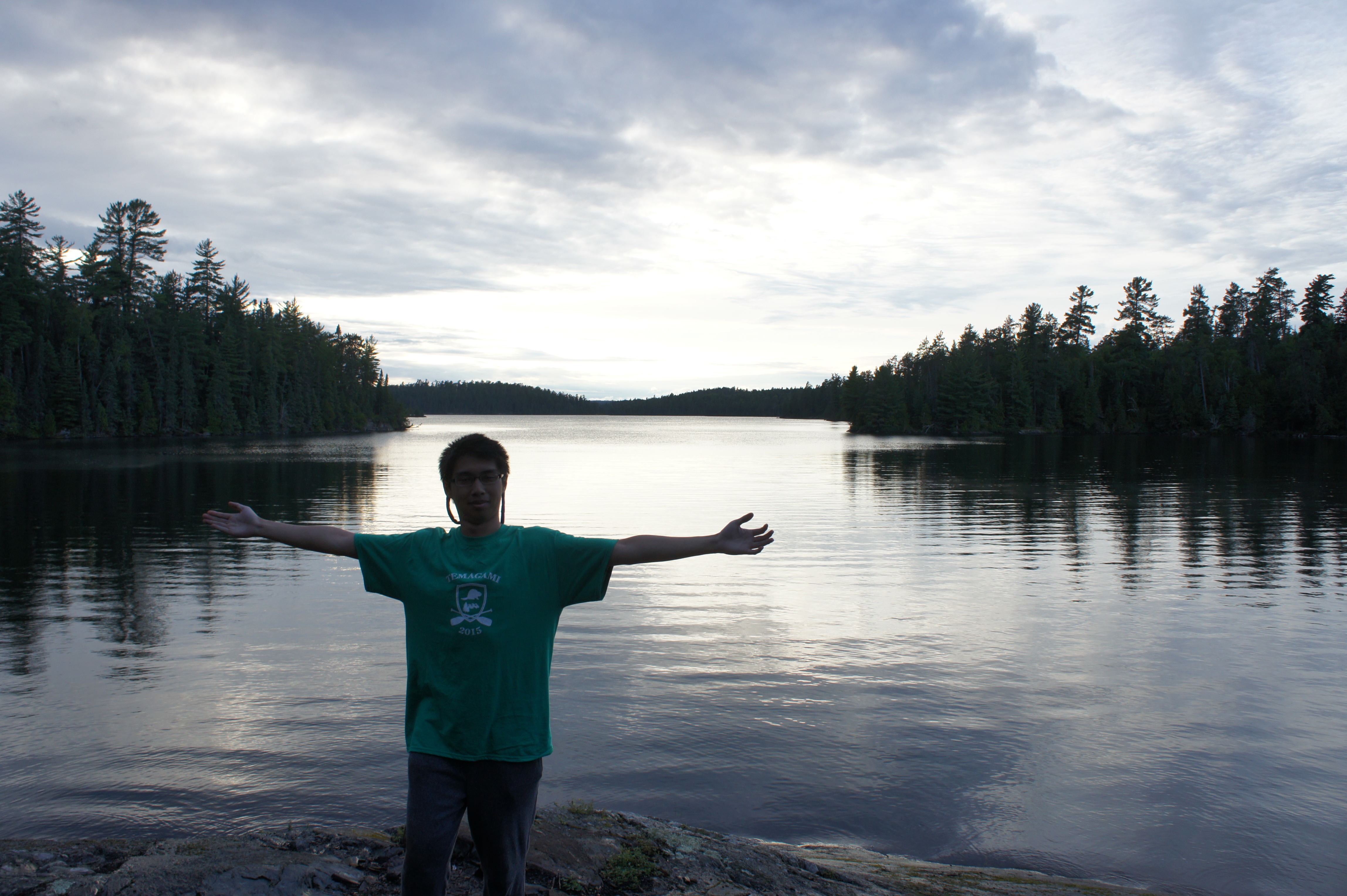
I have always wanted to share the magic of the north with those who have never been there. Stories and photos could only tell so much; the feeling of sitting on a rock island, drinking hot coffee while listening to the cries of a loon can only be experienced. When I stopped by Toronto to visit my cousins after Killarney 2015, they took one look at the photos and decided they wanted to go on the next trip. All I needed was the spark of interest to set the trip planning in motion. After setting the launch date for August 22, 2015, I began mapping out the route. I’ve always wanted to paddle the waters of Temagami in Ontario, what I better way to experience it than with two first timers. I wanted it to be a trip they would never forget. I went all out and designed t-shirts for the trip on CustomInk. It actually turned out halfway decent.
Temagami 2015 logo
Delorme satellite messenger, a new purchase for the trip
Richmond to Temagami road trip
So, on August 22, 2015, Brian and I left Richmond, VA to head to Toronto to pick up our cousins Andrew and Eric. From there, it would be another 4 hours to Temagami. We spent the night of the 22nd in Toronto, helping my cousins pack and trying on watershoes and prepping our gear. In the morning, we finished the drive, stopping only at North Bay to take a quick look at the town and eat some lunch at a restaurant called Cecil’s.
Cecil’s in North Bay, Ontario
Temagami municipality
We arrived in Temagami at about 6:00pm, from there we head to our lodging for the night, a place called Loon Lodge nestled on an island on Lake Temagami. The lodge is owned and operated by a very nice couple, John and Jenny. I had never stayed at a lodge like this before, it was Canadian in every way. Outside were forest green, restored Keewaydin Camp canoes resting by the dock, plaques of trophy Pike and Walleye hung from the cabin walls, hummingbirds drinking from the feeder and a portrait of Grey Owl displayed proudly in the dining hall. Needless to say, we were in love with the place. We spent the evening swimming and diving off the docks, racing canoes and enjoying the glory of a Northern summer.
Mapping
Nightcap
Lake Temagami
Grey Owl
breakfast
August 23, 2015: Monday morning, we each ate a giant breakfast at the lodge. I had forgotten how good Canadian sausages were. A couple of boys related to the lodge owners joined us and told tales of their fishing victories against giant Northern Pike. After breakfast, we packed up our gear and began navigating through Lake Temagami. Our journey had officially begun. We battled choppy waters and headwinds towards Diamond Lake. Halfway into the paddle and several hours later, we came to the realization that we would have to chose a different route.
Lake Temagami
clear water
headwinds
Breaktime
The route from Jeffsmap.com
The water was far too rough and we raced against threatening storm clouds that turned the water black. With such an open view of the wilderness, we could actually see the rain approaching. The drumming of rain hitting the water became louder and louder until it was finally right over our heads. After paddling a total of 20km that day, we made our way past the Keewaydin camp and into Upper Kokoko Bay where we found a nice rock campsite. I could tell Brian was excited, he’s been interested in the Keewaydin camp for quite some time now. One of the oldest camps in North America, they teach traditional camping and canoeing skills; paddling with woodvas canoes, hauling wannigans and portaging with tumplines. Their camps are broken up into sections of boys and girls. Some of the more experienced sections even take expeditions up to the James Bay. I was surprised to learn that Grey Owl actually was a member of the camp in his youth.
Storm approaches
basecamp
preparing firewood
Rain, just outside Keewaydin Temagami campgrounds
tarp tying
It was pouring by the time we reached the campsite. Brian and I worked quickly to set up the tarps while Eric and Andrew gathered firewood to dry our clothes. We had spicy curry chicken and chickpeas for dinner with a nice loaf of bannock, salami and cheese. The boys had ferocious appetites. As the night wound down, it was clear we were all exhausted. The sound of wind and rain rapping on the tents didn’t even hinder our sleep.
Enjoying a day of sunshine in Upper Kokoko Bay
Rock beach
Rock island
August 24, 2015: We woke up to a chilly morning and lowered the food barrel from the trees. It was time to make some breakfast. Scrambled eggs with cheddar cheese slices in tortilla wraps. Eric and I later took the canoe for a paddle around the bay in search of walleye, while Brian took Andrew for some canoe lessons. He was a natural paddler and was even starting to get down the J-stroke. This afternoon was actually the longest stretch we had on the trip without rain. We found a small rock island where we set our canoes and soaked in the passing sunlight. For dinner we decided to cook some chili with baked corn bread using the reflector oven. The corn bread is definitely something I will be adding to my camping menus, very easy to make and actually really good. For desert we ate smores and drank tea, coffee and hot chocolate. The clouds passed just long enough for us to get a great view of the big dipper.
Preparing chili
Dinner
Rain
camp dishes
breaking bannock
August 25, 2015: We woke up to yet another morning of overcast. It actually took us a few hours to eat breakfast and pack up all of our gear for the paddle home. At this point, we polished off the remainder of the food. I actually originally planned for an additional day and night out in the backcountry, but our food supplies were low, the fishing unsuccessful and the rain persisted. We decided to head back and get an extra day in at the lodge. We had a 6 hour paddle ahead of us and it was time to feed these guys. We made all 12 packs of oatmeal, as well as the mac and cheese with tuna.
With satisfied bellies, we made the easy paddle to the portage site. It would be a 570m portage and we were dreading it. It was wet, slippery and the mosquitoes were out. The fiberglass canoes were much heavier than kevlar. In addition, the yokes were not formed very well. We decided to assign two men per canoe for the portage and it ended up saving our spines. The paddle home was much more scenic than the way in. Kokoko Lake had several beautiful island campsites with Jack Pine scattered throughout. There were also shallow marsh regions which reminded me of Algonquin. We then reached our second portage a short 120m that was even rockier. After a quick snack break of gorp, salami and dried fruit we paddled through the beautiful and peaceful Kokoko bay. The water was calm and the paddling was smooth. The boys have come a long way since the beginning of the trip. Their paddle strokes were now powerful and consistent. Despite the rain and overcast, the beauty of Temagami was overwhelming.
Jack pine
the crew
Upon reaching Loon Lodge at 7:10pm (closing time at 8:00pm), we were happy to see John and Jenny once again. We were all starving. John fired up the grill and we ate massive meals of fish and chips, burgers and poutine. After the feast, we carried our gear to the welcoming and familar common room of the lodge. We were cold, our faces weathered from the wind, our muscles sore from paddling. We each took turns taking hot showers and felt like kings. I don’t think the feeling of dryness and warmth could never be appreciated enough. We hung our clothes by the imitation fireplace and watched Steven Seagul movies on Canadian television. It amazed me how easy it was to get dry indoors. While we were out in the upper Kokoko bay, hanging the clothes out to dry was basically futile against the intermittent showers and wind. Even during times of sunshine, there was an invisible mist of humidity which kept things damp.
Temagami sunset
old wood canvas canoe shop
The next morning we packed up early and said our goodbyes to John and Jenny. John gave us a boat lift back to the access point and we loaded up the car. They seemed likely truly genuine nice people. As we were driving down the Temagami lake access road, the corner of my eye caught sight of a whole family of bears. One mama bear and 4 cubs. The tradition holds true! An epic wildlife sighting at the end of every trip. Tradition recap: Algonquin 2014 (moose), Killarney 2015 (black bear), now Temagami 2015 (family of black bears). The perfect exit to our time in the Temagami wilderness. We decided to explore the town, and hit up markets and local businesses. Andrew ended up buying a dreamcatcher, a necklass and bracelet. I ended up buying some local gin by a distillery near the Georgian bay. Brian picked up a case of beer. We picked up grapes as well and ate lunch in the town, fish burgers with poutine. We also visited an old site where they made wood canvas canoes many years ago. It appeared that the shop was no longer in use.
Temagami, population 900.
Beaver plane
grocery store with wood canvas canoe
Before leaving the town, we decided to make the climb up the Temagami firetower. It was a high climb with 157 steps to reach 100 feet. It stands on top of Caribou Mountain 400′ above town and 1300′ above sea level. The scenery was beautiful as we marveled at the boreal forest and Canadian shield while a beaver plane took off for an adventure.
The main reason I wanted to go on this trip was to immerse my cousins in the experience of true backcountry camping. By the looks on their faces, I knew they had a good time despite rain for four straight days. In a short time, they learned the basics of canoeing, they learned how to make fire with wet wood, they filtered water, they looked after one another and they cooked meals in the wilderness. They portaged difficult trails and carried heavy fiberglass canoes from lake to lake. I think most importantly, they learned the lesson of delayed gratification. If it’s raining, it’s okay to be uncomfortable, wet and cold, as long as you are working to improve the situation.
Setting up tarps, gathering firewood is all hard work under wet conditions, but knowing that we will be warm and dry once again is something to work for. Portages are difficult, but they too are conquered one careful step at a time. By enduring these difficulties that not many people are willing to take on, you are rewarded by being present in the splendor of Canadian wilderness.
July 21, 2015: We embark upon a 15 hour road trip to Killarney Provincial Park in Ontario, Canada. Our mission, to answer the calling of the La Cloche mountains and sapphire waters of OSA lake. We left at 1:15pm and arrived to Barrie, Ontario at 2:00am spending the night at a Best Western, apparently the only hotel room left in Barrie. Thankfully my brother was able to find us this hotel from his desktop in Virginia. In the morning we completed the final 3.5 hours of the trip to the town of
Killarney, picking up our canoe along the way at Tyson Lake Marina. Our vessel was an old but sturdy Scott Kevlar canoe weighing in at 52 lbs. The small town of Killarney has a population of less than 1000, it sits on the coast of the Georgian Bay which opens up into the mighty Lake Huron. It is hard to describe the beauty of this town. The air is fresh with a similar atmosphere to a coastal city although without the hint of salt in the air. Just fresh water. It was a warm 27 degrees celsius, dry and sunny with breezes from the lake. We couldn’t believe the water when we saw it, a crystal blue unlike anything we’ve seen before. Most of the people who come to Killarney Provincial Park, stop by this town to visit Herbert’s Fish and Chips, a place where they serve fresh fish caught right out of the Georgian Bay. We had walleye that was simply superb. I now know what they mean when they say that Walleye (pickerel) is the best tasting freshwater fish. After filling our bellies, we headed into the park.
Town of Killarney on the Georgian Bay
Fresh walleye from the bay
Prior to entering the park, we saw signs warning us that Killarney is open bear country. We took all the necessary precautions before entering the park to camp safely, including a water proof food barrel to tie up a tree at night, we hung bear bells on our duluth packs while we portaged to create noise and not startle any bears. I have always been interested in bears and their behavior, I used this trip as an opportunity to learn more. Fortunately, only black bears are present in central Ontario. They are definitely the least aggressive of the species in North America and will avoid human contact 99% of the time. It is the rare 1% of black bears that have developed a predatory instinct toward humans that we must be wary of. Although there has never been a fatal bear attack in Killarney Provincial Park, this is unfortunately not true of all Ontario parks. The following is a link to all of the fatal bear attacks in North America (notably two incidents at Algonquin Park).
Bear Country
Hanging a bear barrel/bag is best done in the daylight!
In addition to the predatory bears, one must be cautious of bears that have become too comfortable around humans. Due to the frequent use of camp sites and the improper disposal of food, some bears can develop a habit of lingering around campsites in search of food. These bears can become dangerous when they are defending food or if they are feeling threatened by campers. The best defense one could have against bears is to practice safe camping measures: stay in large groups, make noise while you portage, hanging your food and all scented items in a food barrel suspended high in a tree. Needless to say, LEAVE NO TRACE. Some portagers even had their toothpaste snatched by a bear from their packs in between trips! When all measures fail and you find yourself face to face with an angry bear, bear spray is probably your best defense. I bought it for this trip and fortunately never had to use it against a bear.
George Lake
While obtaining our camp permits, we were surprised to find that a spot had opened up on OSA lake for our 2nd and 3rd nights instead of our initially reserved Muriel Lake. We were pumped at the prospect of camping in the heart of Killarney. We unloaded our car and packed up our gear at one of the George Lake access points. In terms of size, Killarney is much smaller than Algonquin, yet both are totally different parks. The climate in Killarney is dry with relatively little rainfall throughout the year. It is usually sunny and the quartz mountain range provides a totally different backdrop as well.
George Lake
Campsite
Rock jumping
The voyageurs in the past used to implement the Hudson Bay start before beginning on a big journey. Basically, on the first day of multi-day trip, they would paddle a very short distance and set up camp for the night, this way, they could get accustomed to the gear and the loads they would be carrying and also could turn back if they noticed that they forgot something. We decided to use this practice as well and it worked perfectly. We camped the first night right on George Lake, we needed as much daylight as possible to set up and cook dinner, and of course to swim! I couldn’t pass the opportunity after seeing young campers plunge from cliffs into the blue waters. We cooked up some hot chicken curry and had some tea, watching the beautiful late sunset.
campsite view
The sunsets at about 8:45pm in central Ontario
Cooking spicy chicken curry
The next morning, we made our way to the first portage, a short one at only 45m to enter Freeland Lake. The Scott canoe was surprisingly very easy to portage. I attribute this to the well designed yoke which rested comfortably on my shoulders. The Freeland Lake area was more consistent with Ontario backcountry canoe camping that I was familiar with, hundreds of lily pads and flowers in full bloom.
First portage of the trip
Sarah spotted a snapping turtle the size of a sewer grate swimming under our canoe. After another 410m portage, we were on Killarney Lake. We noticed that as we went further into the interior, the water became even clearer. Killarney Lake is surrounded by the white mountains and was clearly a popular site for campers. We saw a family of campers settled comfortably on one of the islands. We then traveled across a swampy area with numerous beaver dams, after hauling our canoe across one, we made our last 120m portgage of the day to OSA lake!
Freeland Lake
lily pads and flowers in full bloom
Beaver dam
Beaver tail paddle
Upon first laying eyes on OSA lake, I suddenly understood why the Group of 7 artists visited Killarney for inspiration. I don’t think any camera would ever do this place justice, the clear blue waters allow visibility up to 20ft. The white quartzite mountains seemed to enhance the blue by reflecting even more sunlight. The clouds were spectacular.
After a hot day of paddling, there’s nothing like splashing your face in the crystal blue waters of Killarney
Amazingly, this giant lake only has 4 campsites. As we paddled around, we found that several were already occupied. We took our time searching for a place to set up camp and stopped to have lunch on a small island. We even contemplated staying on this island to camp but decided it would be much too windy without the trees to shield the wind. Finally, We found a perfect island campsite at site #32. A beautiful spruce island inhabited by red squirrels that were apparently tagged with white collars.
Island lunch break, OSA lake
OSA lake
Campsite #32, OSA lake
Our time on OSA was simply bliss. Perfect weather, with a cool shade among the pine and spruce. We were exhausted and slept for 10 hours after dinner, it was still light out. We swam and sunned on the rocks without a care in the world. There was tiny island just off the shore that we could swim to. Seemed like someone already built a little Inuksuk on it.
Campsite #32 on OSA lake.
The next day we packed up and we paddled to the unofficial portage trail, a little tricky to find but we found some canoes parked on the trail already. I must commend JeffsMaps once again, this portage is not official and we would have never knew about it without JeffsMap. It was a tough one, at 1285m with an elevation gain of about 65 ft. The trail also had many downed trees along the path. I think it is tradition for me to see a wild animal during the last portage of a canoe trip. The previous year in algonquin park, I longed to see a moose on our 7 day trip. By the 6th day I was starting to lose hope, it was only till the last portage on the 7th day did we see young moose grazing by Tom Thomson Lake.
Moose sighting in Algonquin Park 2014, after the last portage on the last day of the trip.
Mosquito head nets were crucial for long portages.
Such moments I believe are truly religious. It’s hard to explain to someone who doesn’t spend a significant amount of time outdoors. In Killarney, a part of me wanted to see a bear, but a bigger part of me did not. During this last portage of Killarney as I heaved the canoe over a down tree, I spotted an adolescent bear at the corner of my eye, running away from us as it heard us approach. After all of my years camping and hiking, this was actually the first encounter I’ve had with a wild bear. It was pretty awesome. I decided to tell Sarah at the end of the portage about the bear sighting. We kept conversing and making noise during the rest of the portage.
The rest of the paddle home was relaxing. As we came closer to civilization, it was nice to see occupied campsites on George Lake and kids jumping from cliffs into the water. As we packed up and headed to Toronto for the night, I couldn’t help but think what amazing luck we had during this trip. Clear skies, warm and dry weather, no injuries, and tons of memories. Killarney is really a magical place unlike any other park in Ontario, truly deserving of the title of the crown jewel of Ontario.