Blackrock Summit – Shenandoah National Park, VA

Screen Shot 2016-07-25 at 7.16.39 PMIt was a particularly hot summer weekend in Charlottesville, with highs greater than 100 degrees F. We were on a getaway from Richmond and despite the heat, we somehow wanted to squeeze in a quick hike in Shenandoah National Park. During this time of year, the popular watering holes like White Oak Canyon, are packed, so we decided it was time to find a new trail.

In the heat and humidity, we had to be conservative with what we hoped to accomplish. Naturally, we chose the easiest hike in the park: Blackrock Summit, a quick 1 mile loop around the mountain and back. This was more of a walk than a hike. The elevation was minimal and the trail very well maintained. Despite the ease of the hike, the vistas were awesome. Climbing upon the rock bed at the top allowed a full 360 degree view of the park and surroundings. The formation of the rocks at the top were certainly unusual and even appeared out of place. With the help of some trail signs, we were able to learn that this was once the floor of the ancient Iapetus Ocean that predates the Appalachian Mountains. Over time, geological forces transformed the seabed into solid quartzite rocks. Overtime, this region too will become overgrown with vegetation and will look like the surrounding mountains.

We reached the top in the early morning and descended the mountain just as the sun reached it’s peak. We sought refuge in the canopy of the forest where it was at least 10 degrees cooler. We searched for mushrooms and marveled at the lush forest in the peak summer time. It had been too long since my last visit to Shenandoah National Park, this outing reminded that she always has something special to offer in every season.

St Mary’s Wilderness – George Washington National Forest, VA

DSC01814
The trail to the waterfalls follows St. Mary’s river as it meanders through the Blue Ridge. Follow the pink ribbons to reach the falls.
stmarys
A 2 hour drive to reach the well maintained St. Mary’s Road. Approach the trail from the Cold Springs Road.

When presented with free time and the opportunity to explore arises, it can be difficult to decide where to go. The number of destinations seem endless with each place offering something completely different: the Blue Ridge mountains to the west, the coastal tidewater to the east and the Appalachian plateau to the Southwest. I usually end up letting the season and conditions deciding for me. What better place to explore in early Spring than the St. Mary’s Wilderness Area in the Blue Ridge? I read numerous reviews about the area of its beauty and clear river beds. St. Mary’s is designated a wilderness area, and as such, the trails are poorly marked. It appeared that summer hikers frequently got lost on the poorly marked trails and overgrown brush. I hoped to avoid all of this by navigating in early spring, with bare trees and clearer paths.

Spring
Spring phlox

My cousin from Toronto accompanied me on this outing, marking his first proper hike in Virginia. When we arrived to the trail head, I was surprised to find that the earth was scorched and the trees charred. I later learned that a wildfire just two weeks prior had burned over 800 acres of the wilderness area. St Mary’s spans over 35,000 acres making it the largest Virgina Wilderness area on national forest land. The region was previously a mining ore for manganese and iron until it was abandoned in the mid 1900s. Today it serves as a beautiful hiking and fly fishing trail along the St Mary’s River, complete with a beautiful waterfall at the end.

There are numerous routes to get to the waterfall. The most popular route listed on Hikingupwards.com recommended starting out along the Blue Ridge Parkway. One reviewer discouraged this path, because it was poorly marked and he took numerous detours after getting lost. They recommended an easier way to get to the falls. Off of Cold Springs Rd (Route 608) is St Marys Road. This road is in excellent shape and leads you all the way down to a well kept parking area and the beginning of the trail that puts you right next to St Marys River. From there, you simply follow the river to the falls. Internet win.

DSC01940
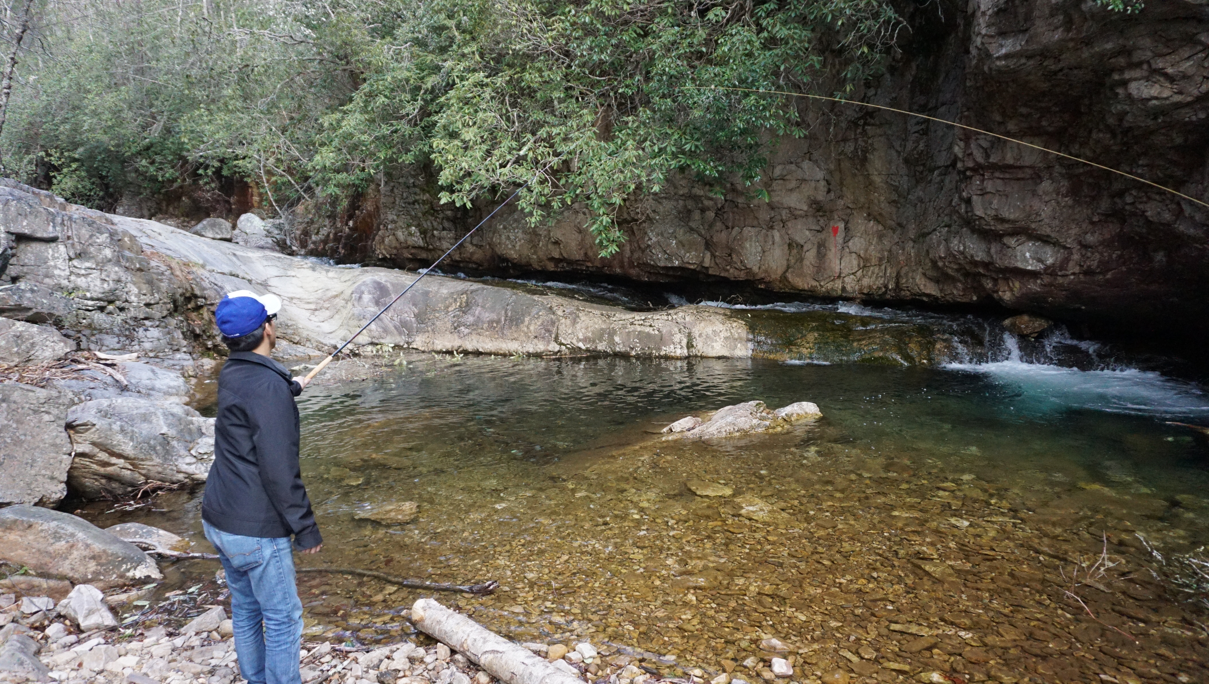
We tried our hand at some Tenkara, a form of Japanese fly fishing that does not require a reel.

The hike twists and turns through a beautiful gorge, providing a unique vista in Virginia. There was lots of rock hopping, and scaling as the trail crossed back and forth over the river five times. We tried our hand also at some Tenkara (traditional Japanese fly fishing). This style of fly fishing uses only a rod, line and fly – no reel. With flask in hand with some Nordic honey wine and packed lunches, we enjoyed the peace of spring time in the mountains.

Voyageur Quest (Algonquin Park) by David Hartman

My favorite adventure, documentary filmmaker, David Hartman recently released this cool promo video he created for a company called Voyageur Quest in Algonquin Park, Ontario. Located in the remote Northwest corner of Algonquin Park, the company offers visitors a chance to stay at a cabin completely off the grid. They offer activities and lodging throughout the year for visitors to experience all that Algonquin has to offer. The video does an amazing job capturing the beauty and atmosphere of Algonquin Park. I have camped in Algonquin Park numerous times in my childhood and recently took a weeklong canoe trip with my brother in August 2014. Itching to go back.

Check out more of David’s work at his website: Hayfire Media.

The Path of Grey Owl – a Goh Iromoto film

This film by Goh Iromoto sheds light on the remarkable story of Grey Owl (Archibald Belaney), an Englishman who chose to take on the identity of a member of the First Nations people in Ontario, Canada. He was most noted for his work as a conservationist, protecting animals such as the beaver that were essential in maintaining the forests and landscapes in Ontario. Evidence of his work as a conservationist still remains today in Canada. This video also showcases the beauty of the boreal land in Temagami, Ontario, a place I was fortunate enough to experience on our canoe trip in August 2015. Itching to go back.

Save the Boundary Waters (A Year in the Wilderness)

“Dave and Amy Freeman will embark on a yearlong adventure in the Boundary Waters Canoe Area Wilderness in support of the Campaign to Save the Boundary Waters’ efforts to protect the Boundary Waters from proposed sulfide-ore copper mining on the Wilderness edge. The two will travel more than 3,000 miles by canoe and dog team as they explore more than 500 lakes and streams throughout the year. The journey will begin on September 23, 2015, the fall equinox, on the edge of the Boundary Waters in Ely, Minnesota, and conclude with a paddle along the proposed sulfide-ore copper mining’s path of pollution through the Boundary Waters and Voyageurs National Park. In 2014, Dave and Amy traveled by canoe and sailboat from Ely to Washington, DC, on the Paddle to DC as a first step in their efforts to protect the Wilderness.” – savetheboundarywaters.org

Please help show your support for the boundary waters by visiting the website and signing their petition. Mining affects many of our great canoeing regions. This reminds me of the Temagami region in Ontario and the pressure that mining companies constantly exert on our pristine wilderness areas. What’s unique to the BWCA is the special place it holds in the hearts of many of the American veterans. It serves as a healing place for many of these veterans and is the least we can do as a country to protect it for them.