It’s been a while since I’ve edited any videos, so when the inspiration flows you just go with it. This is a video of spring 2022 in Virginia. Lots of cherry blossoms and flowers. It has actually been a really nice spring. Stay safe and healthy everyone.
Some of my favorite shots this Spring season. All shots with the oldie but goodie Sony a6000. Stay safe and healthy everyone.
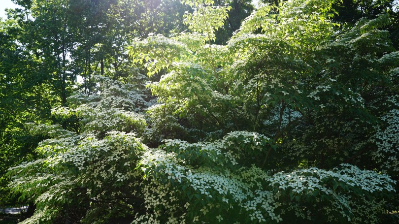
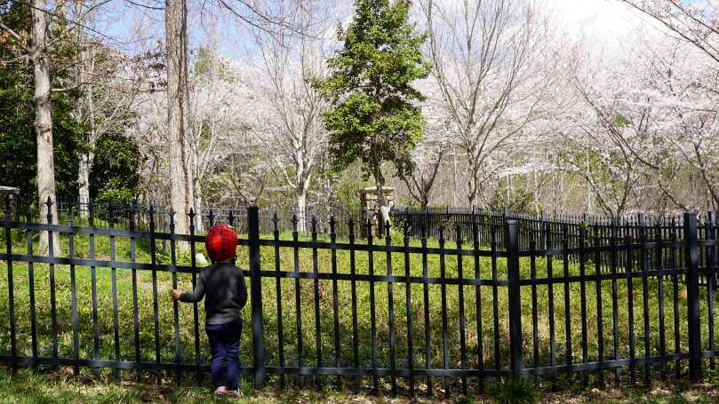
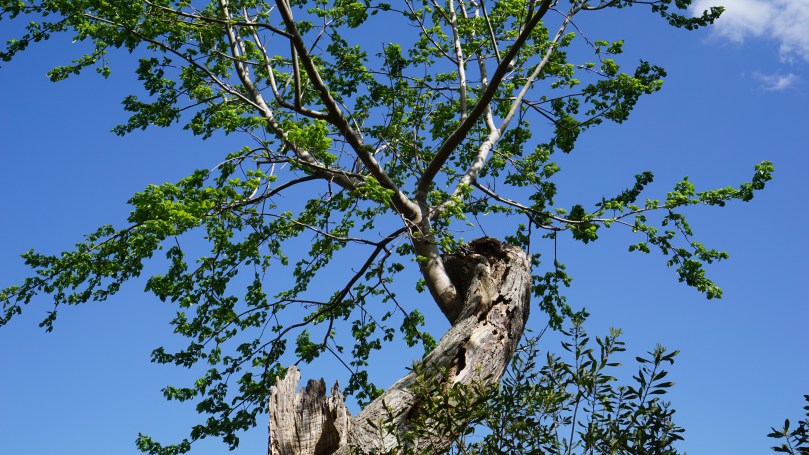
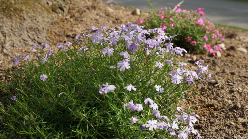
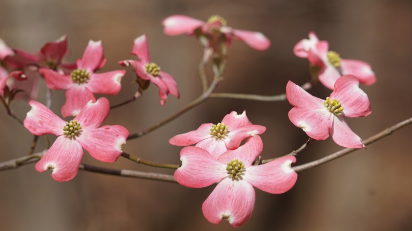
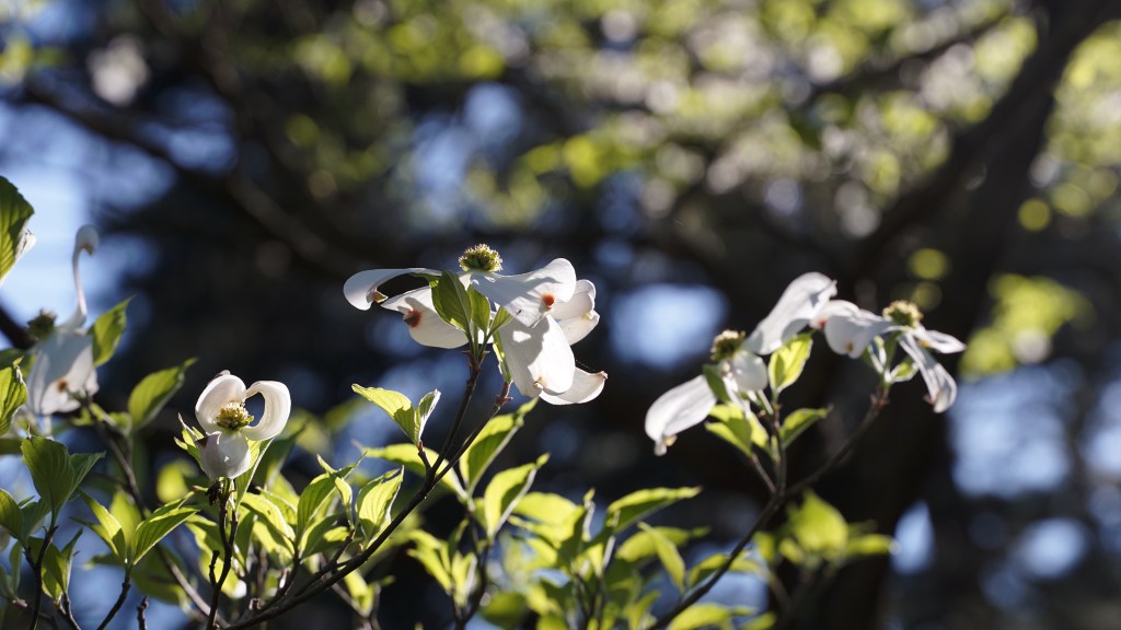
Yoshino Cherry Blossoms in Midlothian Mines ParkWoolridge Family Cemetery in Midlothian Mines ParkLife finds a wayGrowing some phloxDogwoodLovin those buttercups
We took the family to spend a couple of days on the Piankatank River. The water was calm and the wildlife was out and about. I was able to get a shot of the bald eagles that have been hunting our segment of the river for years. I’ve been breaking in the Sigma 100-400mm telephoto lens. I still have it attached to the trusty old Sony a6000 that’s been pulling it’s weight for the past 5 years now. Hard to believe it’s been that long. I still have much to learn about telephoto lenses, but it’s been a lot of fun. Happy Holidays to everyone. Stay safe and healthy out there…and keep those masks on! Cheers.
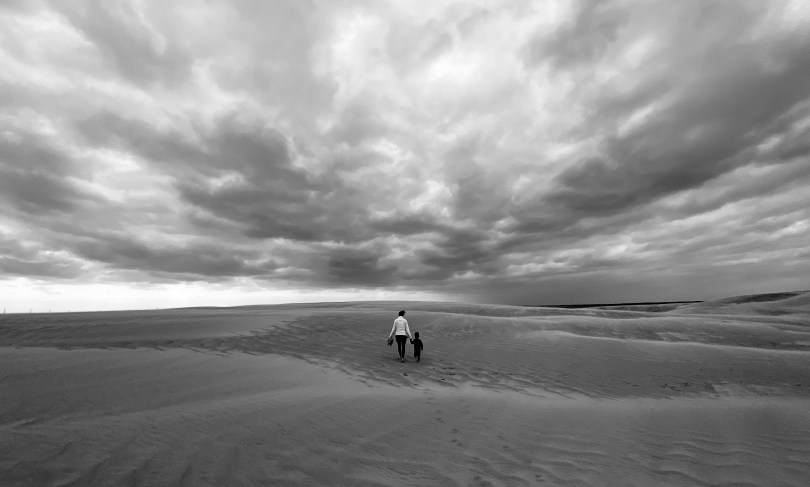
In the middle of the Outer Banks in North Carolina, you would never expect to find the tallest active sand dune on the east coast. At Jockey’s Ridge State Park, you can explore these sand dunes and more. The park covers an area of 427 acres and is the most visited park in the North Carolina park system.
The temperatures can apparently be truly desert-like in the hot summer months. Reaching 110 degrees F and the sand can be up to 30 degrees hotter. Our visit was in late September so there was virtually no one when we arrived. For our son, this was the largest sandbox he’d ever seen and he was thrilled.
* Make sure to bring plenty of water on those hot days. Sunglasses help too even if it’s not sunny, especially on windy days
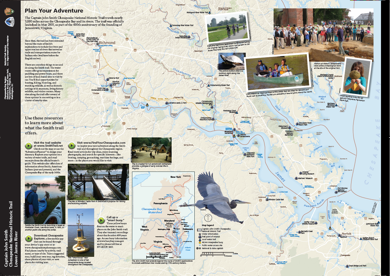
Deep Bottom Park is special not only for its historic significance, but also for its position on a unique part of the James River known as — the oxbow. The U-shape bend of the river at this section of the James resembles the harness for an ox. The river in this section is also unusually deep, hence the name of the park.
“…Gabriel Archer, who along with John Smith and a band of other Jamestown colonists first traveled through here in May 1607, estimated the depth at “five or six fadom eight oars’ length from the shore.” ” – National Park Service, US Department of Interior.
This portion of the river is also part of the Captain John Smith Chesapeake national Historic Trail, one of only two water trails designated as a “National Historic Trail”, the other being the Star-Spangled Banner National Historic Trail. The Captain John Smith trail consists of a series of waterways in the eastern USA covering approximately 3000 miles (4800km) flowing along the Chesapeake Bay. The waterways are of historic significance as they trace the 1607-1609 voyages of Captain John Smith on his expedition to chart the land and waterways of the Chesapeake.
In 1612, years after his expedition, John Smith was able to publish his map of Virginia, a masterpiece that would continue to be used for 7 decades.
Deep Bottom Park is a quiet and small getaway on the James River. About 20 minutes out from Richmond, the park provides access to the two boat ramps – one is a canoe launch facing Four Mile Creek, and the second is the main boat launch out to the James River. This section of the James River is uncharacteristically deep (hence the name of the park).
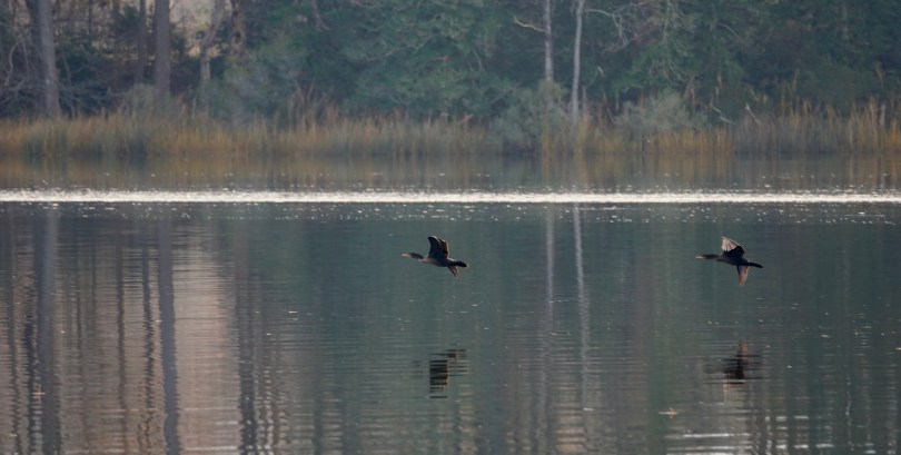
We were blessed with another beautiful spring day. The sun was out with temperatures in the low 60s F. Although not designed as a biking trail, our toddler found plenty of suitable ground to blaze through. We spent most of our time at the canoe launch, where we had the dock all to ourselves. From here, we were able to immerse ourselves into the surroundings and the wildlife welcomed us. We saw a large osprey, a large blue heron, fish jumping out of the water and countless frogs and tadpoles and everything in between.
From what I could see from the dock, the waterway up to Four Mile Creek, looked like a good one to paddle. The water was calm, and the wildlife viewing appeared promising. Whether your interest is history, wildlife, the river or fishing, there is something here for everyone. (Be safe out there, and always make sure you have your personal flotation device, PFDs).
Deep Bottom Park also offers picnic facilities, restrooms, and fishing are available at this site. The boat ramps are available twenty-four hours a day to launch and retrieve boats. The park grounds are open from dawn to dusk.
On my last day of break, I wanted to take the family out to explore the freshwater tidal marsh areas of R. Garland Dodd Park in Chesterfield County, Virginia on the Appomatox River. The park spans 176 acres and offers something for everyone of all ages. Apart from the beautiful 2.7 miles of walking trails, there are 2 baseball fields, 2 basketball courts, a football field and 6 tennis courts which are all lighted. There are also 4 soccer fields and two different sets of playgrounds, and numerous shelters.
The main attraction to the park is the floating boardwalk through the Ashton Creek Marsh. In the heart of winter, the place seemed desolate but still very beautiful. I imagine that in the summer, this place would be teeming with wildlife; birds, turtles, and dragonflies to mention a few. We enjoyed the very short hike down to the first Marsh Overlook where the floating board walk begins. Interestingly, at this location is another playground area which seems to be almost hidden in the woods. Our son very much enjoyed the floating boardwalk, as he hopped over the panels to avoid the small gaps. With walking stick in hand he explored the marsh and the plants, marveled at the ducks as they flew in formation and observed the sporadic movements of the dozens of tadpoles.
At the age of 28 months, he is a very capable hiker on flat terrain such as this. Towards the South Gully Bridge is a beautiful outlook on the Appomatox as the marsh opens up into flowing river water. This area is interestingly of historic significance as well. This land was the southern end of the Union position during the Bermuda Hundred Campaign. These were a series of battles fought at the town fo Bermuda Hundred during May of 1864 during the American Civil War. There is evidence of the Union Army’s earthworks in the area however relic hunting is prohibited in the park.
The park is listed as “at Point of Rocks”. The Point of Rocks is a plantation home that was built in 1840 of historic significance during the civil war. It was named after the 60 foot high sandstone cliffs on the Appomattox River. The house had signficance as an observation point during the war for Union General Benjamin F. Butler. It was used for a time as a hospital as well. The home today is owned privately by descendants of John Strachan, but part of the land is part of the park today.
Whether you come for the views, the sports or the history, there is certainly plenty to explore at R. Garland Dodd Park. (30 minutes away from Richmond, VA)
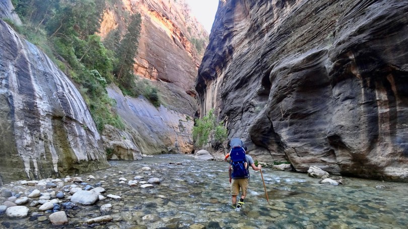
The highlight of our 10 day road trip through the Utah Mighty Five was hiking the narrows with our toddler. This was shot with the Sony FDR X3000 action camera.