Yellowstone & Grand Teton National Park – Wyoming, USA

Map of Yellowstone National Park


In 1872, President Ulysses S. Grant, signed into law, the establishment of the first national park in the United States…Yellowstone National Park. This massive national park covers a whopping 3,468.4 square miles; larger than the states Rhode Island and Delaware. 96% of the park is in Wyoming, 3% in Montana and approximately 1% in Idaho. The stories of Yellowstone and its spectacles are well known to people from all over the world – Old Faithful, the roaming bison, the brilliant springs, and the massive waterfalls.

Minh is thrilled once we reached Gardiner, Montana. The gateway city to the north entrance of Yellowstone National Park.

I wanted to see for my own eyes, the landscapes, wildlife and magic, that inspired a country, to begin protecting and celebrating these areas known as National Parks. In today’s turbulent political climate, it seems as if our country has forgotten about these places, and we are unfortunately heading in the complete opposite direction. More and more wilderness areas are under threat each day, as efforts to seek new resources take priority.  At this rate, who knows how much of our planet will be left in 40 years. I wanted to get away from work, politics and the debates and go explore the wild west for myself.

A photographer captures a moment in the black sand basin of Yellowstone National Park

Sarah and I were fortunate enough to be able to rearrange our schedules to have 8 days (5/19-5/26) off together to explore Yellowstone and the Grand Tetons in Wyoming. We realized this was an ambitious trip, considering the fact that we were bringing our 7 month old boy along; but we were eager to adventure as a new family. I quickly learned that traveling with a baby, turned simple trips…into expeditions. We carefully thinned out our luggage so that we could make room for all of Minh’s clothing, toys, food and milk. He did remarkably well over both legs of the flight (Richmond to Atlanta then Atlanta to Bozeman) and then the three hour drive to Yellowstone National Park. We stopped frequently along the way to make sure he could eat, crawl around, and get some fresh air. I actually preferred the slower pace of traveling with a baby. It helped removed us from from our hectic daily routines and pace of life back in Richmond. Minh taught us to slow down and take everything in. We often found ourselves parked next to the road feeding and playing with him in the back seat or trunk. We took in the serene, roadside skylines of Montana and Wyoming without much care for anything else.

Yellowstone, a geothermal wonderland

When planning a trip to Yellowstone, the lodging options are both varied and abundant. We were traveling with a baby so we knew that we wanted to be in the actual park. This would help cut down our travel time each morning and allow us to see as much of the park as possible. For those traveling with some more flexibility, there are several good options to explore, such as small towns just outside Yellowstone (ex. Gardiner and West Yellowstone) or even camping options within the park. We booked one of the last spots in the northern section of Yellowstone at the Canyon lodge. Despite traveling during shoulder season to avoid the crowds, all of the lodges seemed very busy. I could not imagine what it would be like during the summer (peak season).The next morning, we were eager to explore the raw and rugged spaces of Yellowstone in broad daylight. There certainly is a palpable pulse in the earth of Yellowstone. This massive park is centered over the largest super volcano on the continent. The landscape never lets you forget that you are treading over a sleeping giant of a volcano. From the steaming hot springs, bubbling mud pits to the spitting of geysers, this place is certainly alive……..and mighty.

The Grand Canyon of Yellowstone National Park
Yellowstone landscape

As the first national park to be created, Yellowstone certainly makes you feel as if you are at the heart of it all. I’m glad that we packed for all different types of weather, because at 7500ft, things could change really quickly. In the early morning hours, the park is draped in a blanket of fog which clears usually by about 9:00am. We had sunny days for all of our time at Yellowstone which was very lucky considering the forecast predicting light rain and cloudy skies. In true mountain fashion, we were hit with a snow flurry as we were leaving the park. I was surprised to learn that it is not uncommon to get snowfall as late as July!I was also surprised to learn that it took me quite some time to get used to the high altitude. Strenuous activities tired me out faster than usual and I had a very mild headache the first 24 hours. The decrease oxygen concentration is certainly noticeable in my opinion and it is not recommended for people with pre-existing coronary artery disease to travel at such heights. This lower oxygen content could put the coronary arteries of the heart in a dangerous scenario of supply and demand mismatch, leading to worsening ischemia and therefore angina. So if you have pre-existing coronary artery disease, congestive heart failure, or pulmonary hypertension make sure you get cleared by your physician before. (my only medical plug in for this article).

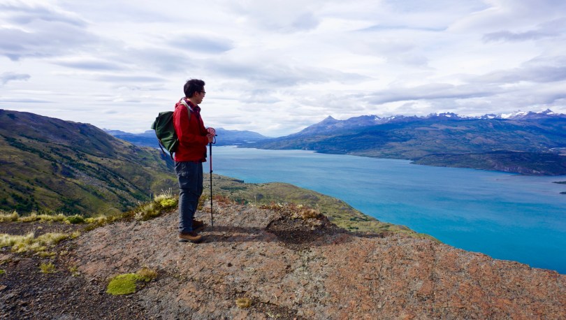
Yellowstone is divided into villages which are centered around main attractions such as Yellowstone Lake, Old Faithful, Grand Canyon of Yellowstone and Mammoth Hot Springs. As a result of this set up, I feel like Yellowstone has a more “touristy” feel, than most national parks. During peak season, cars are lined up back to back and alongside the roads, with frequent stops as visitors often pull to the side for photos of bison or landscapes. One could always take the beaten path and venture into backcountry Yellowstone, for a more secluded experience. With Minh coming along, we actually wanted the “tourist” experience, with access to bathrooms, restaurants and drive-up landmarks to visit. I don’t think he’s quite yet ready for backcountry Ontario canoe camping ;).

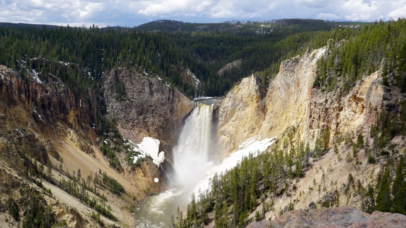
We spent the next 4 days and nights exploring all quadrants of this magnificent land. We started each day at the Canyon Lodge for an early, hearty breakfast. We would then drive to the farthest part away from the lodge and then starting working our way back at each site. Although the main attractions (Old Faithful, Grand Prismatic Spring etc) were spectacular sights to see, I think my favorite parts of the park were the lesser known attractions such as the mud volcano and the mouth of the Yellowstone River as it opened up in to the grand canyon of Yellowstone. These were areas where you could get away from the crowds and listen to the breathing of earth below us.

Idaho

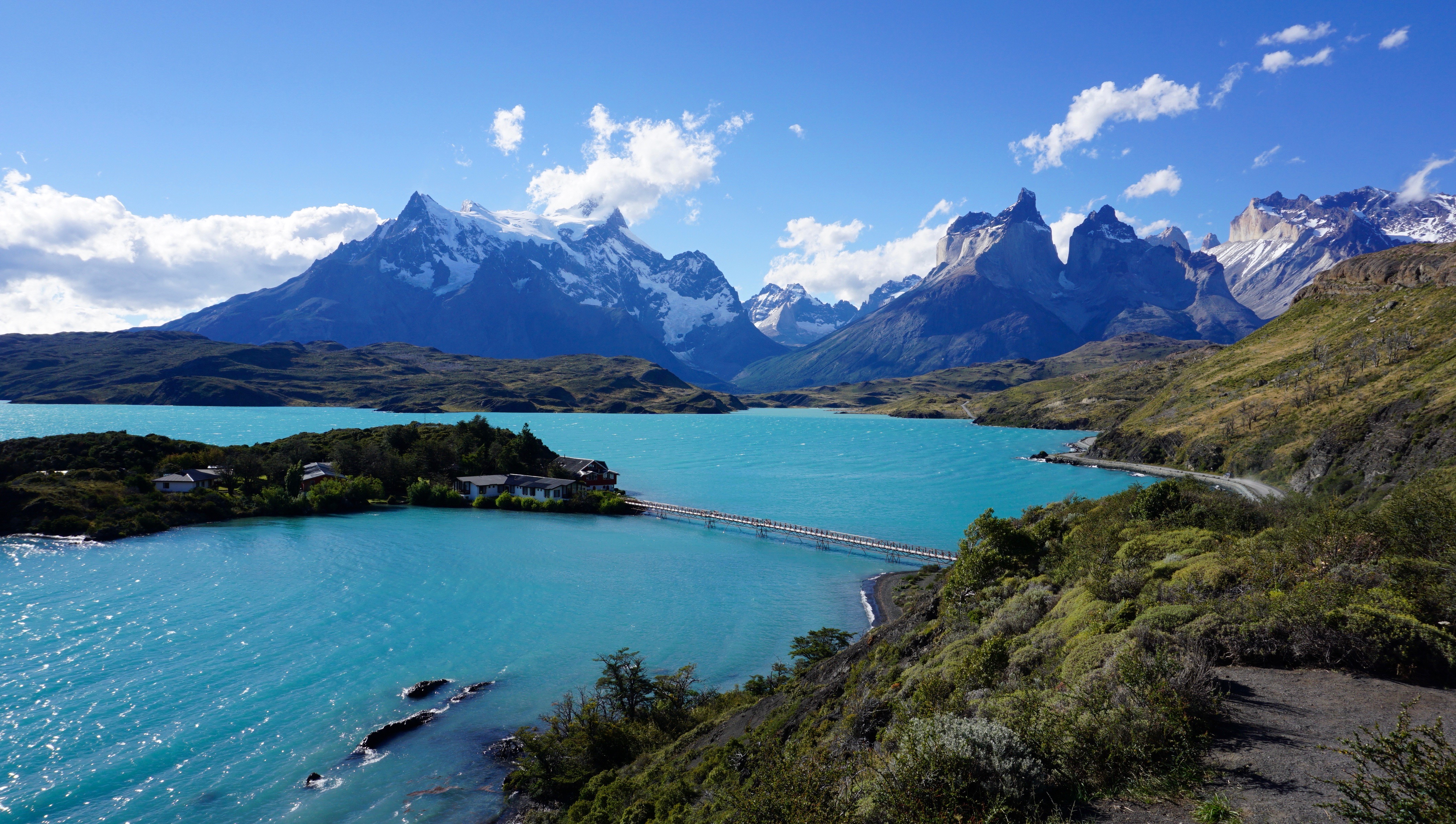
The second leg of our adventure took us to Jackson Hole, Wyoming where we spent the next two nights at the Lodge at Jackson Hole. This was our home base for exploring the Grand Tetons and surrounding Jackson area. We were skeptical that we would actually see the tetons because of the predicted rain for the next two days. Still hopeful, we packed our lunches and head out to explore Grand Teton National Park. A short 30 minute drive from Jackson Hole, the teton range certainly has a different vibe than yellowstone. It had more of a national park “feel” that I was used to. The crowds were not as intense and the pace a little slower.

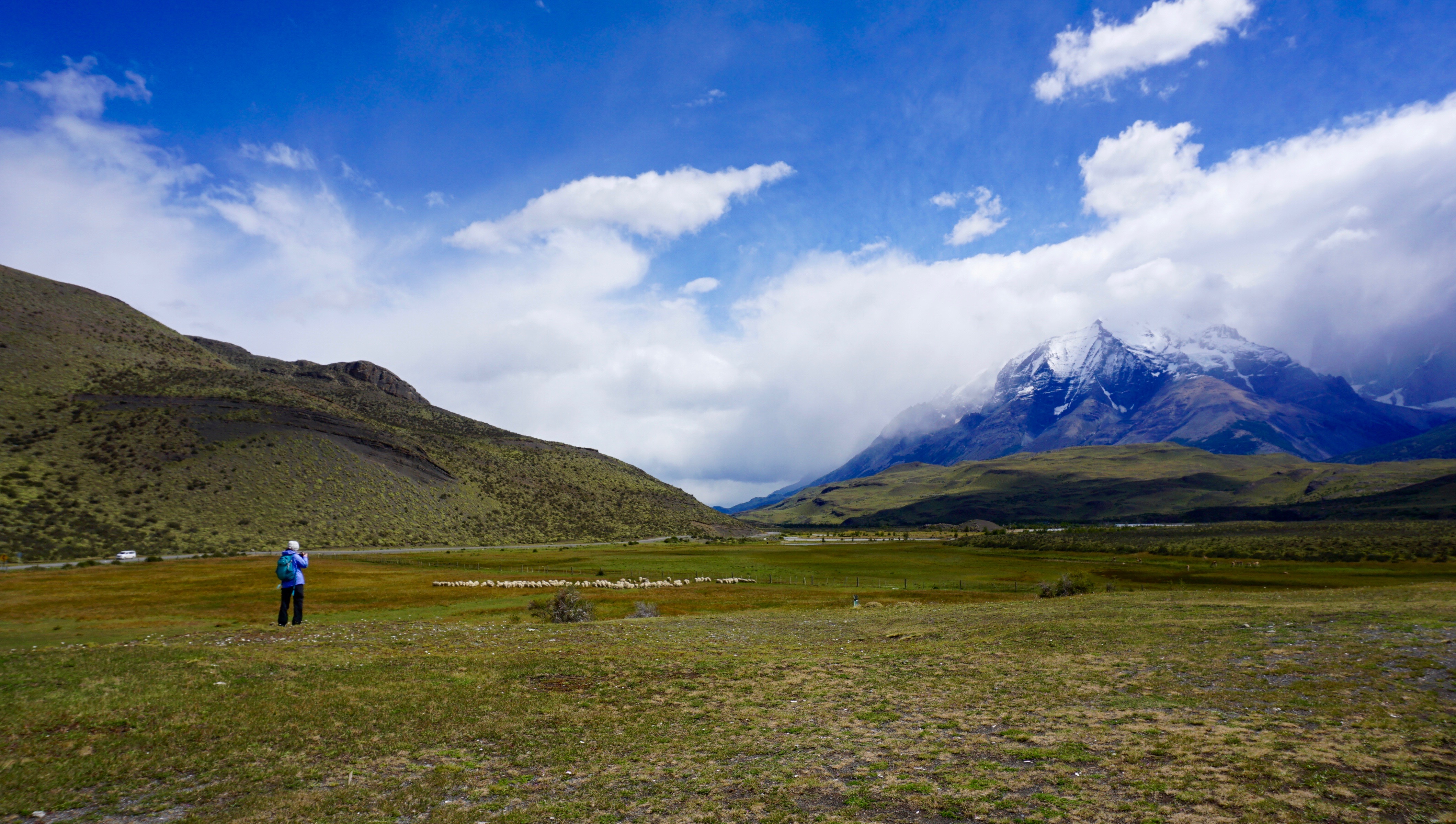
Miraculously, and I don’t know how, but we were blessed with unexpected sunshine that cut it’s way through the clouds and parted a view for us to the teton range. We watched in marvel as more and more of the Tetons emerged into fire before us. The sunshine stayed with us for the rest of the day. Unlike yellowstone, Grand Teton National Park is not situated over a super volcano. As a result, the landscapes are less raw, and more majestic, it appears a bit more hospitable to wildlife but I’m not a geologist or biologist. Within the first few hours in the park, the locals felt like showing off, we caught sight of a mother grizzly and her cubs, moose, elk, antelope and of course bison. We spent the day driving from site to site and sitting in the back of our car, playing with Minh and watching the sun, and clouds revolve through the most gorgeous landscapes.

Before we knew it, our time out west was drawing to a close. We had one last night left in Belgrade, Montana ahead of us before we went home. The drive from Jackson Hole to Bozeman, Montana was one of my favorite parts of the trip. The drive through Idaho was spectacular. We climbed high into the mountains before traveling through some of the flattest land I’ve ever seen. The 4 hour drive brought us just outside Bozeman where we would spent the night at Ross Creek Cabins, a set of charming small cabins run by a very nice couple, Steve and Karen. I highly recommend this place for anyone looking to exploring Bozeman and the surrounding areas. As we sat by the campfire reflecting on the past 7 days, we both realized that this was the first time that we were going to see a sunset out west! We put Minh to bed every night around 7:00pm so we haven’t seen a single one prior. As we sat there watching the orange and purple hues collide, with a gentle dry breeze across our face, I just thought one thing……I love this land.

There are 60 National Parks in the United States. How many have you been to?

Torres Del Paine National Park – Patagonia, Chile

patagonia_map
Map of Patagonia, from National Geographic

At the very end of the world, in the most southern tip of South America, exists the land of wind, fire and ice known as Patagonia. This landscape of spectacular mountains, deserts, glaciers and alpine meadows spans across both Argentina and Chile, from the western pacific coast to the eastern atlantic coast. Curiously, the name Patagonia translates roughly to “land of the big feet”. It originated from the word “Patagão” (or Patagoni) – a name Magellan gave to the natives of this new land he encountered on his expedition in 1520. The Patagoni he described were actually the Tehuelche people, who in general, were much taller than the average European. Their large footprints found in tracks led the first explorers to believe that this was a mystical land of giants. The footprints were in fact large because of the leather skinned guanaco boots that they all wore during the cold winters.

36
View from the small Puerto Natales airport, staring into Patagonia

Patagonia is a land of secrets and wonder – even the story behind its name I found fascinating. It has long been at the top of my list of places to visit and finally on January 20, 2017 (inauguration day), we left Virginia to explore this untamed land.Traveling to Patagonia was no easy feat. After a 2 hour drive to Washington DC, we flew 5 hours to reach Panama City, and then 6 hours to Santiago, Chile. From there, it was a 3.5 hour flight to reach Puerto Natales followed by a 2 hour drive to reach Patagonia Camp. We broke up our traveling with a day’s rest in Santiago on both legs of our journey.

Map of Torres Del Paine National Park

I will never forget the flight to Puerto Natales Airport in Patagonia. The harsh winds created fierce turbulence and a hair-standing landing. Upon opening the cabin doors, our faces were hit with the howling winds and cold air of Patagonia. All around us in this desolate airport at the end of the world, were mountains as far as the eye could see…mountains, fields and emptiness. We would now have five full days to explore this mysterious land.

We grabbed our luggage amongst the dozens of hikers from all over the world and hit the road to Patagonia Camp (our base camp and home for the next 5 days). From here, we could rest and relax and plan our excursions into Torres Del Paine National Park each day. I hope to one day write a review about our experience at Patagonia Camp, but for now, all I can say is that it was simply an unforgettable experience with fantastic staff members.

Torres Del Paine National is one of the most popular attractions in Chilean Patagonia. It is one of the 11 protected areas of the Magallanes Region and Chilean Antarctica. The park’s 2422 square kms of mountains, glaciers, lakes, and rivers attract thousands of visitors each year. The centerpiece of the park are the Paine (pronounced PIE-nay, meaning “blue”) mountains and more specifically the Towers of Paine (Torres Del Paine: spanish translation). These are three distinct granite peaks in the Paine mountain range that many consider to be the 8th wonder of the world.

Lago Pehoe

Our first full day in Patagonia was spent on an easy 8.5km hike through pre-Andean xerophilous scrubland. There was plenty of wildlife to see; guanacos, flamingos, condors and grey foxes. The most elusive animal in Patagonia is at the top of the food chain. The puma. I found this to be an unusual terrain for this predator, but clearly it was very successful. The fields were scattered with guanaco skeletons that were picked clean by condors after the pumas have had their fill. I was most in awe at how different everything was from any other place that I had been. The terrain, the geology, the wildlife, climate, and of course the flora.

One of the symbols of Patagonia is the evergreen shrub know as Calafate (box-leaved barberry, berberis microphylla). It is a plant native to southern Chile and Argentina  They were scattered through the fields during our hike and we were able to taste its edible blue-black berries. These berries were used frequently by the locals to produce all sorts of goods, such as jams, flavoring and even beer. Legend says that anyone who eats a Calafate berry will one day find their way back to Patagonia.

We continued our trek through the scrubland and explored caves with prehistoric paintings that dated over 6500 years old. We came back to camp that evening and met many of the other visitors. They were really from all over the world, Denmark, Canada, Britain and the USA. Most who come to Patagonia, travel here to hike the trail to the base of the towers, in the heart of the park. And some talented hikers showed us their watercolor creations of the towers once they reached the base. We were definitely excited for what lay ahead.

In Patagonia, the unpredictable weather makes trip planning essential, and you should always a back up option in mind if your primary objective does not follow through. In this sense, I felt that Patagonia camp did an excellent job of laying out potential options for the next day’s event. They were checking on the weather constantly to decide which trails when be optimal of the next days travel. This was of course a land where you can have all four seasons in one hour. The variability in weather was also drastic even in the smallest distances throughout the park. For instance, it could be pouring rain in the west end of the park and bright sunshine and clear skies on the east end over the mountain ranges. We had originally planned to go to the base of the towers on the second day, however storms had washed away the bridge access. We decided to shoot for the French Valley as the second option, however once we arrived, the ferry (which had been out of commission for the past 3 days) was full.

We went to our third option the Lazo-Weber trail. A 12km hike with a little bit more elevation climb than our first day but not incredibly strenuous. We hiked this trail in the opposite direction from west to east. This particular day ended up being one of our most beautiful days in the park. We were able to get great angles of the paine mountains and had amazing lookouts at the lagoons and meadows. This hike allows for one of the best views at Almirante Nito (8759ft), Los Cuernos (8530ft) and Cerro Fortaleza (9514ft) and the Paine Grande (10006ft). Our hike took us through meadows, forests and mountain tops. One of the most memorable moments for me was eating lunch inside a quiet forest, to shield us from the harsh winds. At the end of the 12km, was a small Patagonian ranch where we sat, ate lunches and drank.

On Day 3, we were itching to get into the heart of the park. We woke up early and head to the ferry to finally reach the segment on the “W” trail known as the french valley. It was a strenuous day of hiking, but the breath taking views, kept us pushing forward.

The French Valley – Patagonia, Chile

As we approached the glacier, we scaled rocks up melting glacier waters and crossed several wooden bridges. This is when things started to get interesting. At several parts of this trail, we were just basically fording through ankle deep glacier water. Once inside the French Valley, we found a quiet spot to eat lunch and gaze in awe at this magnificent glacier. We sat, ate, and listened to the cracking the glacier, as it continued it’s melt and freeze cycle in the summer time. After lunch, we filled our bottles with some of the best tasting glacier water I’ve ever had and caught the ferry to the mainland.

Before we knew it, our time in Patagonia was coming to an end. I can see how someone could easily spend several months here and still not see everything they wanted to. Although we were disappointed about not being able to see the base of the towers, we were grateful for so many things. Most importantly, no one got hurt and the weather was absolutely perfect. It had rained 50 days straight shortly before our arrival so we knew we were incredibly lucky. We visited during the Patagonian summer, and although we had incredible views. Some tour guides suggested to come back in the fall when the park is much quieter and the scenery is even more colorful with the fall foliage. The winds were also apparently less intense. It was not in our fate to see the base of the towers this go around, but I hope that the story  of the Calafate berry holds true – maybe one day, we will find ourselves back to this amazing land.