
6:50 am on the Piankatank River in Gloucester, VA.
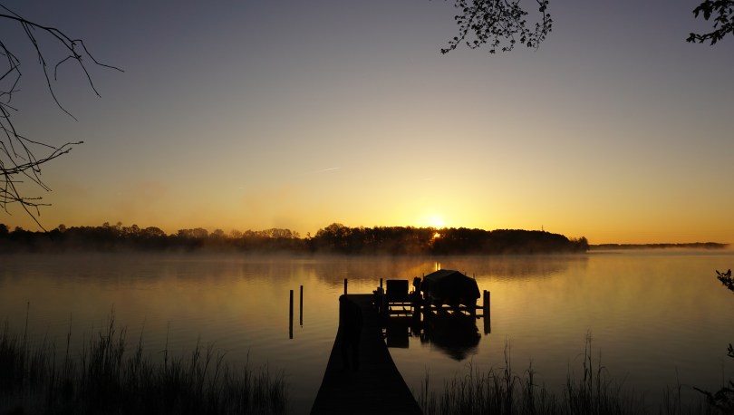
6:50 am on the Piankatank River in Gloucester, VA.
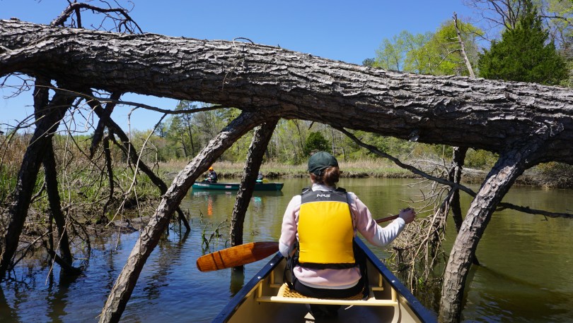

There is never a shortage of waterways to explore in Virginia. In a short 1 hour road trip from Richmond, one can reach the largest estuary in the United States; the Chesapeake Bay. Here, fresh water from over 150 rivers and streams of New York, West Virginia, Pennsylvania, Delaware, Maryland, District of Columbia and Virginia meet the Atlantic Ocean to create a brackish water ecosystem teeming with diverse wildlife and vegetation. There isn’t a better way to connect with this landscape than by canoe. We decided to paddled through the south arm of the Ware River, one of five canoe trails that make up the Gloucester Blueways. The county established these Blueways as a way to encourage visitors to the area and to encourage preservation of these precious lands.

The population of bald eagles and osprey has been healthy in recent years and we had were within sight of them the second we reached the put in. The salty waters of the Mobjack bay was surprisingly clear and calm as we embarked on our excursion.

A sense of calm and stillness surrounded us as we approached the wetlands. We were protected from the wind by reeds and twists of and turns of the stream. I was stunned by the vast array of wildlife we encountered. From blue crabs, to herons and even a red-tailed hawk, each bend of the river presented a new surprise.
There is certainly something very special about the wetlands. For years the Chesapeake Bay Foundation has been fighting to protect these lands. These regions are especially important in preserving the clarity of the Chesapeake bay. It is the final stop for all of our river and stream runoff from land before it reaches the bay. The major pollutants of the bay are in the form of nitrogen and phosphorus. Such elements are crucial to life, however an overabundance can be detrimental. When these elements are in excess, they contribute to algae blooms which clouds the water and inhibits sunlight that is crucial to the growth of bay grasses. The decline in oxygen from dying plants can cause dramatic pH changes which can kill off crabs, fish and more plants. Today, 300 million pounds of polluting nitrogen reaches the bay each year, over 6 times the amount that reached the bay in the 1600s.


While the war effort in cleaning the bay is underway on many fronts. Many believe that the oyster will be the savior of the bay. The eastern oyster is an incredibly resilient species, although years of disease, pollution and over harvesting have caused numbers in the bay to decrease to less than 1% of what it once was. This shift in oyster population has also contributed to the decline in the health of the bay. Oysters are able to filter up to one gallon of water in one hour. They play a vital role in preserving the clarity and hence the habitat of the Chesapeake Bay. In the recent years, the news has been promising with oyster populations making a bounce back and with them, the blue crab population. Both iconic species of the Chesapeake Bay.


I had some time at the end of this trip to reflect on some tripping gear as well. This was my third outing on the prospector, and so far she has been handling like a dream. At only 52 lbs, she’s a breeze to load onto the car and take anywhere. She is responsive and feels comfortable on all different types of water. The comfortable yoke design also makes her almost a joy to portage…but i wouldn’t go that far. I’ve also been quite happy with the Sony a6000 mirrorless camera I’ve been shooting with. I’ve realized that I normally shooting in fairly wide angles at an average of 16mm. Although I haven’t used many other lenses other than my portrait 35mm, I can definitely see the utility in the zoom lenses >250mm in capturing wildlife. The eight bald eagle sightings on this trip convinced me to at least look into some of these lenses.

The scorching Virginia summers often steer our canoe trips to the cooler mountain lakes, however this is spring, and anything is fair game. It was actually a refreshing and chilly day as we paddled, at temperatures in the 50s F. Let’s see how long these cool temperatures last. With the north arm of the Ware River and four more routes to explore on the Gloucester Blueways, there’s still plenty to see. Long live the Chesapeake Bay.
Learn more about the blueways here: http://www.gloucesterblueways.org/
Help save the Chesapeake Bay here: Chesapeake Bay Foundation


When presented with free time and the opportunity to explore arises, it can be difficult to decide where to go. The number of destinations seem endless with each place offering something completely different: the Blue Ridge mountains to the west, the coastal tidewater to the east and the Appalachian plateau to the Southwest. I usually end up letting the season and conditions deciding for me. What better place to explore in early Spring than the St. Mary’s Wilderness Area in the Blue Ridge? I read numerous reviews about the area of its beauty and clear river beds. St. Mary’s is designated a wilderness area, and as such, the trails are poorly marked. It appeared that summer hikers frequently got lost on the poorly marked trails and overgrown brush. I hoped to avoid all of this by navigating in early spring, with bare trees and clearer paths.


My cousin from Toronto accompanied me on this outing, marking his first proper hike in Virginia. When we arrived to the trail head, I was surprised to find that the earth was scorched and the trees charred. I later learned that a wildfire just two weeks prior had burned over 800 acres of the wilderness area. St Mary’s spans over 35,000 acres making it the largest Virgina Wilderness area on national forest land. The region was previously a mining ore for manganese and iron until it was abandoned in the mid 1900s. Today it serves as a beautiful hiking and fly fishing trail along the St Mary’s River, complete with a beautiful waterfall at the end.


There are numerous routes to get to the waterfall. The most popular route listed on Hikingupwards.com recommended starting out along the Blue Ridge Parkway. One reviewer discouraged this path, because it was poorly marked and he took numerous detours after getting lost. They recommended an easier way to get to the falls. Off of Cold Springs Rd (Route 608) is St Marys Road. This road is in excellent shape and leads you all the way down to a well kept parking area and the beginning of the trail that puts you right next to St Marys River. From there, you simply follow the river to the falls. Internet win.
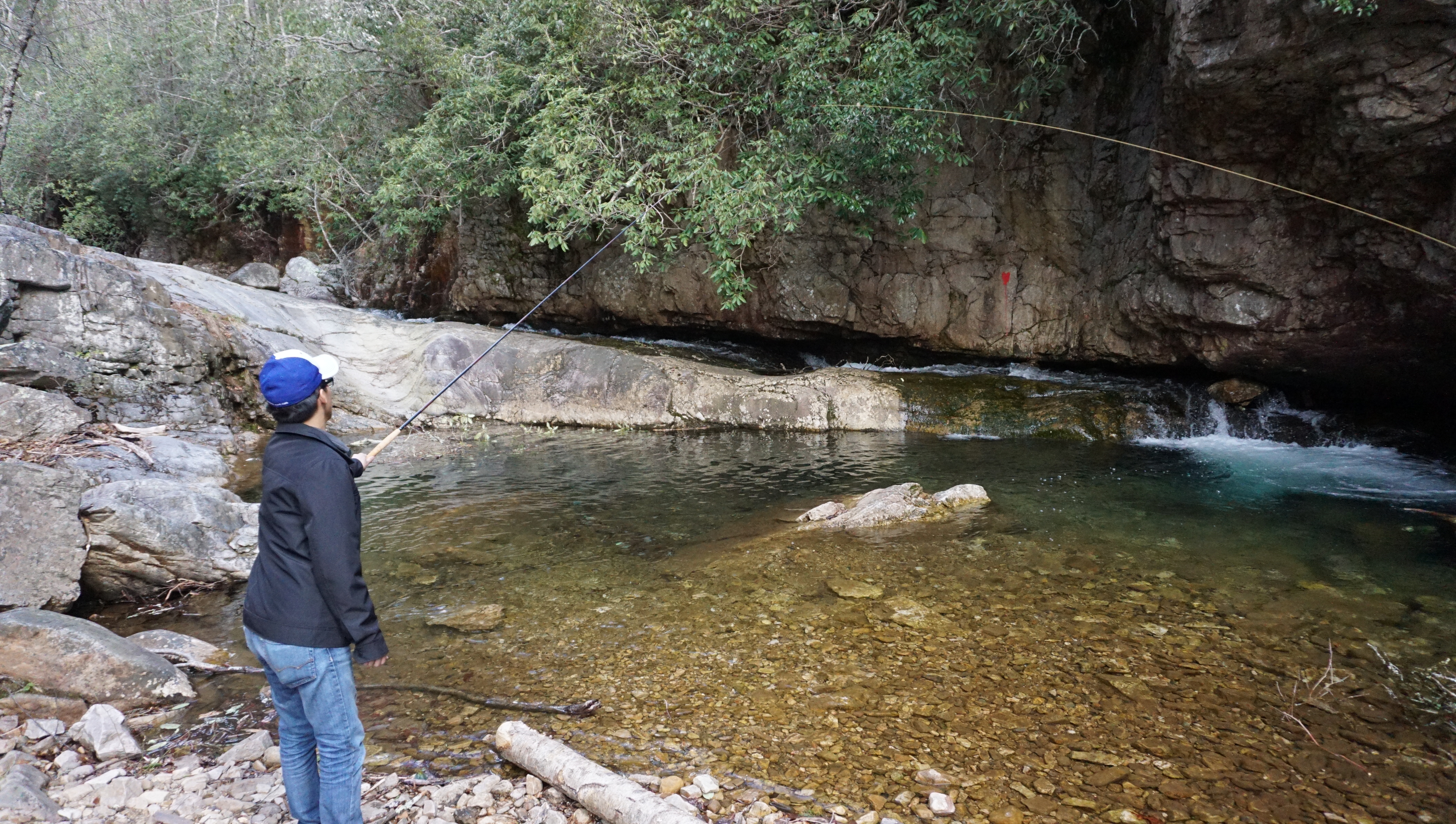
The hike twists and turns through a beautiful gorge, providing a unique vista in Virginia. There was lots of rock hopping, and scaling as the trail crossed back and forth over the river five times. We tried our hand also at some Tenkara (traditional Japanese fly fishing). This style of fly fishing uses only a rod, line and fly – no reel. With flask in hand with some Nordic honey wine and packed lunches, we enjoyed the peace of spring time in the mountains.
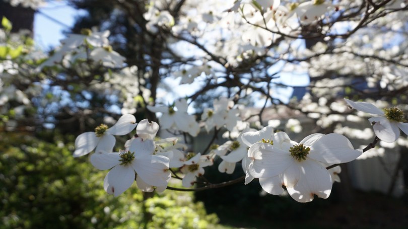
Flowering Dogwood, the state flower of Virginia.
