The canoe plays a pivotal role in the history of Canada. It was the vessel that allowed the voyageurs to utilize the rivers as highway systems for trade and expansion. It was the canoe that built Canada into the country it is today. In the modern era, it serves as more than just a recreational vessel, but a symbol of Canada, and our heritage. I wanted to share this trailer of an upcoming film, scheduled to be released on 2/6/2017 called “The Canoe” by Goh Iromoto, which investigates the relationship of the canoe with the Canadian people.
“This film captures the human connection and bond created by Canada’s well-known craft & symbol, the canoe. Through the stories of five paddlers across the province of Ontario, Canada – a majestic background both in it’s landscape & history – the film underscores the strength of the human spirit and how the canoe can be a vessel for creating deep and meaningful connections.”
“Guided profiles the gentle spirit of Maine wilderness guide Ray Reitze, in his element amidst the whispering pines, singing crickets and croaking frogs of the North Maine Woods. Ray shares his philosophy of how to live in harmony with the outdoors to the next generation of guides, grappling with his own mortality as he transitions from the physical world of guiding to a more spiritual understanding of nature and our ephemeral place in it.”
A cool video I came across, with some beautiful shots of the wilderness and canoe culture in Maine. Definitely looks like a place I’d like to paddle one day.
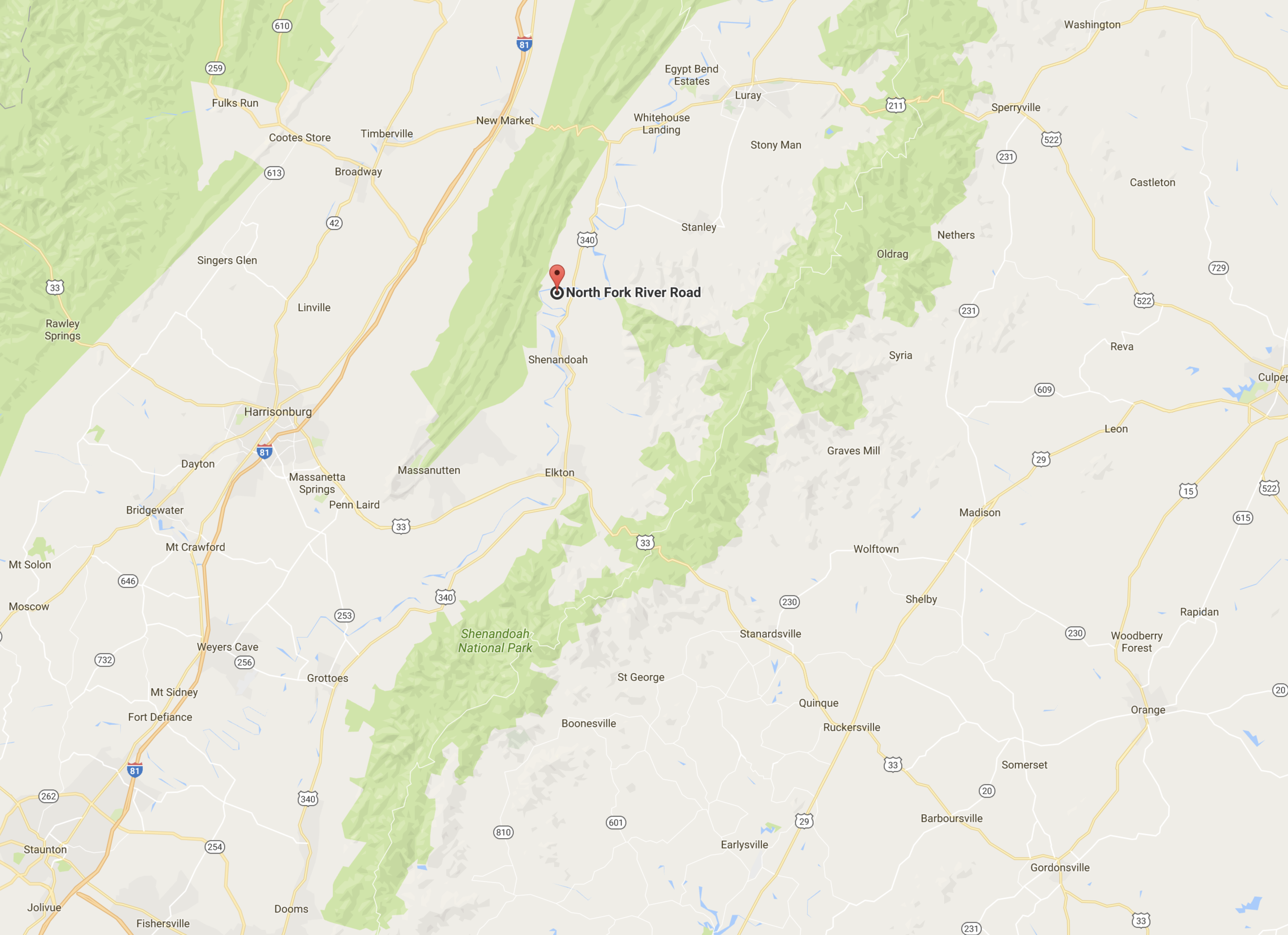
We spent Christmas in a cabin along the Shenandoah River, just west of Shenandoah National Park. The weather was warm enough to paddle, so we paired up siblings and went head to head in canoe races up and down the river. It was rare for all of us to have a holiday break together so we naturally had to make the most of this occasion. I had never been to the town of Shenandoah (population 2354 in 2013) before this outing. And as we drove through this sleepy town, it was hard for me to imagine that this place served a key role during the civil war. There were three iron ore furnaces around this town which smelted raw iron into pig iron. Apparently in the days before the war, this pig iron was shipped down the Shenandoah River to Harpers Ferry in West Virginia. During war time, these goods were transported by wagon to Gordonsville, VA and then subsequently by rail to Richmond where it could have been used at the Tredegar Iron Works. Both of these Virginia mountain towns now are peaceful and quiet as can be. I was especially impressed by Gordonsville’s display of Christmas Lights. It was certainly a welcoming sight while driving through the winding, dark and foggy roads of the mountains.
Trains at Lewis Ginter Botanical Garden
Christmas lights at Lewis Ginter
Christmas cookies
I just realized that I have not been able to produce any new videos of canoe trips this year. I have several projects in the works right now but they have yet to be polished. I’ve been very happy overall with the performance of the Sony a6000 both as a still and video camera. Lately I’ve been experimenting with different lenses and shutter speeds in videography and have been able to catch some pretty decent footage. For our trip in Quebec, I also brought along an external audio recording device to see how the audio quality would compare to the native mic. Here is a demo reel of random shots I was able to capture in 2016.
2016 Demo Reel: by John Le
As the holidays come to a close and a new year around the corner, I look back at how much time I was able to spend with family and friends and the total number of nights I camped outdoors. While it was a good year for paddling and hiking, the total number of nights I spent outdoors, totaled just five. Four of those nights were in the La Verendrye Wilderness Reserve of Quebec, Canada and the other night was spent camping in St. Mary’s Wilderness. I’ve made up my mind….in 2017, I’m going for double digits. Happy New Years to all!
Gordonsville, Virginia – all decked out for Christmas. In the middle of the Virginia mountains.
South Entrance to Shenandoah National Park, Rockfish Gap.
Fall is the busiest time along Skyline Drive and the Blue Ridge Parkway in Virginia, and it’s easy to see why. The crisp mountain air and the gorgeous colors have us strapping on our hiking boots as much as possible. This last impromptu hike was actually suggested by our friends. They are preparing for a trek through Patagonia and wanted to get some good hikes in to build endurance. They suggested a trail I had never been on, the Rip Rap Trail Loop in Shenandoah National Park. A strenuous 9.8 mile that starts at Wildcat Ridge, then meets up with the Rip Rap Trail to finish the loop. We entered the park through the familiar Rockfish Gap Entrance and parked in the Wildcat Ridge Parking Area.
Chimney Rock
Mountain streams
The initial trail is a moderate descent down into the valley where we traveled along side the mountain stream known as Meadow Run. We crossed the streams several times and before beginning our ascent up to Chimney Rock. I would say that the first half of this hike is much prettier than the second half. I am partial however to hiking along the gentle streams as they meander through the valley. This hike is known for it’s beautiful watering hole at the bottom of the valley where two streams merge into one 50ft long watering hole. I’ll try to come back one day in the summer to camp and swim at this location. Peak fall colors seemed to arrive later than ever this year, attributable to the much warmer temperatures we have seen over the past years.
crossing streams
I often worry about how climate change will impact the fragile environment around us. This would mean hotter summers, longer mosquito seasons, a harsher environment for the brook trout that thrive in cold mountain streams. In Canada the effects can already be seen with ticks on the rise, as they are able to establish more stable populations in the increasingly warmer climates.
For those that have not seen it, Leonardo DiCaprio released his documentary “Before the Flood” last week. It highlights climate change and the barriers we face as a planet in addressing this pressing matter. I highly recommend this film to everyone. I thank DiCaprio for his efforts in raising awareness about global warming, an issue that affects us all.
St Mary’s Road is very well maintained, with a parking area before the trail head.
Virginia offers a truly diverse landscape to camp. From the sandy beaches of the eastern shore and Chesapeake bay to the blue ridge mountains and highlands to the west. Without a doubt, one of favorite places to camp, is next to a gently flowing stream in the mountains. I was recently on my one week vacation and I knew that at least one of these days would be reserved for some camping. My friend Min and I originally planned on camping at Ramsey’s Draft in the George Washington National Forest however we were unable to find any suitable campsites near the entrance. Ramsey’s Draft is a beautiful wilderness area I have explored previously, where giant hemlock trees once towered by a wild trout stream. The only problem was the hike to Hiner Spring and the campsites was several miles. We planned this trip as a relaxed camping trip, with minimal hiking and mostly focused on just cooking and fishing. So, we cut our losses and booked it for St. Mary’s Wilderness, a place where I knew there would be excellent camp sites along a river bed. We left the canoe at home this time and trekked in the old fashioned way – on foot. The first day was perfect, warm, sunny and dry. It took us only about a half hour to hike in to the first campsite. It was a perfect site situated at the river’s bend and allowed us easy access to clean mountain waters.
This grill, used on canoe trips served as a handy tool to cook steak.
One of the most exciting parts of camping in my opinion is setting up basecamp. There are numerous factors that go in to creating a comfy home in the woods, albeit just a temporary one. The heart of the campsite, the fire pit is the most important part. Building a structurally sound pit that allows for cooking and efficient heat dispersion is a skill that I still build upon. Always remember to take in account, the wind direction, the location of your tent in respect to the fire pit as well as position of your seats around the fire so you are not downwind of the smoke. Finding a suitable location of your tent is also important. Flat ground can be difficult to find in the forest. It is never a pleasant way to sleep when you are sliding down an incline in your tent. Sometimes, you’ll also have to clear a suitable grid, void of sharp rocks, sticks that may damage your tent. Also keep it out of the way of any standing, dead trees that could potential topple in a heavy storm. The pathway to water is one that has to be safely mapped so it can be accessed at all hours. Access to firewood is also important and Min loves collecting and processing firewood, it is something he takes great pride in. A folding saw, and axe are two crucial camp tools that allow a members to live comfortably. It gives you the ability to topple dead standing trees, and also quickly prepare a stack of firewood to last days.
wild flowers
ferrule rod
rocks
workhorse of a tent
After developing a strong base of embers from the fire, we stabilized the portable grill into the fire pit and cooked up some delicious steaks. It cooked perfectly, and we served it with some baked potatoes. As the darkness set it, we threw more wood on the fire and spent the night chilling and catching up about our jobs, families and friends. In the middle of fall, I was surprised to say it felt comfortable in St. Mary’s Wilderness. We were in short sleeve shirts in the middle of the night. Camping in the valley provided us with protection from the wind and we were sitting in low 60s F weather.
Campfire
Trangia alcohol stove
Streams
We slept well that night, however awoke to rain starting at 6:00am. It continued as an autumn shower without any signs of stopping. We packed up our gear and decided to head home. It had been a long time since i had been caught out in the rain, camping in Virginia and although it can be a pain, there is certainly a beauty to it. All around us, we could hear the drops, beating on trees and plants, as leaves drifted in the forest all around. The river beds were fast to fill, especially since we were in the valley. The water was teeming with wildlife, brook trout, frogs, and countless crawfish made their appearance. The rain seemed to awaken the forest. Just goes to show you that if you only camp when the weather is nice, you’re missing half of what’s out there.
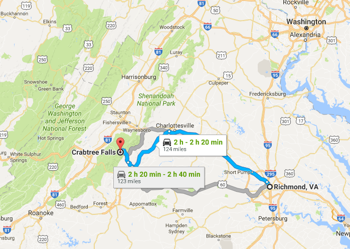
The changing of the seasons is always a special time in Virginia. Although the summers can be uncomfortably hot and humid, I’m always sad to see it go. Before the official end of summer, we traveled out to the Blue Ridge Mountains in George Washington National Forest to hike Spy Rock, near Montebello along Route VA 56 West. The hike is of moderate difficulty at 3.2 miles and we paired it with a quick run up Crabtree Falls, the tallest waterfall in Virginia.
Montebello Trout Hatchery
Hatchery
Rainbow Trout
In the mountains, the climate was noticeably different; it was at least 10 degrees cooler and the earliest hints of yellow and orange leaves signified that fall was already here. The trails at both hikes were packed filled with people as we expected on a pretty Saturday. We parked at the Montebello Trout Hatchery because the main parking lot was already full. This gave us a nice opportunity to examine the rainbows, browns and brook trouts that were being raised. While only the brook trout is native to Virginia, the browns and rainbows are a popular trout species to raise since they grow to massive sizes and promote a healthy fly fishing culture in the Virginia mountains.
Spy Rock at 3980ft provides a 360 degree view of the Blue Ridge Mountains
The hike up Spy Rock took us along a rocky road for the initial segment until it intersected with the Appalachian Trail to take us to the top of Spy Rock. The view atop is impressive, allowing a full 360 degree view of central Virginia. We ate a quick lunch and made our descent and back into the car along VA 56 to Crabtree Falls. We then ascended the first mile up Crab Tree Falls to view the lower falls. The water was slow flowing at the end of summer but still a magical sight. On the way home we visited the Albermarle Ciderworks for a cool drink and dinner in downtown Charlottesville. I am sad to see summer go but excited for all the things fall has to offer: camping, changing colors, harvests and of course the start of the holiday season. Cheers to Summer 2016.
It was a particularly hot summer weekend in Charlottesville, with highs greater than 100 degrees F. We were on a getaway from Richmond and despite the heat, we somehow wanted to squeeze in a quick hike in Shenandoah National Park. During this time of year, the popular watering holes like White Oak Canyon, are packed, so we decided it was time to find a new trail.
Shenandoah shrooms
In the heat and humidity, we had to be conservative with what we hoped to accomplish. Naturally, we chose the easiest hike in the park: Blackrock Summit, a quick 1 mile loop around the mountain and back. This was more of a walk than a hike. The elevation was minimal and the trail very well maintained. Despite the ease of the hike, the vistas were awesome. Climbing upon the rock bed at the top allowed a full 360 degree view of the park and surroundings. The formation of the rocks at the top were certainly unusual and even appeared out of place. With the help of some trail signs, we were able to learn that this was once the floor of the ancient Iapetus Ocean that predates the Appalachian Mountains. Over time, geological forces transformed the seabed into solid quartzite rocks. Overtime, this region too will become overgrown with vegetation and will look like the surrounding mountains.
We reached the top in the early morning and descended the mountain just as the sun reached it’s peak. We sought refuge in the canopy of the forest where it was at least 10 degrees cooler. We searched for mushrooms and marveled at the lush forest in the peak summer time. It had been too long since my last visit to Shenandoah National Park, this outing reminded that she always has something special to offer in every season.
The trail to the waterfalls follows St. Mary’s river as it meanders through the Blue Ridge. Follow the pink ribbons to reach the falls.A 2 hour drive to reach the well maintained St. Mary’s Road. Approach the trail from the Cold Springs Road.
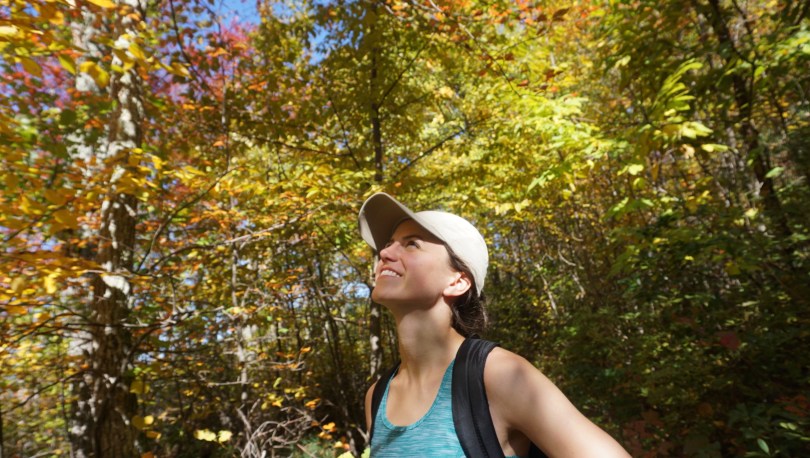
When presented with free time and the opportunity to explore arises, it can be difficult to decide where to go. The number of destinations seem endless with each place offering something completely different: the Blue Ridge mountains to the west, the coastal tidewater to the east and the Appalachian plateau to the Southwest. I usually end up letting the season and conditions deciding for me. What better place to explore in early Spring than the St. Mary’s Wilderness Area in the Blue Ridge? I read numerous reviews about the area of its beauty and clear river beds. St. Mary’s is designated a wilderness area, and as such, the trails are poorly marked. It appeared that summer hikers frequently got lost on the poorly marked trails and overgrown brush. I hoped to avoid all of this by navigating in early spring, with bare trees and clearer paths.
Rock hopping
St. Mary’s Falls
Trail Markers
Pink ribbon marked the trail
Honey wine
Spring flox
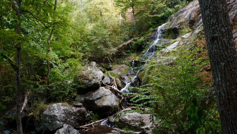
My cousin from Toronto accompanied me on this outing, marking his first proper hike in Virginia. When we arrived to the trail head, I was surprised to find that the earth was scorched and the trees charred. I later learned that a wildfire just two weeks prior had burned over 800 acres of the wilderness area. St Mary’s spans over 35,000 acres making it the largest Virgina Wilderness area on national forest land. The region was previously a mining ore for manganese and iron until it was abandoned in the mid 1900s. Today it serves as a beautiful hiking and fly fishing trail along the St Mary’s River, complete with a beautiful waterfall at the end.
Making a dry crossing
Canyon view
There are numerous routes to get to the waterfall. The most popular route listed on Hikingupwards.com recommended starting out along the Blue Ridge Parkway. One reviewer discouraged this path, because it was poorly marked and he took numerous detours after getting lost. They recommended an easier way to get to the falls. Off of Cold Springs Rd (Route 608) is St Marys Road. This road is in excellent shape and leads you all the way down to a well kept parking area and the beginning of the trail that puts you right next to St Marys River. From there, you simply follow the river to the falls. Internet win.
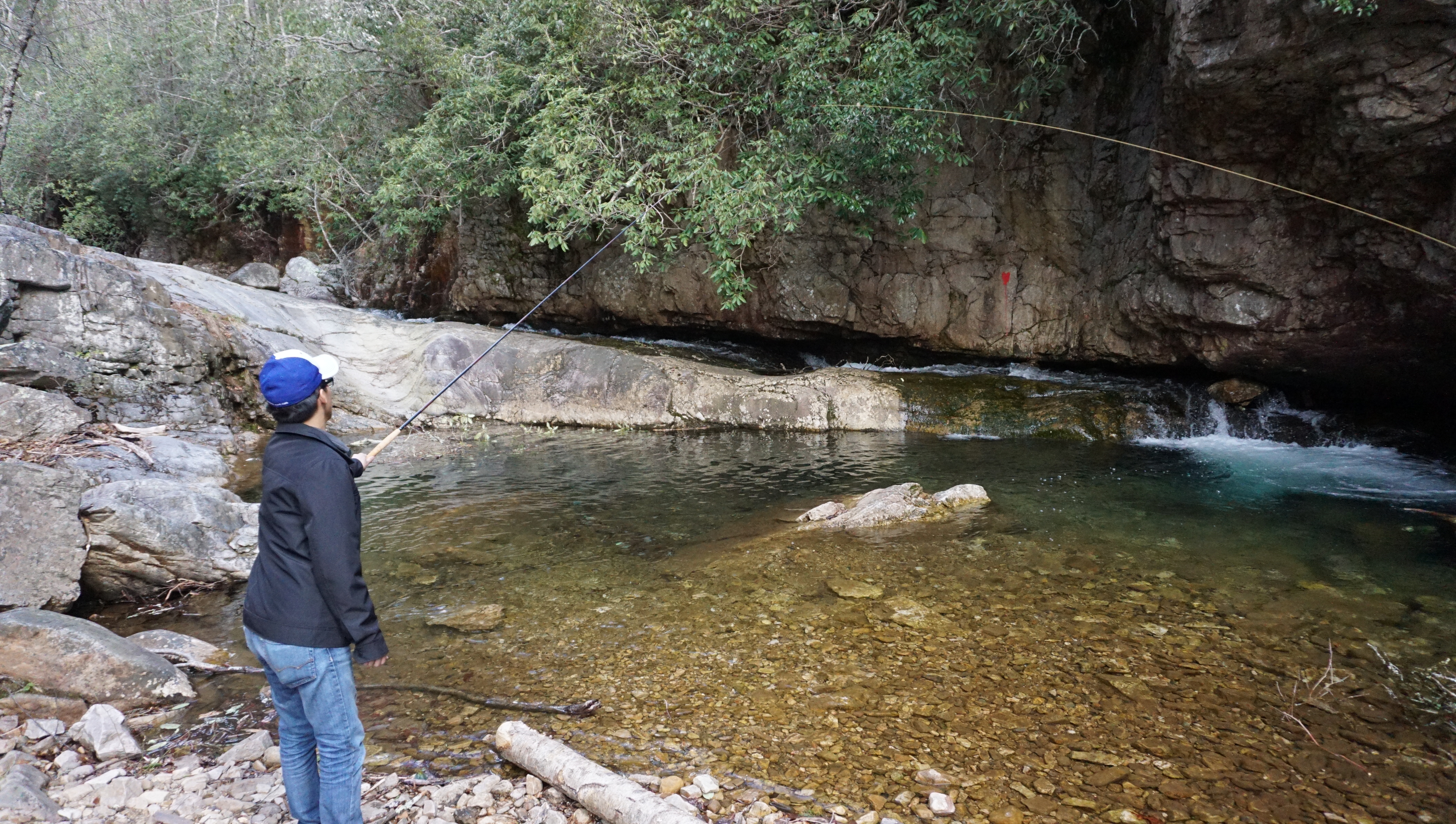
We tried our hand at some Tenkara, a form of Japanese fly fishing that does not require a reel.
The hike twists and turns through a beautiful gorge, providing a unique vista in Virginia. There was lots of rock hopping, and scaling as the trail crossed back and forth over the river five times. We tried our hand also at some Tenkara (traditional Japanese fly fishing). This style of fly fishing uses only a rod, line and fly – no reel. With flask in hand with some Nordic honey wine and packed lunches, we enjoyed the peace of spring time in the mountains.


 It was a particularly hot summer weekend in Charlottesville, with highs greater than 100 degrees F. We were on a getaway from Richmond and despite the heat, we somehow wanted to squeeze in a quick hike in Shenandoah National Park. During this time of year, the popular watering holes like