This short film was recently featured on National Geographic in their short films showcase. A story of two canoeists in their 70s who are still out there kickin it. It’s too good not to share.
“35 years after their first visit to the Noatak River in Alaska’s wild and spectacular Brooks Range, two adventurers in their 70’s reflect on a lifetime of outdoor experiences and what still awaits them.
In this 14-minute short film, the filmmakers behind MILE… MILE & A HALF follow these friends along one of the longest rivers in the US unaltered by civilization. The film premiered at the 2016 Banff Mountain Film Festival and has screened with the Wild & Scenic Film Festival Tour and Dances With Films.”
A film by The Muir Project Directed & Shot by Jason Fitzpatrick, Jen Serena & Ric Serena Music by Paul Bessenbacher & Matt Bowen Sound edit & mix by Durand Trench Color correction by Bruce Goodman
Equipment provided by Canon, Kessler Crane & Osprey Packs.
Filmed in Gates of the Arctic National Park, Alaska.
“LABRADOR PASSAGE follows two men who set out to retrace a historic 1905 canoe journey through Labrador, using non-synthetic equipment such as a waxed canvas tent, tin-cloth rain gear and a cedar canvas canoe. Blending history, adventure and profiles of the men and women who make the gear, this film explores what it means to be inspired and defeated by the wilderness. “
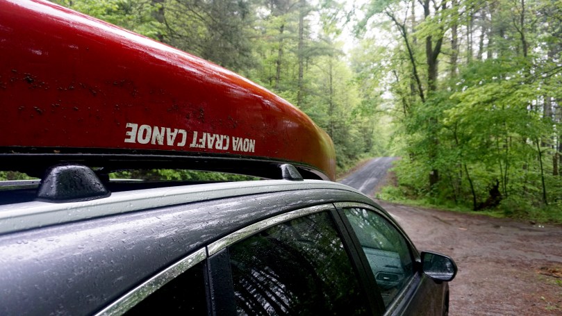
Interesting video I came across about canoeing in the remote parts of eastern Canada. Cabin fever is starting to set in….
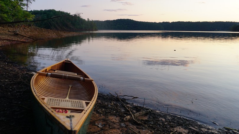
For those that are interested in canoe camping, Philpott Lake in southwest Virginia just may be the best place to learn. This massive 3000 acre reservoir spans across three counties (Henry, Franklin and Patrick counties) and was constructed by the U.S. Army Corps of Engineers (from 1948-1952) in order to help control flooding from the Smith River as well as generate hydroelectric energy and serve as a place for recreational activities.
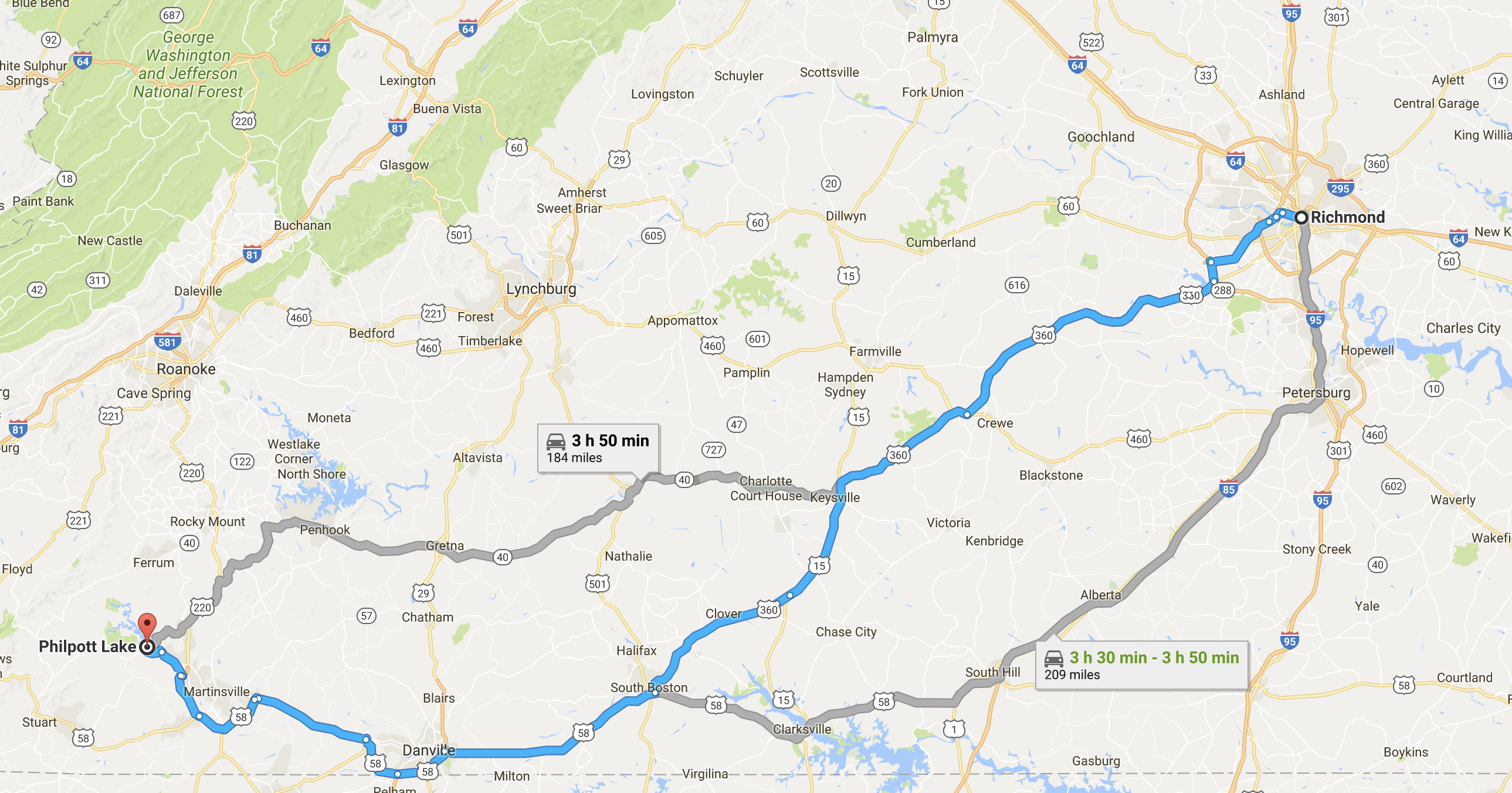
We took to the road on a Thursday morning with clear, blue skies. It was an easy, and flat 3.5 hour drive from Richmond to the town of Bassett, Virginia. Upon arrival to the lake, we were impressed with how clean and organized the park seemed to be. We stopped by the visitor’s center to ask for some maps and it reminded of very much of a welcoming center you would see at an Ontario Provincial Park. There were stuffed animals on display, with fish species charts that covered the walls. From the visitor center, we were at a great vantage point and had a beautiful view of the Philpott Dam and Lake, sparkling blue in the sunlight. We were eager to paddle these waters.
We would be camping on Deer Island, a spot where visitors can visit if they wished to do some primitive camping. In order to get there, we got back in the car and drove to the Salthouse Branch Launch Point. Here we met a friendly ranger and paid our $20 per night camping fee. We reassured us, that if we would need anything at all throughout the night, that there would be a ranger on call 24/7. We parked the car right next to the beach and launch site and began unloading our gear. Once again, this is a very well kept lake, and the launch site had every facility we could have asked for, clean bathrooms and showers, picnic tables, and water fountains. We loaded our gear off a small dock next to the public beach and set out for the quick paddle to Deer Island (less than 0.5 miles). There wasn’t a single soul camping on Deer Island so we took our time circling the land until we found a suitable campsite…..#20. The campsite was immaculate without any signs of garbage. Once our camp was set up and the firewood had been cut, I went in for a refreshing dip.
While we were camping in Virginia, my brother Brian had been on a week long road trip up north in Manitoba, Canada. He was driving home to Virginia and would be joining us at Philpott Lake before we all head back to Richmond together. He was exhausted from spending days on the road. At midnight, we paddled back out under a full moon and cut through the fog on the water back to the Salt House Branch Landing. We helped him load his gear and we brought him back to the campsite. The orange glow of our campfire guiding us home.
Paddling through fog to the access point. (salt house branch)
He was tired and covered in camping scars, after run ins with poison ivy, black flies and mosquitos. He was certainly happy to be back in Virginia, where they were literally no mosquitoes at our campsite. We were not complaining but we were wondering why there were no bugs. I wonder if this is due to the fact that Philpott is a man-made lake. The elements that make a natural ecosystem where mosquitoes would thrive are not there. I have no idea, but we are not complaining. No need for a bug shelter or even bug spray for that matter.As we cooked him some dinner, he shared tales of his adventures up north, we listened intently by the fire and our group once again reunited. The last time the three of us were together was one year ago, when we paddled our way through La Verendrye Wilderness Reserve, in Quebec.
Brian solo camping at Kwasitchewan falls, Manitoba.
In the morning, we paddled out to the access point for a luxury shower at the Salt House Branch beach. This was truly glamping. The washrooms at Philpott Lake, just like everything else was very clean. This was something I could get use to on canoe camping trips. It turned out to be a very lazy day for us. Brian was exhausted from his road trip, so we took it easy and explored the surrounding forest. We made fires from pine sap, cooked and relaxed. No ambitious goals, just us and the lake. Before we knew it, the sun was coming down, and the forest was cooling off. We went on more night canoe paddles and explored the other launch sites. We met a friendly ranger and a police officer and spent some time talking to them. The ranger was clearly interested in our canoe camping ensemble and asked where we were from. Turns, out that he had been to Ontario…. many times. He hunted and fished in the backwoods of Ontario near and was very familiar with Algonquin Park. Small world.
In summary, Philpott Lake is a clean, beautiful, and fun place for anyone interested in primitive canoe camping. It is the perfect place to learn all of the motions involved in canoe camping. The short paddles to the campsites make it very feasible for all ages, and the access to clean facilities make it seem like clamping. There are rangers and campers around so there is also plenty of support. The rangers patrol throughout the night at the access points to keep everyone safe. On a scale of intensity, this experience fits in between car camping, and canoe back country camping… although much closer to car camping. I would love to come back to try our hand at fishing the famous Walleye populations in this lake, perhaps in the spring time.
*As always, for all visitors and campers, please remember to pack out whatever you bring in. Please keep this beautiful lake clean for all to enjoy and for future generations to come.
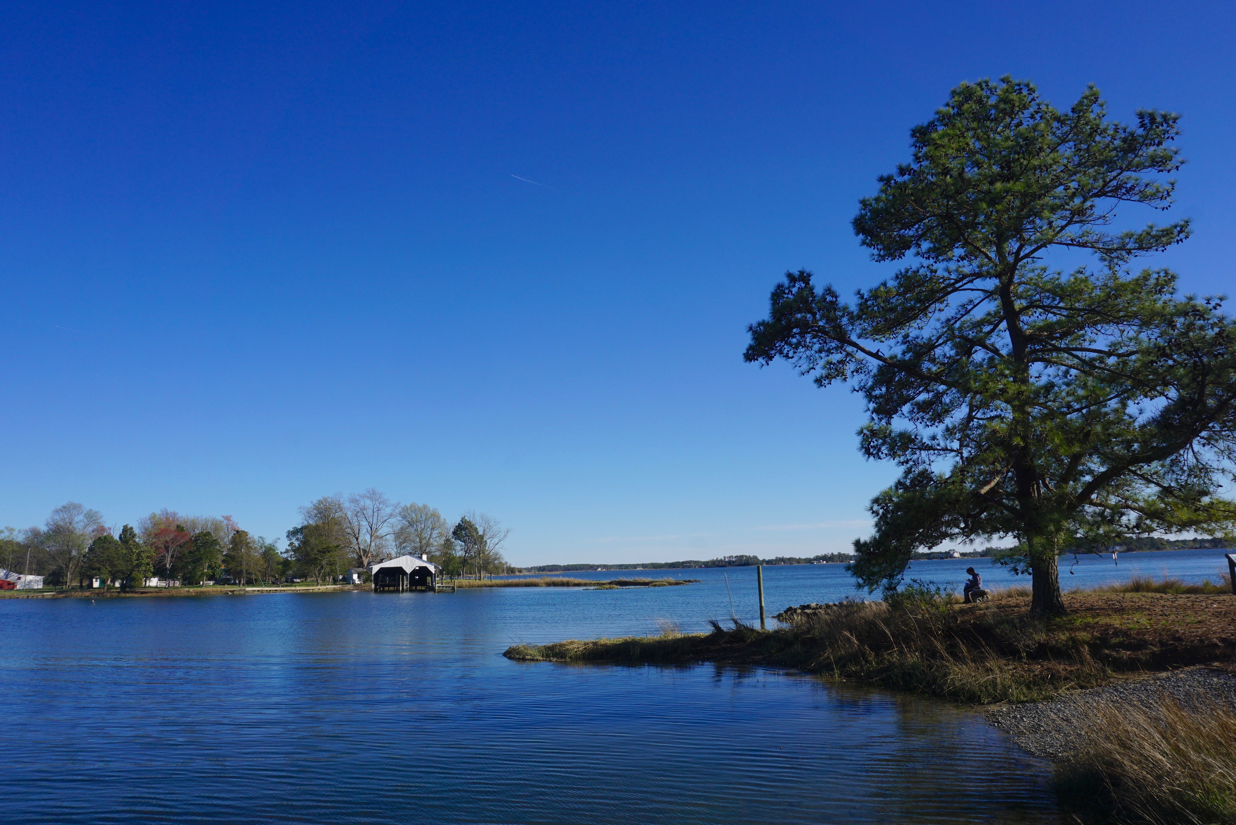
Tanyard Landing Trail map. Dolphins can be spotted as you head out closer to Morris Bay and towards the larger York River, although these bigger waters are more suitable for kayaks.
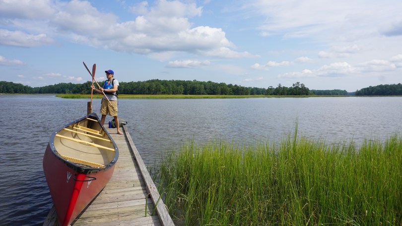
On an unseasonably mild summer, August day, we headed east to the coastal plains (tidewater) region of Virginia. With the predicted forecast of highs of 82F with some overcast, we knew this was the perfect time to further explore the beautiful blueways in gloucester county. We had previously completed two of the blueways (Warehouse Landing & John’s Point) and decided to take on our third – Tanyard Landing Trail in Gloucester, Virginia.
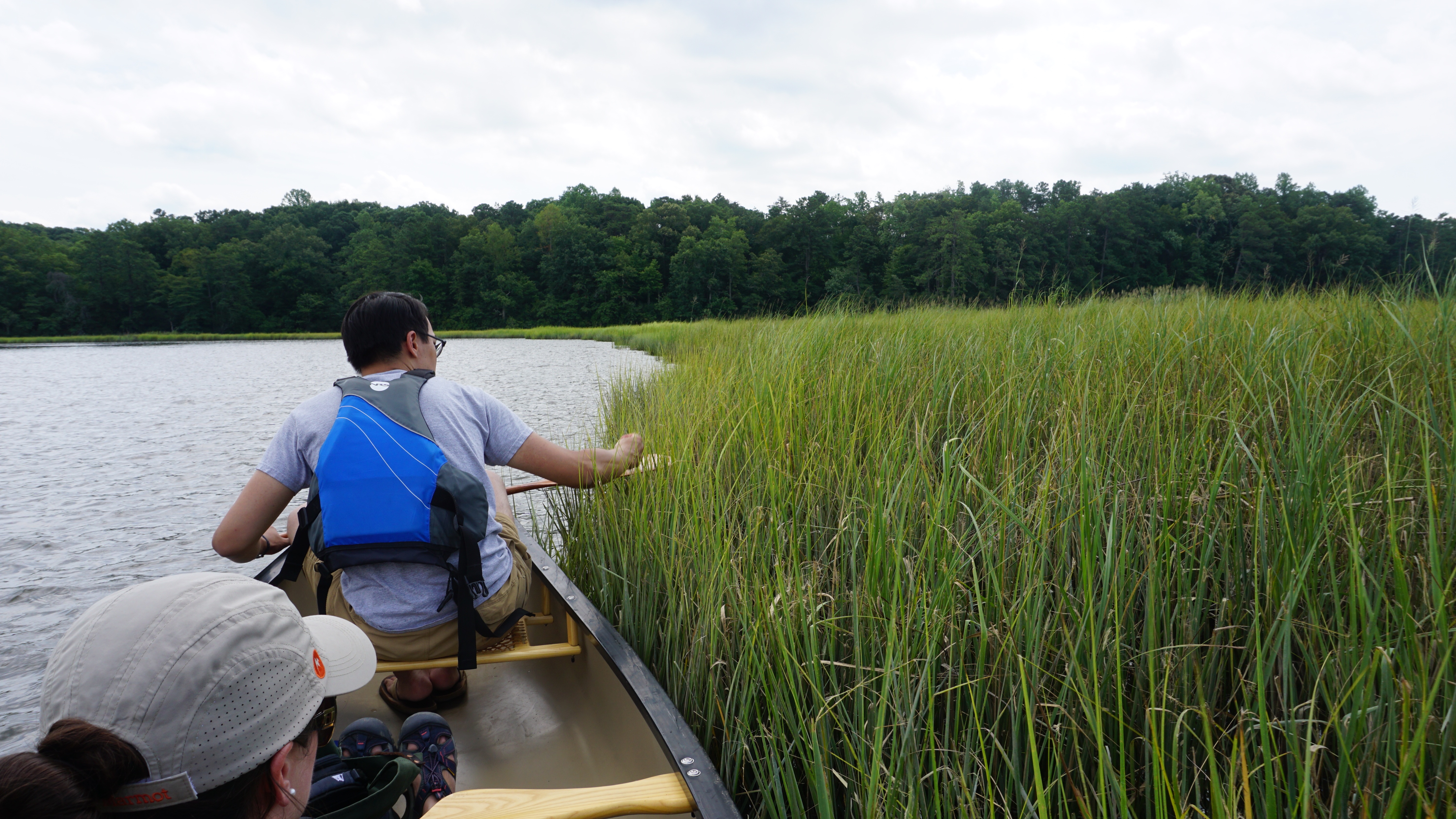
Located just an hour away from richmond, this trail follows the gentle poropotank river, a small tributary of the York River. As a blueway, this trail is designed for non-motorized boats, such as canoes and kayaks. It is a great place to experience a small piece of the huge Chesapeake Bay ecosystem. The wildlife is abundant, with blue herons, bald eagles, kingfishers, crabs, and even dolphins have been spotted in the poropotank river. It was a perfect day to flow through the arteries that make up the Chesapeake Bay. The occasional clouds, helped shade us from the summer sun and welcoming breeze, flowed through us. The air was fresh, with just a hint of salt. The bay grasses were healthy and plentiful. These are the buffer zones that are so important in keeping the bay clean. We meandered down the peaceful river in complete silence. The occasional fish would jump from the water, but otherwise, the only other sound was the wind through the grasses.
Checking out the healthy bay grasses3 person canoe
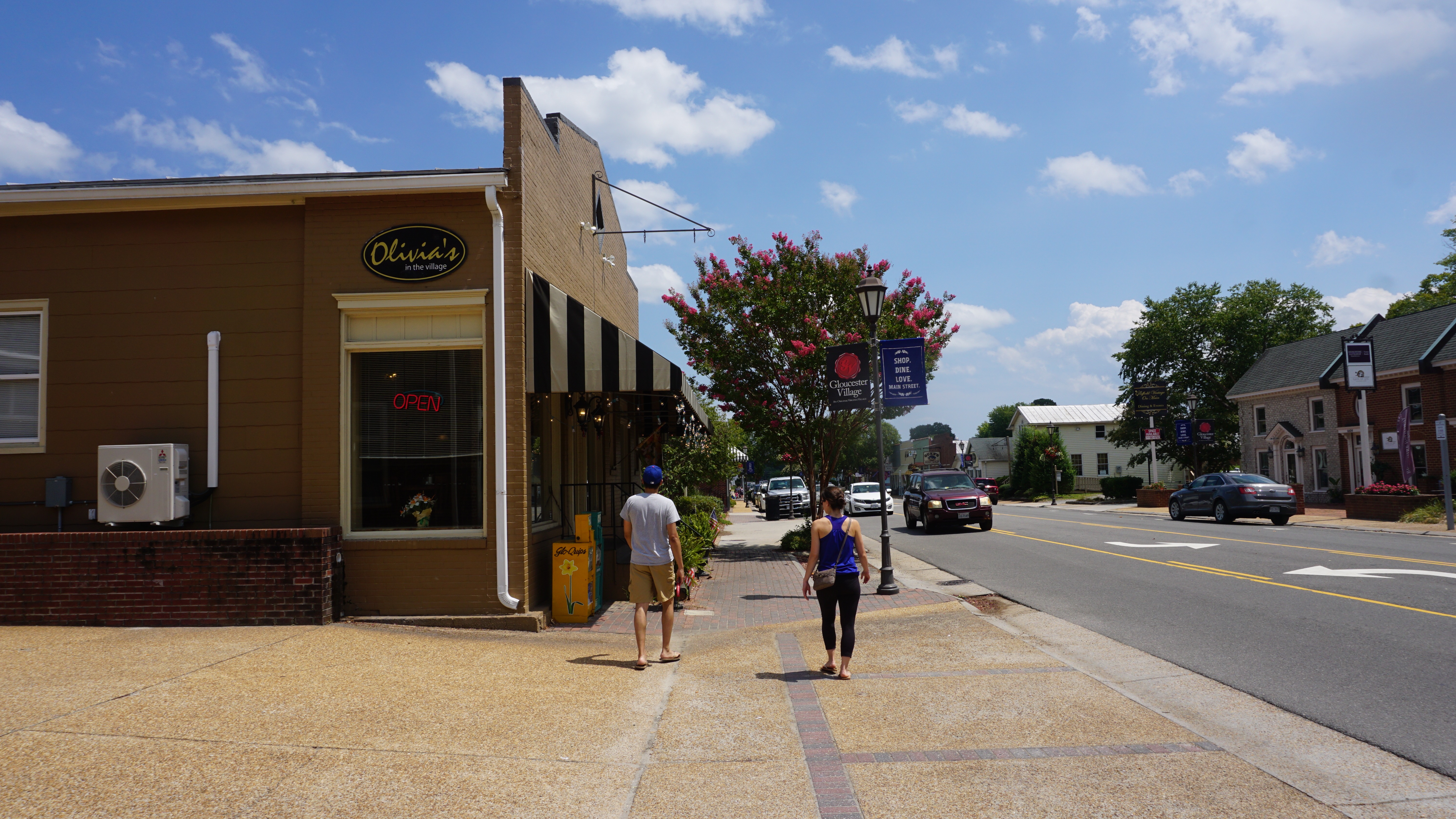
When you first arrive at the Tanyard Landing Boat Ramp, you will have the option of either going west down the trail or east to explore the river upstream. We actually did not stay on the trail, but headed east to explore the inner wetland areas. We spotted one other group kayaking but no one else was on the water. After the day of paddling, we headed to the nearby Gloucester village, a peaceful and quiet town with a population of 2951. The busiest section of town is the main street where most of the shops and restaurants are located. We returned to Olivia’s, our favorite restaurant in town, for crab cakes. For anyone looking for the complete, Virginia tidewater region experience: find a canoe/kayak, pick a blueway to explore, and then stop for food in Gloucester village. It’s what summer is Virginia is all about.
Wishing everyone a happy, healthy and safe Canada Day! To celebrate, Trail guide pictures decided to provide free streaming of their documentary “Canoe – Icon of the North” on youtube. Check it out above.
(Feature photo above was taken by myself at Killarney Provincial Park at sunrise on O.S.A. Lake during the summer of 2015)
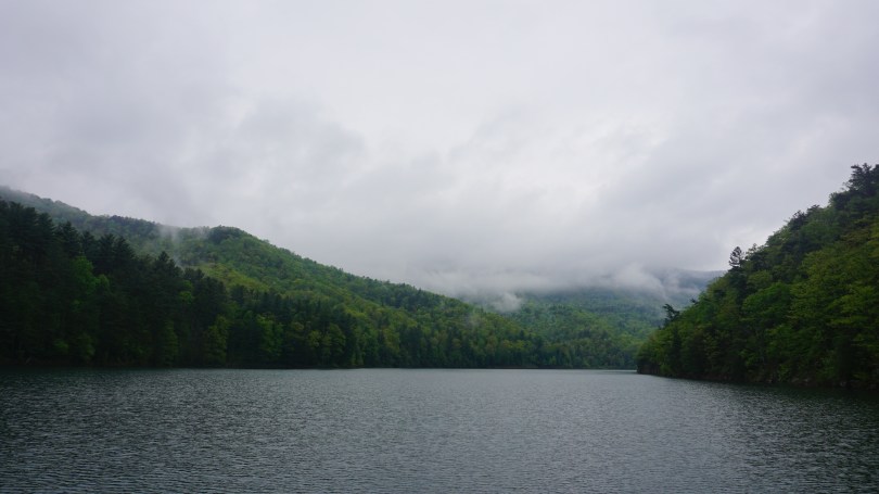
Switzer (Skidmore) lake is one of my favorite places in Virginia. This sparkling, blue lake is located high up in the Virginia mountains of George Washington National Forest at over 2000 ft. The reservoir serves as the water supply for the city of Harrisonburg and is also stocked with brook trout. It is the perfect place to paddle in some of the clearest waters in Virginia.
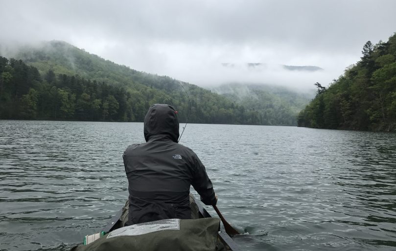
My friend Min and I have not canoe camped since Quebec in the summer of 2016 and we were itching to get out there. We planned a simple overnighter, despite the impending rain that was forecast to hit hard on our second day. No matter. Rain does little to keep us indoors these days. My brother and I have survived torrential downpours in the backcountry of Ontario in Temagami and Algonquin Park. From these experiences, I’ve learned that the rain can actually bring many positives experiences to a camping trip. For one, there is always an awesome cloud display in the mountains afterwards. You are also presented with the opportunity to test the quality of your tarp setup in a situation that counts. Ray Mears once said if you wait for good weather to camp, you end up missing half the opportunities to get outside.
Our last trip to Switzer Lake was in the fall of 2015, where we spent a day exploring the lake and surrounding areas by foot and canoe. Two years later, I can say that the region has changed very little. The roads have received a marked upgrade. They have been flattened and well paved, even now very suitable for a sedan to navigate comfortably.
We head out on a weekday morning when we knew the campsites would be empty. This lake can be particularly busy during the weekend, so don’t expect peace and quiet. The area is frequented by numerous outdoor enthusiasts, mostly students from the nearby James Madison University campus.
Upon our arrival, we spent some time searching for a place to camp and settled in after an hour of searching. We got to work collecting dry, dead wood, setting up the tarp for impending rain, and fishing and exploring the area. One of the most useful pieces of cooking gear up north is the simple grill grate which can be easily rested between rocks so you can have steaks anywhere you go. Once our fires were hot enough and we created a large enough ember pile, we put on some steaks and corn and listened to the sounds of the forest as we ate. Perfect. The rain eventually did come at around 8:30pm, however it came in intermittent showers and we were more than prepared with our tarp and tent. The rain scared away the last kayaker on the lake so we had the whole area to ourselves.
While you might not get the true, backcountry canoe camping experience in Virginia, Switzer Lake comes pretty darn close. There are also many advantages to camping here versus the Canadian backcountry. First and foremost, the bug situation is infinitely better at this time of year. May and June are peak black fly and mosquito seasons in Ontario and make canoe camping pretty much unbearable without bug jackets. High up in these mountains, the bugs were scarce and we came out with hardly a scratch. We saw numerous frogs, butterflies, caterpillars and hawks. I also sleep a little easier in the Virginia woods knowing that the black bears are generally much smaller. Overall, this place offers a canoe camping experience that can certainly hold it’s own.
*A word of caution, to those interested in camping, I have heard of several who have received fines for camping immediately next to the lake. Apparently it is not allowed, however there are numerous campsites just a short walk deeper into the woods away from the lake. I would call the local forest office before planning a trip here to find out which camping sites are open to use.
*As always, for all visitors and campers, please remember to pack out whatever you bring in. Please keep this beautiful lake clean for all to enjoy and for future generations to come.
I finally got around to editing the video clips from our trip to Banff National Park in January 2016. We spent 7 days, exploring this beautiful, winter wonderland in the Canadian rockies.
“There is but one entrance by sea into this country, and that is at the mouth of a very goodly bay, 18 or 20 miles broad. The cape on the south is called Cape Henry, in honor of our most noble Prince. The land, white hilly sands like unto the Downs, and all along the shores rest plety of pines and firs … Within is a country that may have the prerogative over the most pleasant places known, for large and pleasant navigable rivers, heaven and earth never agreed better to frame a place for man’s habitation.” – Captain John Smith (regarding his exploration of the Chesapeake Bay in 1608)
beach combing for shells and oysters
In one of his most well-known passages describing the Chesapeake bay, Captain John Smith’s words still resonate today. This is the largest estuary in the United States and home to an incredible ecosystem. There is no question that the a healthy bay benefits everyone, from a environmental and wildlife standpoint and of course economically. Unfortunately, not everyone shares this sentiment. The future of the bay is uncertain as a proposed budget, by President Trump would eliminate federal funding for the continuing cleanup of the Chesapeake Bay. The Environmental Protection Agency budget for the Chesapeake cleanup was $73 million. With the new bill proposed, this amount would be $0. Organizations like The Chesapeake Bay Foundation have been fighting the battle to restore the bay for many years. Click here to sign a petition to urge congress to preserve funding for the bay: http://takeaction.cbf.org
I used this golden spring weekend, to pull out the canoe from the basement and explore another part of the Chesapeake Bay and the Gloucester Blueways, this time, to John’s Point. We paddled the Ware Riverlast year, but wanted to explore another of the 5 total blueways that exist in Gloucester County. John’s Point is very similar to Warehouse landing, the boat launch is very well kept with a nice clean beach as your launch site. It was a windy day, and the proposed trail totaled 8.8 miles along the Severn River toward Mobjack Bay and back was formidable. This might have been possible in a kayak, but we opted to head west instead of east to explore the inner waterways and the beaches in search of crabs and oysters. We took breaks from the wind as we hopped from island to island, and combed our way through the beaches. We saw several ospreys, one egret, one loon and a red tailed hawk. The water was very clear and all along the beach were oysters popping out of the sand. I came out here to feel once again how special the Chesapeake Bay is. What John Smith said about the bay in 1608, still holds today. It is truly a national treasure worth fighting to protect for future generations to come.
At the very end of the world, in the most southern tip of South America, exists the land of wind, fire and ice known as Patagonia. This landscape of spectacular mountains, deserts, glaciers and alpine meadows spans across both Argentina and Chile, from the western pacific coast to the eastern atlantic coast. Curiously, the name Patagonia translates roughly to “land of the big feet”. It originated from the word “Patagão” (or Patagoni) – a name Magellan gave to the natives of this new land he encountered on his expedition in 1520. The Patagoni he described were actually the Tehuelche people, who in general, were much taller than the average European. Their large footprints found in tracks led the first explorers to believe that this was a mystical land of giants. The footprints were in fact large because of the leather skinned guanaco boots that they all wore during the cold winters.
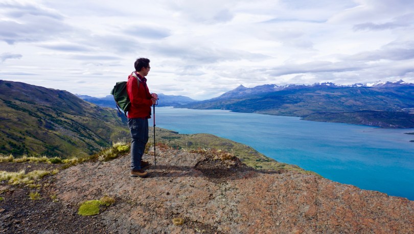
View from the small Puerto Natales airport, staring into Patagonia
Patagonia is a land of secrets and wonder – even the story behind its name I found fascinating. It has long been at the top of my list of places to visit and finally on January 20, 2017 (inauguration day), we left Virginia to explore this untamed land.Traveling to Patagonia was no easy feat. After a 2 hour drive to Washington DC, we flew 5 hours to reach Panama City, and then 6 hours to Santiago, Chile. From there, it was a 3.5 hour flight to reach Puerto Natales followed by a 2 hour drive to reach Patagonia Camp. We broke up our traveling with a day’s rest in Santiago on both legs of our journey.
Map of Torres Del Paine National Park
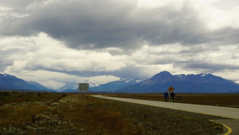
I will never forget the flight to Puerto Natales Airport in Patagonia. The harsh winds created fierce turbulence and a hair-standing landing. Upon opening the cabin doors, our faces were hit with the howling winds and cold air of Patagonia. All around us in this desolate airport at the end of the world, were mountains as far as the eye could see…mountains, fields and emptiness. We would now have five full days to explore this mysterious land.
We grabbed our luggage amongst the dozens of hikers from all over the world and hit the road to Patagonia Camp (our base camp and home for the next 5 days). From here, we could rest and relax and plan our excursions into Torres Del Paine National Park each day. I hope to one day write a review about our experience at Patagonia Camp, but for now, all I can say is that it was simply an unforgettable experience with fantastic staff members.
Patagonia Camp sits on Lake Torro
Drinking some mate, before a day of hiking
Sketching in the field log
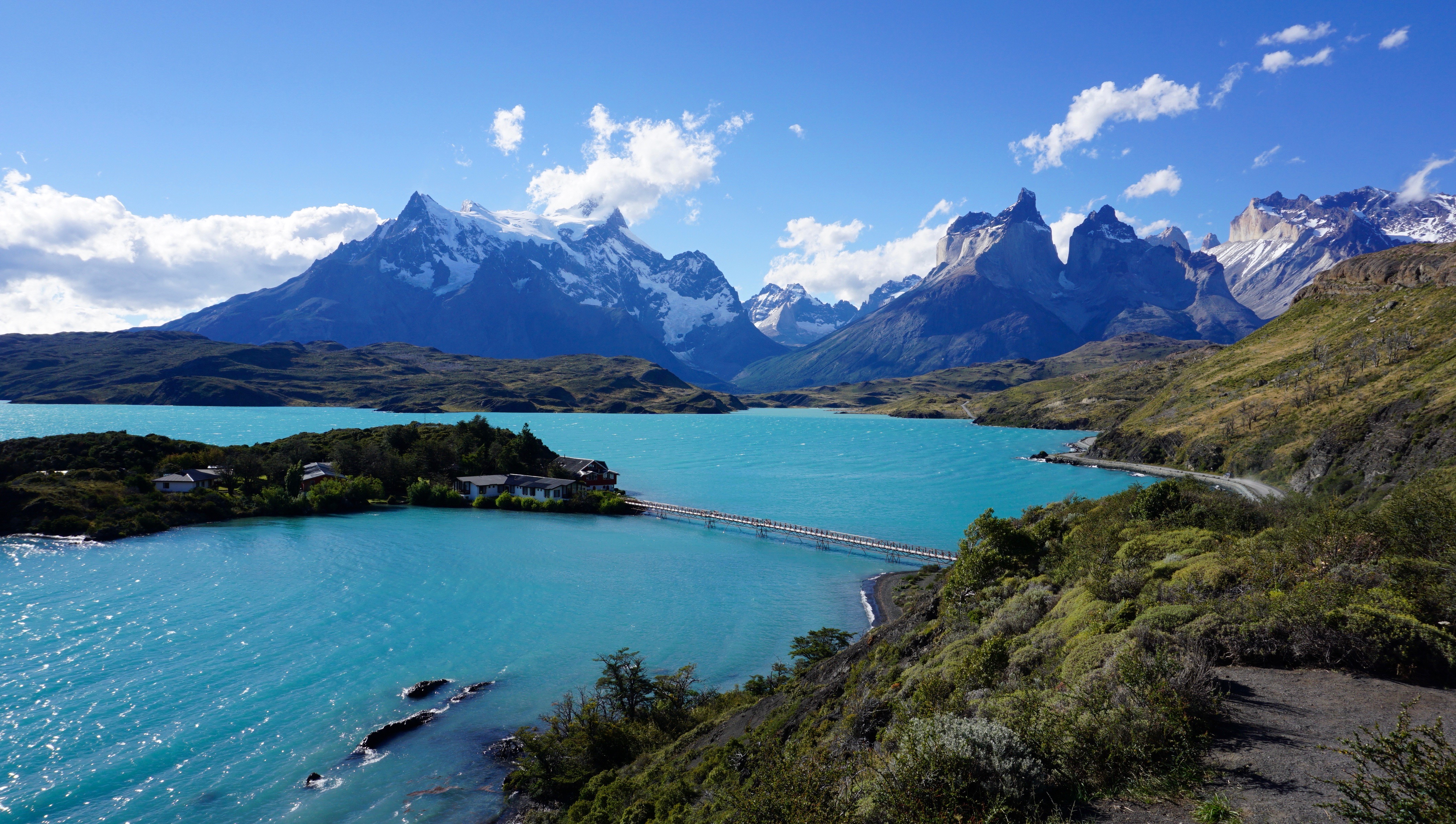
Torres Del Paine National is one of the most popular attractions in Chilean Patagonia. It is one of the 11 protected areas of the Magallanes Region and Chilean Antarctica. The park’s 2422 square kms of mountains, glaciers, lakes, and rivers attract thousands of visitors each year. The centerpiece of the park are the Paine (pronounced PIE-nay, meaning “blue”) mountains and more specifically the Towers of Paine (Torres Del Paine: spanish translation). These are three distinct granite peaks in the Paine mountain range that many consider to be the 8th wonder of the world.
Lago Pehoe
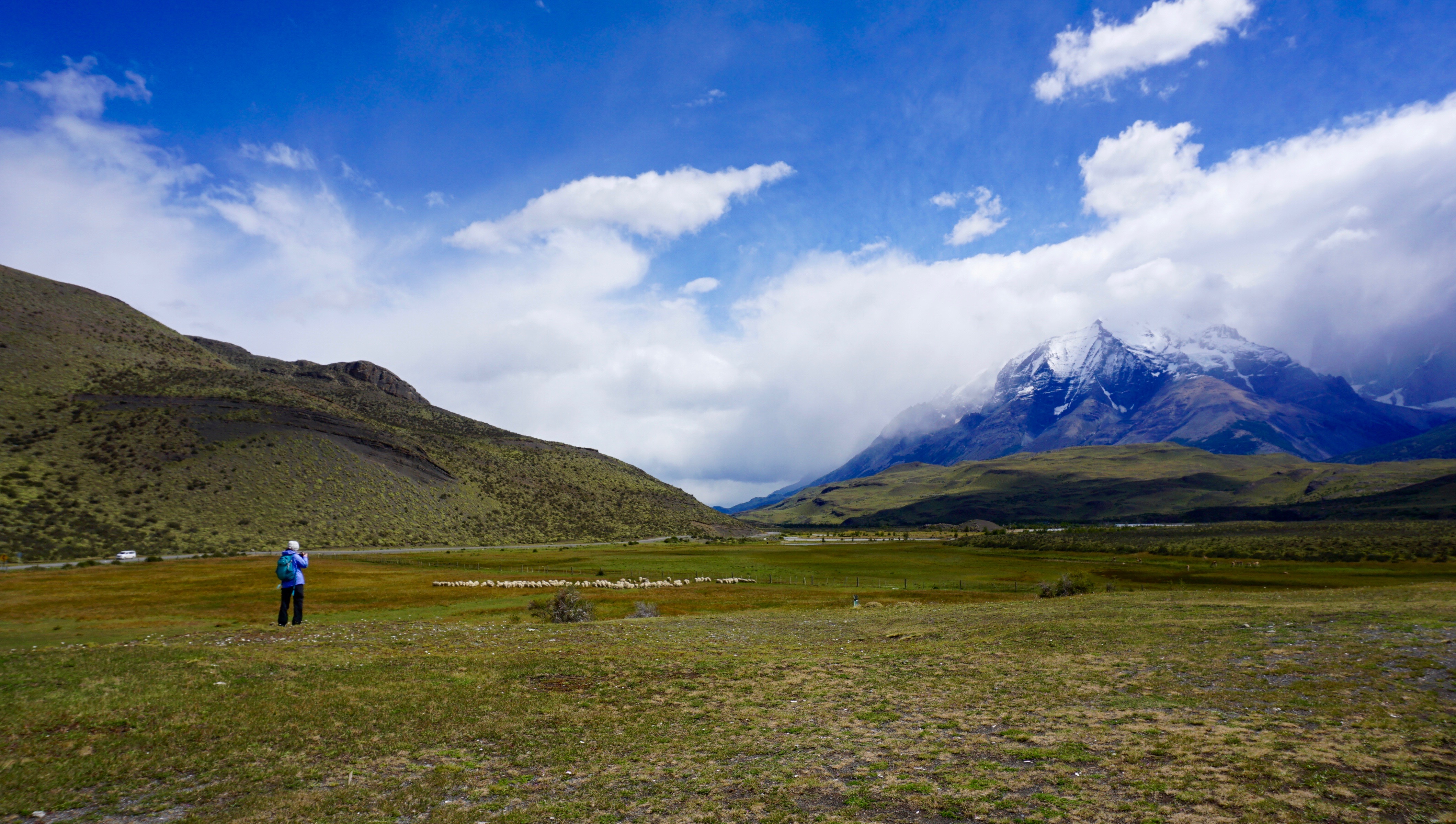
Our first full day in Patagonia was spent on an easy 8.5km hike through pre-Andean xerophilous scrubland. There was plenty of wildlife to see; guanacos, flamingos, condors and grey foxes. The most elusive animal in Patagonia is at the top of the food chain. The puma. I found this to be an unusual terrain for this predator, but clearly it was very successful. The fields were scattered with guanaco skeletons that were picked clean by condors after the pumas have had their fill. I was most in awe at how different everything was from any other place that I had been. The terrain, the geology, the wildlife, climate, and of course the flora.
Guanaco skeleton
pictographs
Calafate bush
One of the symbols of Patagonia is the evergreen shrub know as Calafate (box-leaved barberry, berberis microphylla). It is a plant native to southern Chile and Argentina They were scattered through the fields during our hike and we were able to taste its edible blue-black berries. These berries were used frequently by the locals to produce all sorts of goods, such as jams, flavoring and even beer. Legend says that anyone who eats a Calafate berry will one day find their way back to Patagonia.
We continued our trek through the scrubland and explored caves with prehistoric paintings that dated over 6500 years old. We came back to camp that evening and met many of the other visitors. They were really from all over the world, Denmark, Canada, Britain and the USA. Most who come to Patagonia, travel here to hike the trail to the base of the towers, in the heart of the park. And some talented hikers showed us their watercolor creations of the towers once they reached the base. We were definitely excited for what lay ahead.
In Patagonia, the unpredictable weather makes trip planning essential, and you should always a back up option in mind if your primary objective does not follow through. In this sense, I felt that Patagonia camp did an excellent job of laying out potential options for the next day’s event. They were checking on the weather constantly to decide which trails when be optimal of the next days travel. This was of course a land where you can have all four seasons in one hour. The variability in weather was also drastic even in the smallest distances throughout the park. For instance, it could be pouring rain in the west end of the park and bright sunshine and clear skies on the east end over the mountain ranges. We had originally planned to go to the base of the towers on the second day, however storms had washed away the bridge access. We decided to shoot for the French Valley as the second option, however once we arrived, the ferry (which had been out of commission for the past 3 days) was full.
Patagonian horses
mountain dance
lunch in the forest
We went to our third option the Lazo-Weber trail. A 12km hike with a little bit more elevation climb than our first day but not incredibly strenuous. We hiked this trail in the opposite direction from west to east. This particular day ended up being one of our most beautiful days in the park. We were able to get great angles of the paine mountains and had amazing lookouts at the lagoons and meadows. This hike allows for one of the best views at Almirante Nito (8759ft), Los Cuernos (8530ft) and Cerro Fortaleza (9514ft) and the Paine Grande (10006ft). Our hike took us through meadows, forests and mountain tops. One of the most memorable moments for me was eating lunch inside a quiet forest, to shield us from the harsh winds. At the end of the 12km, was a small Patagonian ranch where we sat, ate lunches and drank.
On Day 3, we were itching to get into the heart of the park. We woke up early and head to the ferry to finally reach the segment on the “W” trail known as the french valley. It was a strenuous day of hiking, but the breath taking views, kept us pushing forward.
The French Valley – Patagonia, Chile
As we approached the glacier, we scaled rocks up melting glacier waters and crossed several wooden bridges. This is when things started to get interesting. At several parts of this trail, we were just basically fording through ankle deep glacier water. Once inside the French Valley, we found a quiet spot to eat lunch and gaze in awe at this magnificent glacier. We sat, ate, and listened to the cracking the glacier, as it continued it’s melt and freeze cycle in the summer time. After lunch, we filled our bottles with some of the best tasting glacier water I’ve ever had and caught the ferry to the mainland.
crossing bridges to the French Valley
ice cold glacier water
calafate beer
french valley
Before we knew it, our time in Patagonia was coming to an end. I can see how someone could easily spend several months here and still not see everything they wanted to. Although we were disappointed about not being able to see the base of the towers, we were grateful for so many things. Most importantly, no one got hurt and the weather was absolutely perfect. It had rained 50 days straight shortly before our arrival so we knew we were incredibly lucky. We visited during the Patagonian summer, and although we had incredible views. Some tour guides suggested to come back in the fall when the park is much quieter and the scenery is even more colorful with the fall foliage. The winds were also apparently less intense. It was not in our fate to see the base of the towers this go around, but I hope that the story of the Calafate berry holds true – maybe one day, we will find ourselves back to this amazing land.