La Vérendrye 2016 – Quebec, Canada

It is part of the human spirit to be curious. Our desire for exploration has helped define us as a species. When traveling through new lands, the rush of having your senses engaged in something new and unpredictable is hard to describe. For this reason, I often wonder if I will ever canoe trip the same routes again. While returning to a familiar park may offer comfort and reassurance, the allure of paddling new waters and trekking unfamiliar lands is always stronger. This need for exploration brought our latest trip to the great, Canadian, province of Quebec.

Screen Shot 2016-08-28 at 12.27.31 AM.png
Richmond to Maniwaki, Quebec

Quebec, similar to Ontario, is a paddler’s dream. It is Canada’s largest province, (almost 3 times the size of Texas), and is 12% fresh water by surface area, holding 3% of the world’s renewable fresh water. The parks in Quebec, however are far less visited than Ontario’s, allowing for even more of a remote excursion. For our trip, we decided to venture into Réserve Faunique La Vérendrye (La Vérendrye Wildlife Reserve). The park covers a massive  12 589 square km, with over 4000 lakes to explore. One could spend months at a time exploring this park without ever retracing your path. I was excited to bring along my good friend Min, who has been with me on countless trips in Virginia but never to the Canadian shield.

DSC02858 (1)
Breakfast with the locals

Our drive was 14 hours straight up north to the town of Maniwaki, Quebec in the provincial riding of Gatineau, Population 3930. On the last leg of our road trip, we found ourselves cruising through the back country roads of Quebec on a nearly empty gas tank. We arrived at 11:15pm with only 4 miles left in the gas tank…. (Rule of the northern road: never let the tank drop below half)….we got lucky. After a long day of last minute packing, wrapping up phone calls and e-mails from work, and a worthy drive, we were finally free from human society. We all slept soundly that night. A shot of whiskey with the local First Nations people helped too.

The next morning, we enjoyed a nice breakfast at a mom and pop diner and made a quick stop at Canadian Tire to pick up some last minute supplies before making our way off the grid and into Le Domaine.

DSC02873
Min charts our course over the next 5 days

Day 1: Le Domaine to Campsite (distance traveled 15km)

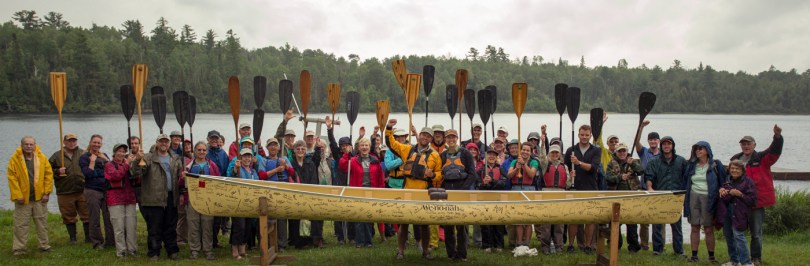
The wonderful sight of racked canoes, maps and photos on cabin walls, and sapphire blue waters greeted us when we reached Canot Camping La Verendrye. The staff was very helpful in helping us choose a suitable route. We sorted through the laminated maps and decided on Circuit 15, a short 45km loop.

DSC03037
Approaching the big waters of Lac Poulter

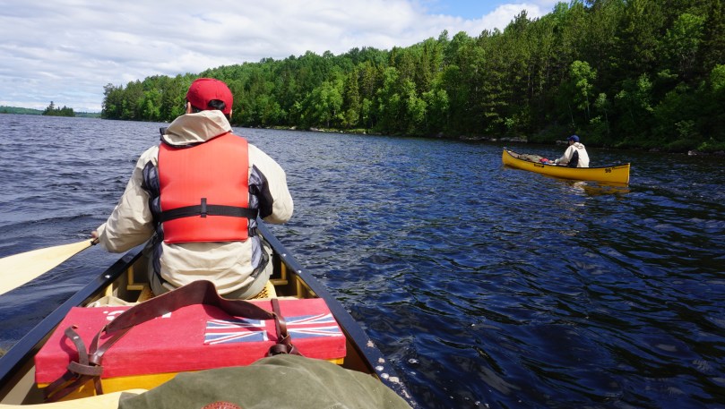
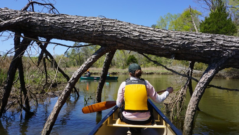
When we originally set the date for this trip, we were well aware, that we were going during peak black fly and mosquito season. I just don’t think any of us knew how bad it would actually be. As we started to unload our gear, we were greeted with swarms of black flies. We scrambled for our bug jackets and finished the gear load-out in our newly christined bug jackets, spotted with a little bit of our own fresh, blood. We left the Canot Camping beach at approximately 12:30pm and battled headwinds to get to our campsite. With an odd number crew, we would have one person paddling solo. Brian braved the first leg. This proved to be quite the challenge in the windy open waters. We lashed the canoes together for the second half of the trip to keep him from straying into the wind.

The portages in this park were short with the longest being approx 400m. Nevertheless, the black flies made us pay; we suffered heavy bug bite casualties. We realized that in order to have any peace from the bugs, we would need to choose our campsites wisely.  We searched for a site that faced the wind and as far away from dense vegetation and moving water as possible. We were lucky enough to come across one of the pristine beach sites that La Verendrye is known for.


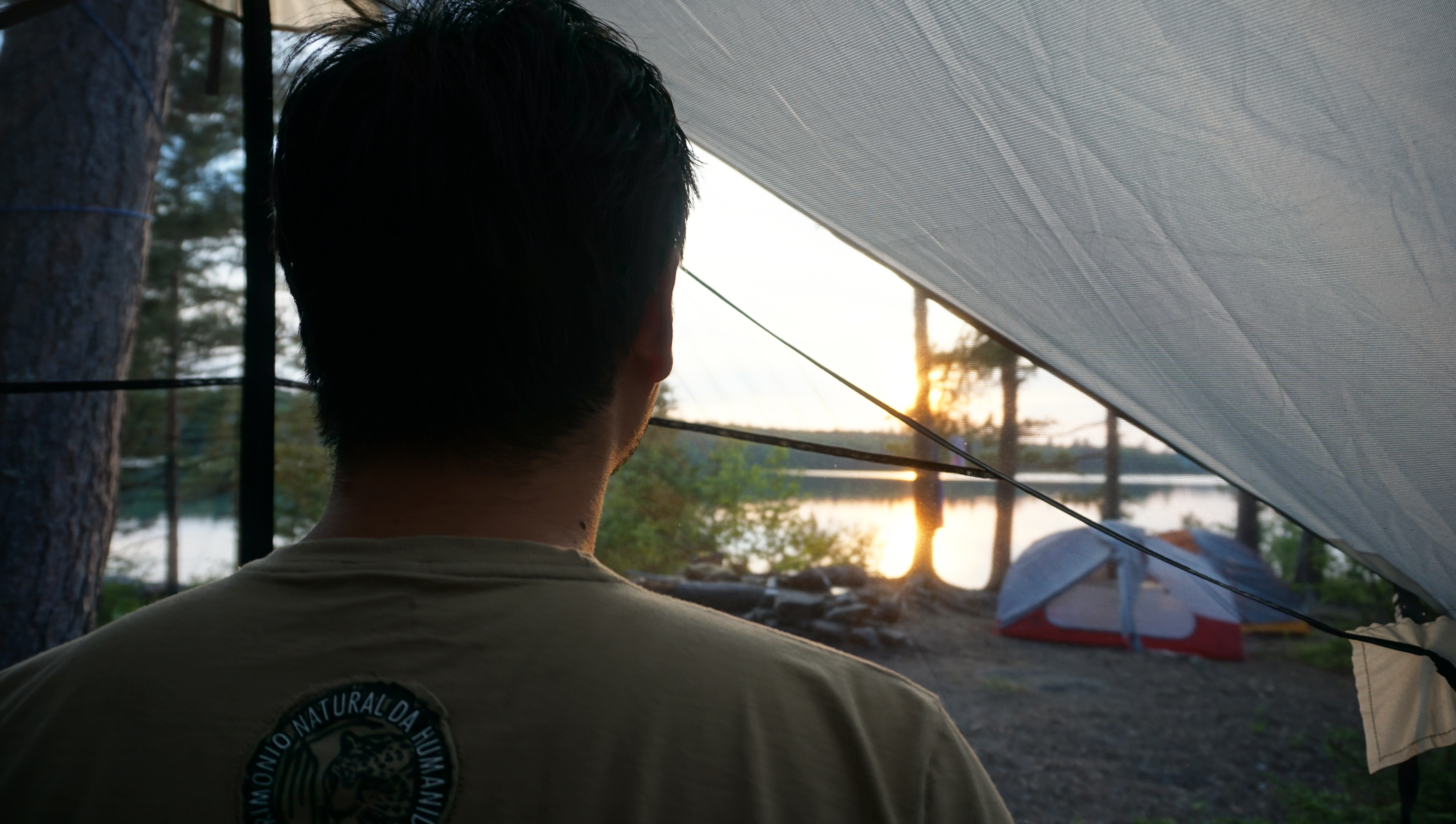
We pulled our canoes up on the sandy beach and felt the powerful and liberating, gusts of wind against our faces as we emerged from our bug jackets. It seemed to keep the bugs at bay…for the moment. We left ourselves plenty of daylight to set up basecamp. Our most important piece of gear on this trip was Brian’s treasured Eureka Bug Shelter. It is basically a tarp with a fully enclosed meshed area that can be pegged to the ground, allowing us to live in a bug free zone and carry out basic camp chores. The last time we used the bug shelter was on Little Joe Lake in Algonquin Park (2014). We each set out to accomplish our camp chores, filtering water, chopping firewood, setting up tents, and unpacking bedding.

dsc02942
First Verendrye sunset

Min had the tall order of preparing meals for the trip. He has never let me down in the past and he certainly did not this time. He had elaborate menus arranged for us, ranging from pastas,  variety of meats, corn breads and dried fruits. We ate like kings and slept early that night to the familiar cries of the loon, officially signifying our return to the northern land. We had made it.

DSC03204
wannigan and sleeping gear

Day 2: Campsite “15-15”

We awoke leisurely the next morning. Our objective this trip was to take things slow and simply enjoy the wilderness around us. Instead of moving to a new campsite, day after day.  We found that 2 nights per campsite suited our tempo. It felt luxurious. We cooked meals, boiled coffee, and looked over the maps. The bugs limited our activity to mostly the bug shelter, so we turned it into the most comfortable place that we could. We dug a small hole to have a modest fire to keep us company.

Min made quick work of some pine with handy axe work to give us a bench to sit on. It certainly felt like a home away from home. While the flies and mosquitoes buzzed at the bug shelter, we were able to sit and relax and enjoy good conversation. We discovered that interestingly, every night, at approximately 9:30pm, the bug activity just suddenly stopped….no more buzzing, no more swatting at each other. After this time, we were free to enjoy the night without the jackets. We took this opportunity to brush our teeth, bathe in the freezing waters by moonlight and enjoy a large campfire  by the stars. Life was good in La Verendrye.

Day 3: The Best Day

In my mind, Day 3 will go down as one of my favorite days of camping ever. It was my turn to paddle solo, and it was going to be a monster day. 26km ahead of us to the next campsite through some big waters. We set off early in the morning, having packed down the bug shelther the night before. The water was still calm when we launched and we made amazing time. Once we reached the main lakes, it was once again a battle upwind. we paddled against chop and waves to gain only feet at a time. At the halfway mark we came across an unusual set of small island rocks in the center of the lake. In the heart of the wind, we pulled ashore and lashed together the canoes. It was time to refuel.

DSC03038
Middle of Lac Poulter
DSC03043
island eggs

We needed to get food and water back into our sun beaten bodies. We hungrily devoured tuna wraps with onions, with generous helpings of dried fruit and plenty of water. Food had never tasted so good. We could feel our bodies recharging and our spirits lifted. We pushed on afterwards towards the second half of the trip. We all dreaded the 3 short portages that waited ahead for us. As we continued to paddle, the unmistakable sound of white water became louder and louder. We had reached “Les Rapides”, the short white water section of our trip.

This left us with two options: Portage around the rapids, or run it. No brainer. Running the short white water segments was exciting and the reward was two fold….we got to skip all portages. We estimated that we were able to shave at least 1.5 hours by running the rapids. This spirit boost was what we needed to finish the final leg of the journey to our next campsite. 26km done.

DCIM100GOPROGOPR7402.
Min sneaks in a quick rest before approaching “Les Rapides”


DSC03092
Northern lights signify the beginning of summer

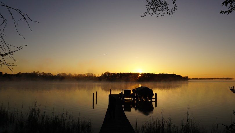
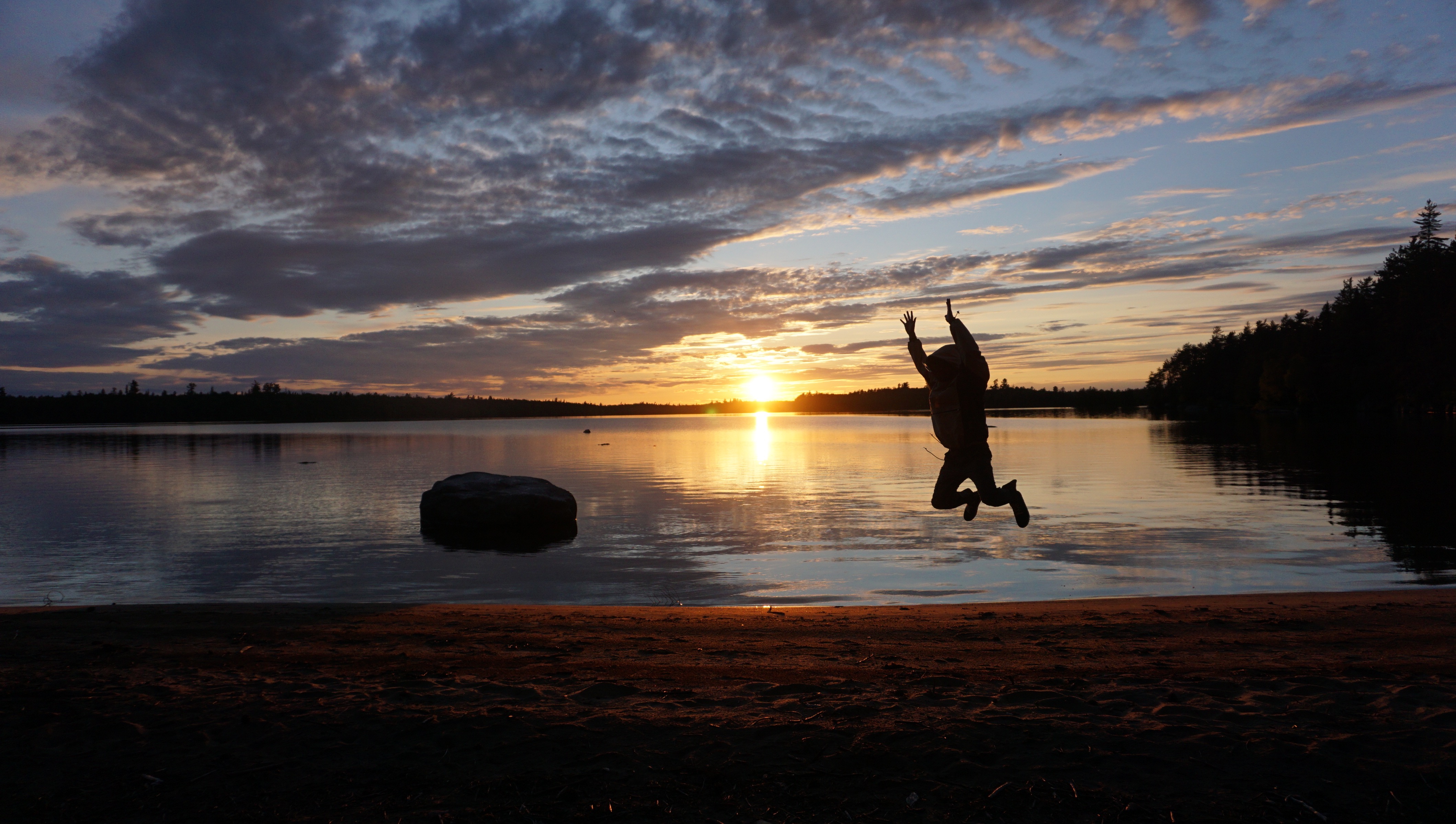
We didn’t speak much as we set up camp. We had only been out in the wilderness for 3 days but it our actions felt deliberate and well coordinated. It was clear that we were getting acclimated to our surroundings. This campsite was at a higher elevation with much less vegetation, the wind broke through camp easily and kept the bugs at bay. We were all exhausted and passed out for a nap shortly after dinner. I awoke around midnight to do some night fishing with Brian. While collecting some water by the shore, the unmistakable emerald hue of the northern lights danced over the forest canopy. We stood there and watched in awe. I have never considered myself much of a religious man, but I do believe that such moments are simply too beautiful for coincidence. They truly touch the spirit. We paddled 26km that day, ran whitewater, found a killer camp site, fished and were treated to a beautiful display of the northern lights. It was the best day of camping.

Day 4: Campsite “10-53”

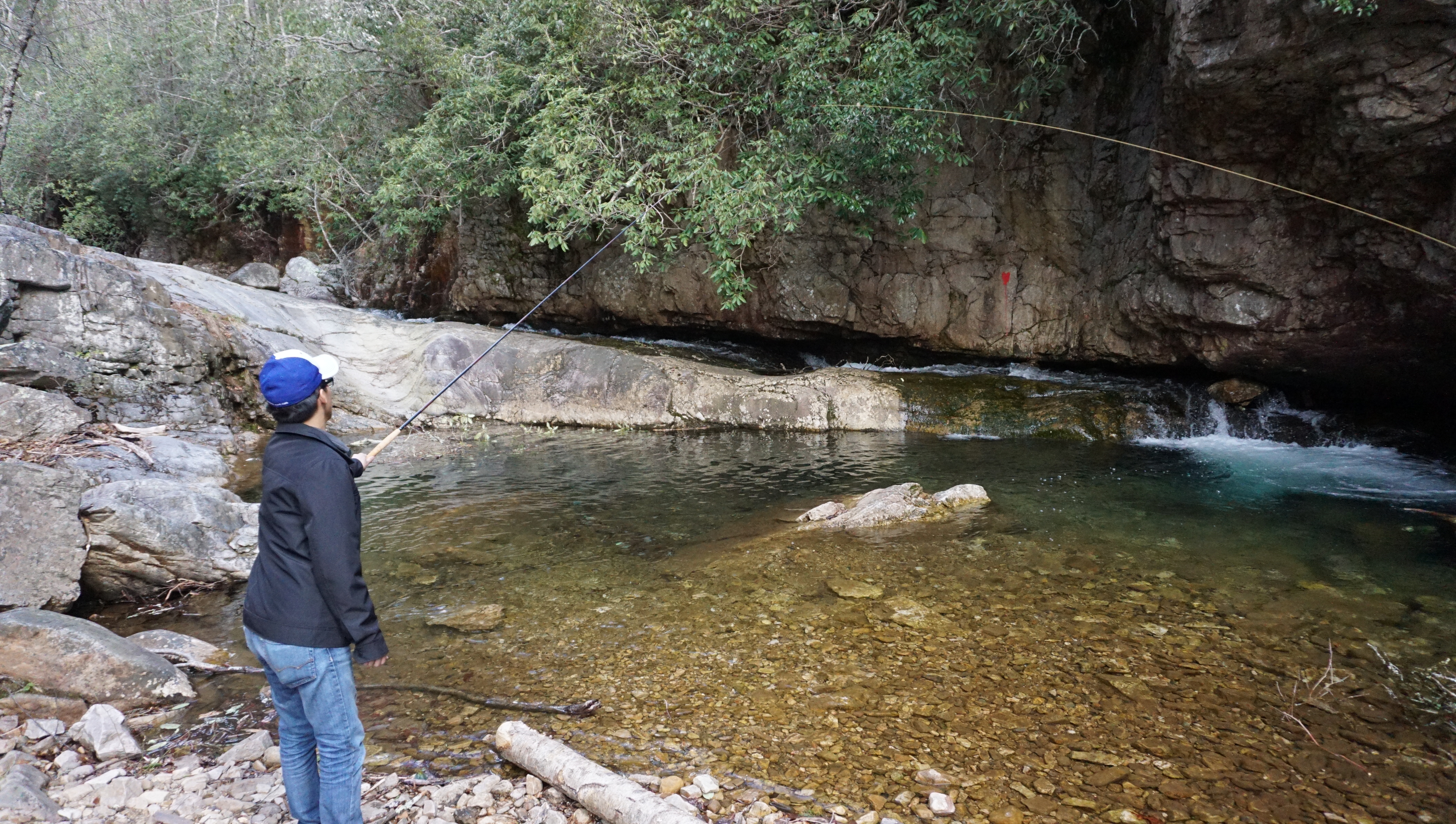
One thing is certain when you’re out on a camping trip. It will reset your circadian rhythm. Having just come off a night float rotation, it took only a couple of days for me to be fully adjusted. Out in the wilderness, there are no alarm clocks, you simply obey the sun in the sky. When it rises, you rise. We woke to the early cries of loons and the sun beating on our tents. It was a relaxing day of swimming, fishing, photography and paddling. Life out here is pretty simple, and I certainly love it. No busy schedules out here, no pagers, no phone calls, no e-mails. When you’re thirsty, go filter water. You’re hungry? Get the fire going and heat up some food. Dirty? Go swim in the lake. That afternoon we paddled out and fished on different islands.  None of us claim to be great fisherman and only had a few bites here and there. Nevertheless it was still a great time. Maybe one day we will land that giant northern pike.

Day 5: Paddle out

I guess all good things must eventually come to an end. Before we knew it, our time in La Verendrye had approached it’s end. After 5 days in the sunshine, it was time to head home. The water was calm that day as we packed up the remaining bits of gear and tied up the wannigan. It was a good half a day of paddling to reach the Le Domaine beach. We arrived at approximately noon where we met with some fellow canoeists. We chatted briefly and shared our experiences of the circuit. These experiences are what make canoe camping so special. The launch sites are always filled with interesting people from all over the continent, who have traveled great distances to enjoy the same beauty.

Our time in La Verendrye felt far too short and we were able to explore only a fraction of this gigantic wilderness area. I am truly glad we decided to come here and canoe in French Canada.  I don’t think any of us could have asked for anything more: no rain, no accidents, and a spectacular viewing of the northern lights on the first day of summer. I will always remember this land for the incredible scenery, the blue waters and the magnificent sunsets. Au revoir La Verendrye.

dsc03169

Warehouse Landing, Gloucester VA

richmondtowareriver
The Chesapeake Bay is a short 1 hour drive away from Richmond, VA.

There is never a shortage of waterways to explore in Virginia. In a short 1 hour road trip from Richmond, one can reach the largest estuary in the United States; the Chesapeake Bay. Here, fresh water from over 150 rivers and streams of New York, West Virginia, Pennsylvania, Delaware, Maryland, District of Columbia and Virginia meet the Atlantic Ocean to create a brackish water ecosystem teeming with diverse wildlife and vegetation. There isn’t a better way to connect with this landscape than by canoe. We decided to paddled through the south arm of the Ware River, one of five canoe trails that make up the Gloucester Blueways. The county established these Blueways as a way to encourage visitors to the area and to encourage preservation of these precious lands.

DSC02021
Unloading at the Mobjack Bay

The population of bald eagles and osprey has been healthy in recent years and we had were within sight of them the second we reached the put in. The salty waters of the Mobjack bay was surprisingly clear and calm as we embarked on our excursion.

DSC02026
The launch

A sense of calm and stillness surrounded us as we approached the wetlands. We were protected from the wind by reeds and twists of and turns of the stream. I was stunned by the vast array of wildlife we encountered. From blue crabs, to herons and even a red-tailed hawk, each bend of the river presented a new surprise.

There is certainly something very special about the wetlands. For years the Chesapeake Bay Foundation has been fighting to protect these lands. These regions are especially important in preserving the clarity of the Chesapeake bay. It is the final stop for all of our river and stream runoff from land before it reaches the bay. The major pollutants of the bay are in the form of nitrogen and phosphorus. Such elements are crucial to life, however an overabundance can be detrimental. When these elements are in excess, they contribute to algae blooms which clouds the water and inhibits sunlight that is crucial to the growth of bay grasses. The decline in oxygen from dying plants can cause dramatic pH changes which can kill off crabs, fish and more plants. Today, 300 million pounds of polluting nitrogen reaches the bay each year, over 6 times the amount that reached the bay in the 1600s.

into the wetlands
into the wetlands

While the war effort in cleaning the bay is underway on many fronts. Many believe that the oyster will be the savior of the bay. The eastern oyster is an incredibly resilient species, although years of disease, pollution and over harvesting have caused numbers in the bay to decrease to less than 1% of what it once was. This shift in oyster population has also contributed to the decline in the health of the bay. Oysters are able to filter up to one gallon of water in one hour. They play a vital role in preserving the clarity and hence the habitat of the Chesapeake Bay. In the recent years, the news has been promising with oyster populations making a bounce back and with them, the blue crab population. Both iconic species of the Chesapeake Bay.

I had some time at the end of this trip to reflect on some tripping gear as well. This was my third outing on the prospector, and so far she has been handling like a dream. At only 52 lbs, she’s a breeze to load onto the car and take anywhere. She is responsive and feels comfortable on all different types of water. The comfortable yoke design also makes her almost a joy to portage…but i wouldn’t go that far. I’ve also been quite happy with the Sony a6000 mirrorless camera I’ve been shooting with. I’ve realized that I normally shooting in fairly wide angles at an average of 16mm. Although I haven’t used many other lenses other than my portrait 35mm, I can definitely see the utility in the zoom lenses >250mm in capturing wildlife. The eight bald eagle sightings on this trip convinced me to at least look into some of these lenses.

DSC02025
Mobjack Bay, Virginia

The scorching Virginia summers often steer our canoe trips to the cooler mountain lakes, however this is spring, and anything is fair game. It was actually a refreshing and chilly day as we paddled, at temperatures in the 50s F. Let’s see how long these cool temperatures last. With the north arm of the Ware River and four more routes to explore on the Gloucester Blueways, there’s still plenty to see. Long live the Chesapeake Bay.

Learn more about the blueways here: http://www.gloucesterblueways.org/

Help save the Chesapeake Bay here: Chesapeake Bay Foundation

St Mary’s Wilderness – George Washington National Forest, VA

DSC01814
The trail to the waterfalls follows St. Mary’s river as it meanders through the Blue Ridge. Follow the pink ribbons to reach the falls.
stmarys
A 2 hour drive to reach the well maintained St. Mary’s Road. Approach the trail from the Cold Springs Road.

When presented with free time and the opportunity to explore arises, it can be difficult to decide where to go. The number of destinations seem endless with each place offering something completely different: the Blue Ridge mountains to the west, the coastal tidewater to the east and the Appalachian plateau to the Southwest. I usually end up letting the season and conditions deciding for me. What better place to explore in early Spring than the St. Mary’s Wilderness Area in the Blue Ridge? I read numerous reviews about the area of its beauty and clear river beds. St. Mary’s is designated a wilderness area, and as such, the trails are poorly marked. It appeared that summer hikers frequently got lost on the poorly marked trails and overgrown brush. I hoped to avoid all of this by navigating in early spring, with bare trees and clearer paths.

Spring
Spring flox

My cousin from Toronto accompanied me on this outing, marking his first proper hike in Virginia. When we arrived to the trail head, I was surprised to find that the earth was scorched and the trees charred. I later learned that a wildfire just two weeks prior had burned over 800 acres of the wilderness area. St Mary’s spans over 35,000 acres making it the largest Virgina Wilderness area on national forest land. The region was previously a mining ore for manganese and iron until it was abandoned in the mid 1900s. Today it serves as a beautiful hiking and fly fishing trail along the St Mary’s River, complete with a beautiful waterfall at the end.

There are numerous routes to get to the waterfall. The most popular route listed on Hikingupwards.com recommended starting out along the Blue Ridge Parkway. One reviewer discouraged this path, because it was poorly marked and he took numerous detours after getting lost. They recommended an easier way to get to the falls. Off of Cold Springs Rd (Route 608) is St Marys Road. This road is in excellent shape and leads you all the way down to a well kept parking area and the beginning of the trail that puts you right next to St Marys River. From there, you simply follow the river to the falls. Internet win.

DSC01940
We tried our hand at some Tenkara, a form of Japanese fly fishing that does not require a reel.

The hike twists and turns through a beautiful gorge, providing a unique vista in Virginia. There was lots of rock hopping, and scaling as the trail crossed back and forth over the river five times. We tried our hand also at some Tenkara (traditional Japanese fly fishing). This style of fly fishing uses only a rod, line and fly – no reel. With flask in hand with some Nordic honey wine and packed lunches, we enjoyed the peace of spring time in the mountains.

Voyageur Quest (Algonquin Park) by David Hartman

My favorite adventure, documentary filmmaker, David Hartman recently released this cool promo video he created for a company called Voyageur Quest in Algonquin Park, Ontario. Located in the remote Northwest corner of Algonquin Park, the company offers visitors a chance to stay at a cabin completely off the grid. They offer activities and lodging throughout the year for visitors to experience all that Algonquin has to offer. The video does an amazing job capturing the beauty and atmosphere of Algonquin Park. I have camped in Algonquin Park numerous times in my childhood and recently took a weeklong canoe trip with my brother in August 2014. Itching to go back.

Check out more of David’s work at his website: Hayfire Media.

The Path of Grey Owl – a Goh Iromoto film

This film by Goh Iromoto sheds light on the remarkable story of Grey Owl (Archibald Belaney), an Englishman who chose to take on the identity of a member of the First Nations people in Ontario, Canada. He was most noted for his work as a conservationist, protecting animals such as the beaver that were essential in maintaining the forests and landscapes in Ontario. Evidence of his work as a conservationist still remains today in Canada. This video also showcases the beauty of the boreal land in Temagami, Ontario, a place I was fortunate enough to experience on our canoe trip in August 2015. Itching to go back.

Making a Leather Journal

Writing during a trip is always a fulfilling experience. Whether you are noting waypoints on a map, making a quick sketch of the landscape, or jotting down memorable moments, such acts allow you to slow down and reflect during a journey. In my mind, there is only one place to log such entries, an old fashioned hand-bound leather journal. I wanted to make something that was durable, handsome and consistent with the tradition of my field outings. Let’s get to it.

Materials:
vegetable tanned leather
cutting blade
cutting board
leather dye
leather conditioner
leather edge beveler
waxed thread
parchment paper
metal ruler
stitching awl
needle nose pliers
hammer

DSC00465

Step 1: Creating the signatures

The first step in making a journal, is to decide how many pages you want to bound, and then dividing them into signatures (unit of folded pages that will be stitched). For instance, if you wish to have 50 sheets in your book, you might want divide them into signatures of 5, each signature having 10 pages. Different types of paper can be used however I preferred to use acid-free parchment paper for the texture and look of the journal.

Step 2: Preparing the leather

Different thicknesses of leather can be used and this will be entirely up to you. You can purchase boxes of scrap leather from Amazon for less than $25 dollars. For this project, a thick vegetable tanned leather was used to give it the durable and thick appearance I wanted. The leather was cut to leave approximately 1/2 inch of leather bordering all of the pages. Once the leather has been cut, you will notice that the leather can have some fraying of fibers from the cut edges. This is where you will use an edge beveler to clean up all of the edges of the leather, giving it a nice and finished appearance.

DSC00466
template

Step 3: Preparing the leather for stitching

In order to assure that all signatures are sewn at a consistent distance from each other, I created a template. This way, all holes will be exactly where I want them to be positioned on the leather. Also, in the future if I decide to create a leather journal with similar dimensions, I could easily use the same template. Depending on the thickness of the leather, this task can be a little time consuming. I initially made the holes with a stitching awl, and then subsequently widened them with a thicker needle and hammer. Needle nosed pliers were also used to help pull the needle through the holes. Once you are satisfied, the leather can also be softened at this stage. This can be accomplished in many ways. One method is simply to manually flex the leather to give it a more broken in feel. Another way is to use rubbing alcohol on the leather and then add petroleum jelly to penetrate the leather.

Step 4: Staining

This can be accomplished with a variety of different stains and colors. I decided to use a stain from Ecoflow called acorn born. It is important to use an old clean cloth for this step to assure that you rub the stain evenly throughout the leather. If not, the stain will be absorbed more readily in some areas of the leather than others, causing an uneven appearance. This may not be a bad thing, as some of you may opt for this appearance.

Step 5. Stitching the signatures

Stitching was completed using a thick waxed thread designed specifically for leather use. This was a lengthy process considering I had 8 signatures to sew in place.

Conclusion:

In the end, I was overall very happy with the journal. It feels sturdy and strong and the acorn brown stain came out looking fantastic. It is an overall quick process and with the proper leather tools can be a very fun project. I encourage any one who has ever wanted one to give it a shot. This will definitely be accompanying me on my field and canoe trips.

DSC01420

“Spirit of Killarney”

In July 2015, we set out to explore the turquoise waters and white quartzite mountains of Killarney Provincial Park. The landscape inspired countless works by Canada’s Group of Seven Artists. This is a video of our trip. Filmed on several different cameras: Sony Nex5, Nikon 5200, GoPro Hero 2, Iphone 5 and 6.

View the full trip log here.

Save the Boundary Waters (A Year in the Wilderness)

“Dave and Amy Freeman will embark on a yearlong adventure in the Boundary Waters Canoe Area Wilderness in support of the Campaign to Save the Boundary Waters’ efforts to protect the Boundary Waters from proposed sulfide-ore copper mining on the Wilderness edge. The two will travel more than 3,000 miles by canoe and dog team as they explore more than 500 lakes and streams throughout the year. The journey will begin on September 23, 2015, the fall equinox, on the edge of the Boundary Waters in Ely, Minnesota, and conclude with a paddle along the proposed sulfide-ore copper mining’s path of pollution through the Boundary Waters and Voyageurs National Park. In 2014, Dave and Amy traveled by canoe and sailboat from Ely to Washington, DC, on the Paddle to DC as a first step in their efforts to protect the Wilderness.” – savetheboundarywaters.org

Please help show your support for the boundary waters by visiting the website and signing their petition. Mining affects many of our great canoeing regions. This reminds me of the Temagami region in Ontario and the pressure that mining companies constantly exert on our pristine wilderness areas. What’s unique to the BWCA is the special place it holds in the hearts of many of the American veterans. It serves as a healing place for many of these veterans and is the least we can do as a country to protect it for them.