Autumn in the Shenandoah Valley

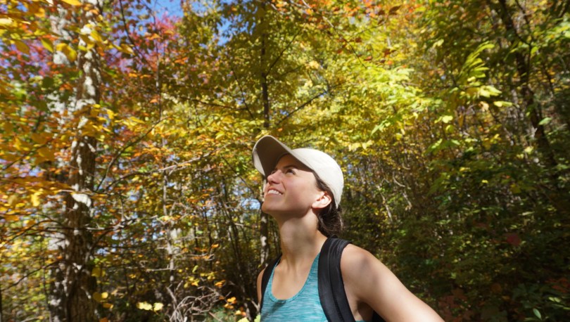
We try to make it out to the Blue Ridge Mountains of Virginia for vacation during peak fall foliage time each year — a chance to breathe in the cold mountain air, watch the colors change and reset as a family.

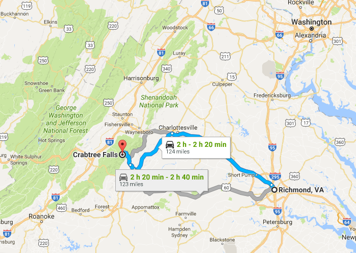
We stayed this time in Massanutten (a census designated place), in the heart of Shenandoah Valley of Virginia. Much of the attraction to this area centers around the ski-resort, however during the fall time it served as a great base for us to explore the surrounding region.

Massanutten, VA

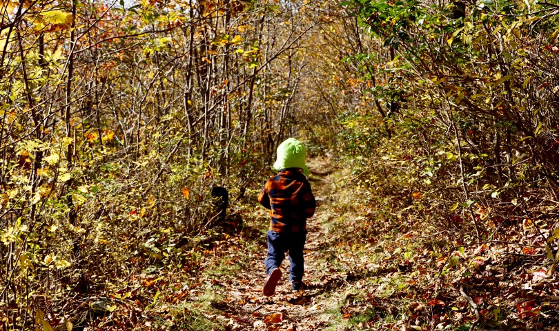
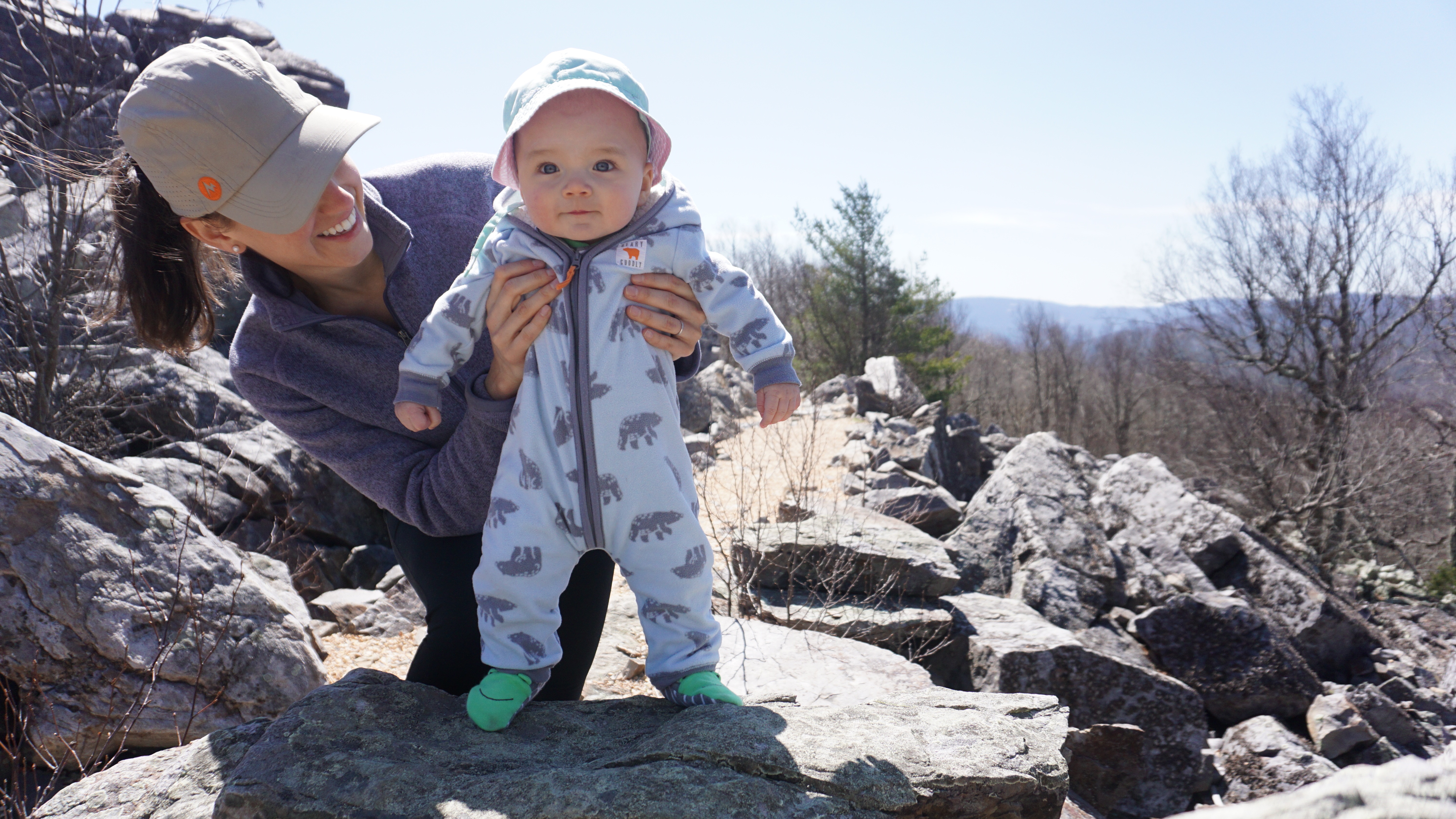
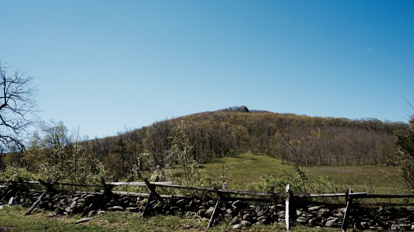
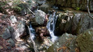
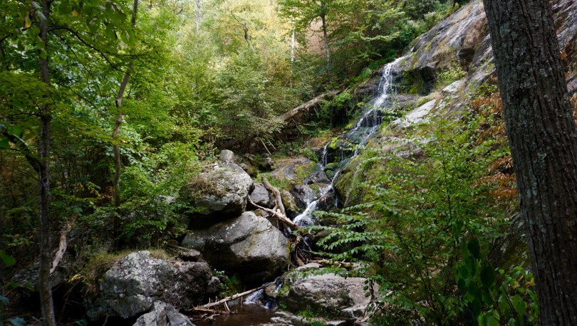
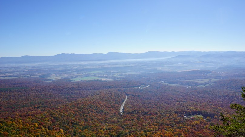
One of the first adventures took us to the Massanutten Story Book Trail, located in Shenandoah County. It was a short, paved hike about 0.7 miles long. It was perfect for our family with kids of ages 5, 2.5 and 8 months. The trail is paved and very accessible for the most part. There are numerous boulders and a wide array of oak species to explore. The view at the end is pretty spectacular – with Shenandoah National Park in the far distance. We took this trail on in late October and I was surprised that there were a lot of gnats about, so be sure to pack some bug spray.

Parking area for the Story Book Trail. These mountain mites are ready to explore.
The view atop the Story Book Trail. Shenandoah National Park is visible in the far distance.

One of the highlights of our trip for the kids was visiting Showalter’s Orchard and Greenhouse in Timberville, Virginia. On a weekday, we found that we had the orchard mostly to ourselves. The kids got to enjoy some donuts, cider and apple treats. The trees in the orchard were packed with apples and were low lying. Fuji apples were in season at the time and the kids had no trouble filling up the bags. Old Hill Ciders are also pressed and made at this same farm in Timberville. We were blessed with spectacular clear skies.

The Massanutten ski resort area still had plenty of activities for the kids in the off season. There were playgrounds, ponds to fish, a water park, trails to explore, restaurants and even an area for gem hunting. The kids were never bored.

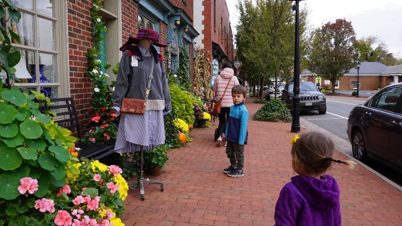
On our way back home, we made a stop in the small town of Gordonsville, Virginia for a lunch break. A local recommended The Jackson and Company Market and I’m glad that they did. It was a chilly fall day and it was the perfect place for the kids to warm up with soup and for the grown ups to have coffee. With a population of approximately 1500, the main street was where all of the action seemed to be. Shops were busy and people were getting ready to put up the town’s Christmas lights. There was even a blacksmith shoppe that we unfortunately didn’t have time to check out, but I guess it’s just more reason for us to come back to the mountains. We’ve been coming to the Virginia blue ridge and Shenandoah for years, and maybe we’re just simple folk, but it just seems like there’s endless things to see, do, and enjoy in this special place.

Main Street of Gordonsville, Virginia
A warm place for soup, quiche and coffee. The Jackson and Company Market in Gordonsville, Virginia was perfect on this chilly fall day.

In traditional dad fashion, I filmed our trip on my trusty a6000. I’ve had the camera for 8 years, and it’s still going strong.

Sherando Lake – Lyndhurst, Virginia

  • Elevation: 1820 ft
  • Location: Sherando Lake Recreation Area, 96 Sherando Lake Rd, Lyndhurst, VA 22952
  • Latitude : 37.919724, Longitude : -79.01
  • Date: 10/21/2021

The George Washington and Jefferson National Forests contain almost 2 million acres, with most of these acres in Virginia (1,664,110 acres). The remainder is mostly in West Virginia (123,629 acres) and then Kentucky at 961 acres. It is home to some of the most beautiful mountain lakes in Virginia. Lake Moomaw and Switzer Lake are two of my favorites. I’ve heard much about the popular Sherando Lake, which is probably the most popular of the lakes given it’s ease of accessibility and plethora of facilities and amenities. Many people come here to swim, camp, hike and of course fish the stocked trout.

img_3068

During a week long trip out to the Blue Ridge Mountains, we made a day trip to Sherando Lake to check it out. With  2 little ones in tow, we hiked an easy trail around the lake at 1.4 miles with very little elevation gain of about 100 ft. The spring-fed lake is small at 25 acres, but picturesque. The entrance to the lake is magnificent, with small stone bathhouses and small bridges that cross meandering creeks. There is a designated beach area for swimmers which I’m sure is packed during the summer months. The trees were starting to turn in late October and the air was crisp.

If you are thinking about heading to Sherando Lake for a day trip or for a camp out, just do it. You won’t be disappointed. (For the paddlers out there, make sure you bring your own canoe/kayak, there are no rentals on site.)

Directions

Location: Sherando Lake Recreation Area, 96 Sherando Lake Rd, Lyndhurst, VA 22952

From I-64: Take exit 96 just east of Stuarts Draft. Turn south onto State Route (SR) 624 and continue. At Lyndhurst, the road changes to SR 664/ Mount Torrey Rd, but there is no distinct turn. Continue south on SR 664 approximately 8 miles to the entrance to Sherando Lake Recreation Area on the right.

From the previous site on the Thomas Jefferson Loop of the VBWT:

About 1 mile down Sherando Lake Road from SR 664, head right for a small parking and lake access area or left for parking, lake access, restrooms, information, camping, and hiking trails.

From Royal Oaks, travel north on SR 814 for 3.6 miles to SR 664. Continue straight onto and follow for 0.6 miles before turning left onto Sherando Lake Road.

To return to the interstate, return to the Blue Ridge Parkway and follow it south to SR 56. Turn right and follow this to I-81. From here, turn north to begin the Forest Trails Loop or south and start the Rockbridge River and Ridge Loop.

Frazier Discovery Trail – Shenandoah National Park, Virginia

  • Distance: 1.3 mile loop
  • Elevation: 2852 ft
  • Elevation gain: 462ft
  • Rating: Easy (although still some steep segments)

The Frazier Discovery trail is a 1.3 mile circuit hike on Loft Mountain in Shenandoah National Park, notable for several great overlooks. With an elevation gain of 462 ft, it is labeled as one of the easier trails in the park, we found it perfect for our small hikers (4 and 2 years old). Located at milepost 79.5, it is closest to enter from the Southern end of the park at Rockfish Gap (approx 20 miles). There are several overlooks on your way to the trail head, so take your time getting there.

dsc01526
Make sure you take the time to pull on one of the beautiful overlooks as you make your way to Loft Mountain.
dsc01511
View from one of the outlooks from Skyline Drive near the Rockfish Gap Entrance to Shenandoah National Park.
dsc01534
The beginning of the trail. Cross Skyline Drive on foot to begin.
dsc01561
Trekking poles are helpful but not mandatory. A hiking stick can be just as good.

We parked at the Loft Mountain Wayside Camp store and information center and crossed the road (skyline drive) to begin our hike. Hiking on a Tuesday, we were fortunate enough to have the mountain to ourselves. It appeared that the leaves were changing colors slightly later than normal. I find that peak fall color in the Virginia Blue Ridge Mountain region is last week of October and early November.

The trail is well marked, and frequently traveled. There are plenty of rocks so hiking boots are definitely recommended. Unlike several other trails through Shenandoah National Park, there was no stream or river bed on this hike….But the views were killer. Have fun out there, and be safe.

dsc01593
Overlook from Frazier Discovery Trail on Loft Mountain
dsc01568
Don’t forget snacks!

Things to bring:

  • hiking boots (highly recommended)
  • water
  • map
  • compass
  • trekking poles (helpful)
  • dress appropriately
  • snacks
  • camera
  • helpful maps below

Shenandoah National Park – Black Rock Summit

October 18, 2020 –  It seems like the only normal thing in 2020 has been the autumn season. By late September, we had already experienced our fair share of chilly days in Virginia. This welcoming drop in the temperatures seemed to trigger the leaves to change color on time. Although tired from the busy work week, we needed to escape to the mountains, specifically to our backyard national park, Shenandoah National Park. We were going to take on what seemed to be a family favorite of late: the Black Rock Summit Trail. This easy 1.0 mile loop was where we took our son for his first hike, and now we were going to take our daughter there for her first hike.

We arrived at the park entrance to find a short line of cars. I think this was the first time I’ve ever had to wait in line to get into Shenandoah. It seemed like everyone wanted to escape quarantine madness and get outside. I don’t blame them. All along the way, people were pulling off at scenic outlooks to take photos of the fall foliage. The parking lot for Black Rock Summit was full when we arrived but we had no trouble finding parking on the side of the road. Our 3 year old son was able to hike the entire trail on his own this time which certainly helped! The paths on this trail are well marked and it is a short hike to get some amazing views, highly recommended if you have young kids in tow. 


Minh’s first hike in Shenandoah, Black Rock Summit. 3/31/2018
Our first hike up Black Rock Summit. Shenandoah National Park. 7/23/2016

Humpback Rocks – Blue Ridge Parkway, Milepost 5.8

The Blue Ridge Parkway spans a total of 469 miles, weaving though the scenic mountains of Virginia and North Carolina. Millions of visitors flock to the parkway, especially in the fall time, to experience the rich geology, wildlife, history and tradition of this special parkway. Spanning over two states, the blue ridge parkway is divided into four sections: Ridge, Plateau, Highlands, and Pisgah. The Ridge Region (northernmost region) is the region I’ve naturally explored the most by proximity.

A short 1.5 hour drive from Richmond, VA, Humpback Rocks is an easy day trip.


It begins in Afton, Virginia at the southern end of Skyline Drive where Shenandoah National Park ends. It runs through the beautiful George Washington and Jefferson National forests and is known for its beautiful rolling pastures and waterways. At milepost 5.8, is Humpback Rock, one of the most popular hikes in the ridge region. It is probably the best bang for your buck hike in the region, a short (but very steep 1.0 mile hike) will take you to the top of the rock formations for a breath taking view of the blue ridge. The Accreditation Council for Graduate Medical Education (ACGME) has been focusing of late on physician wellness and health” during residency. As a way to combat, burnout and fatigue, they are encouraging residency programs across the country to embark on retreats to discuss difficult topics and to better connect with one another. April 27, 2019 – A short 1.5 hour drive and we were away from the hospital and into the mountains. It was a chilly spring day and the skies were clear. It still amazes me, how nature has the ability to recharge and kickstart that internal engine…..further emphasizing the importance of keeping these special areas preserved for future generations to enjoy.

Before the hike

The crew on top of a mountain

Return to White Oak Canyon – Shenandoah National Park, VA

TRAIL MAP OF THE WHITE OAK CANYON AREA

During the hot, summer months in Virginia, the watering holes of Shenandoah National Park are natural sanctuaries for those looking to escape the heat. No trail is better for this than the popular White Oak Canyon Trail. It is the second busiest trail in the park and for good reason – this hike is packed with picturesque pools, natural water slides and waterfalls flowing with pristine, mountain water.

The entire circuit, however, is no easy, feat. For those looking to complete the entire Cedar Run / White Oak Trail circuit, be prepared for a strenuous 8.2 mile hike that covers a steep elevation climb of over 2000ft in rocky terrain.

At the beginning of the circuit, is the Whiteout Canyon parking lot (which can fill up quickly during peak seasons). From here, as you start the trail, you will come to a fork in the road. On the left, will be the Cedar Run trail, and to the right is the White Oak Canyon trail. The entire circuit can be completed in any direction, however it is strongly recommended, to start up the cedar run trail. Completing the circuit in this direction has many advantages. The ascent up cedar run trail is a much more gradual climb with softer terrain. Once you reach the top, the horse trail and white oak fire road will connect you to the top of the white oak canyon trail where you can begin your descent towards the parking lot. Now you can relax and take in the numerous beautiful falls on this side of the trail (you will also have breath to enjoy them).

scouting the falls

Obviously, one does not have to hike the entire circuit to enjoy a good swim. From the parking lot, it is a short 2 mile hike to get to the white oak lower falls. This is probably the most spectacular of all of them. If you’re looking for natural water slides, head to the cedar run falls on the east part of the circuit, where you can check out two awesome water slides. There are also several areas here where you can jump into the pools. Please be careful as this can be dangerous if you have not established the depth of the pools. I bring along a pair of swimming goggles to scout the water for depth and debris before jumping.

Lower White Oak Canyon Falls, the biggest swimming pool on the circuit

There are many other surprises on this circuit. The pools have healthy populations of native brook trout so bring your fly fishing rod. Consider a tenkara rod for these tight spaces up in the mountains. Wildlife here is also abundant and black bear sightings are common, but don’t worry, they tend to keep to themselves. The trail is so busy that the human voices will keep them away. But as always, just be smart and don’t agitate the wildlife, we are visiting their home after all.

On a hot summer day, there’s not a better place to be in Virginia. Be safe, and have fun.

Bring your tenkara rod, to fish for native rookies

resting at the top of white oak canyon

What to bring:

  1. hiking boots
  2. lunch
  3. water shoes (for swimming)
  4. swimsuit and towel
  5. swimming goggles (optional)
  6. plenty of water
  7. water filter (optional)
  8. map
  9. bug spray (especially around the ankles)
  10. fly fishing rod (optional)


*As always, please help keep our parks clean. Take nothing but photos, and leave only footprints!

Happy New Years

screen-shot-2016-12-29-at-10-57-53-pm
The North Fork of the Shenandoah River

We spent Christmas in a cabin along the Shenandoah River, just west of Shenandoah National Park. The weather was warm enough to paddle, so we paired up siblings and went head to head in canoe races up and down the river. It was rare for all of us to have a holiday break together so we naturally had to make the most of this occasion. I had never been to the town of Shenandoah (population 2354 in 2013) before this outing. And as we drove through this sleepy town, it was hard for me to imagine that this place served a key role during the civil war. There were three iron ore furnaces around this town which smelted raw iron into pig iron. Apparently in the days before the war, this pig iron was shipped down the Shenandoah River to Harpers Ferry in West Virginia. During war time, these goods were transported by wagon to Gordonsville, VA and then subsequently by rail to Richmond where it could have been used at the Tredegar Iron Works. Both of these Virginia mountain towns now are peaceful and quiet as can be. I was especially impressed by Gordonsville’s display of Christmas Lights. It was certainly a welcoming sight while driving through the winding, dark and foggy roads of the mountains.

I just realized that I have not been able to produce any new videos of canoe trips this year. I have several projects in the works right now but they have yet to be polished. I’ve been very happy overall with the performance of the Sony a6000 both as a still and video camera. Lately I’ve been experimenting with different lenses and shutter speeds in videography and have been able to catch some pretty decent footage. For our trip in Quebec, I also brought along an external audio recording device to see how the audio quality would compare to the native mic. Here is a demo reel of random shots I was able to capture in 2016.

2016 Demo Reel: by John Le

As the holidays come to a close and a new year around the corner, I look back at how much time I was able to spend with family and friends and the total number of nights I camped outdoors. While it was a good year for paddling and hiking, the total number of nights I spent outdoors, totaled just five. Four of those nights were in the La Verendrye Wilderness Reserve of Quebec, Canada and the other night was spent camping in St. Mary’s Wilderness. I’ve made up my mind….in 2017, I’m going for double digits. Happy New Years to all!

dsc04209
Gordonsville, Virginia – all decked out for Christmas. In the middle of the Virginia mountains.

Rip Rap Trail – Shenandoah National Park

south
South Entrance to Shenandoah National Park, Rockfish Gap.

Fall is the busiest time along Skyline Drive and the Blue Ridge Parkway in Virginia, and it’s easy to see why. The crisp mountain air and the gorgeous colors have us strapping on our hiking boots as much as possible. This last impromptu hike was actually suggested by our friends. They are preparing for a trek through Patagonia and wanted to get some good hikes in to build endurance. They suggested a trail I had never been on, the Rip Rap Trail Loop in Shenandoah National Park. A strenuous 9.8 mile that starts at Wildcat Ridge, then meets up with the Rip Rap Trail to finish the loop. We entered the park through the familiar Rockfish Gap Entrance and parked in the Wildcat Ridge Parking Area.

dsc03880
Mountain streams

The initial trail is a moderate descent down into the valley where we traveled along side the mountain stream known as Meadow Run. We crossed the streams several times and before beginning our ascent up to Chimney Rock. I would say that the first half of this hike is much prettier than the second half. I am partial however to hiking along the gentle streams as they meander through the valley. This hike is known for it’s beautiful watering hole at the bottom of the valley where two streams merge into one 50ft long watering hole. I’ll try to come back one day in the summer to camp and swim at this location. Peak fall colors seemed to arrive later than ever this year, attributable to the much warmer temperatures we have seen over the past years.

dsc03866
crossing streams

I often worry about how climate change will impact the fragile environment around us. This would mean hotter summers, longer mosquito seasons, a harsher environment for the brook trout that thrive in cold mountain streams. In Canada the effects can already be seen with ticks on the rise, as they are able to establish more stable populations in the increasingly warmer climates.

For those that have not seen it, Leonardo DiCaprio released his documentary “Before the Flood” last week. It highlights climate change and the barriers we face as a planet in addressing this pressing matter. I highly recommend this film to everyone. I thank DiCaprio for his efforts in raising awareness about global warming, an issue that affects us all.


Crabtree Falls/Spy Rock – Montebello, Virginia

screen-shot-2016-09-22-at-8-20-49-pm
Richmond to Montebello, Virginia

The changing of the seasons is always a special time in Virginia. Although the summers can be uncomfortably hot and humid, I’m always sad to see it go. Before the official end of summer, we traveled out to the Blue Ridge Mountains in George Washington National Forest to hike Spy Rock, near Montebello along Route VA 56 West. The hike is of moderate difficulty at 3.2 miles and we paired it with a quick run up Crabtree Falls, the tallest waterfall in Virginia.

In the mountains, the climate was noticeably different; it was at least 10 degrees cooler and the earliest hints of yellow and orange leaves signified that fall was already here. The trails at both hikes were packed filled with people as we expected on a pretty Saturday. We parked at the Montebello Trout Hatchery because the main parking lot was already full. This gave us a nice opportunity to examine the rainbows, browns and brook trouts that were being raised. While only the brook trout is native to Virginia, the browns and rainbows are a popular trout species to raise since they grow to massive sizes and promote a healthy fly fishing culture in the Virginia mountains.

dsc03589
Spy Rock at 3980ft provides a 360 degree view of the Blue Ridge Mountains

The hike up Spy Rock took us along a rocky road for the initial segment until it intersected with the Appalachian Trail to take us to the top of Spy Rock. The view atop is impressive, allowing a full 360 degree view of central Virginia. We ate a quick lunch and made our descent and back into the car along VA 56 to Crabtree Falls. We then ascended the first mile up Crab Tree Falls to view the lower falls. The water was slow flowing at the end of summer but still a magical sight. On the way home we visited the Albermarle Ciderworks for a cool drink and dinner in downtown Charlottesville. I am sad to see summer go but excited for all the things fall has to offer: camping, changing colors, harvests and of course the start of the holiday season. Cheers to Summer 2016.