John’s Point (Gloucester Blueways), Gloucester VA

“There is but one entrance by sea into this country, and that is at the mouth of a very goodly bay, 18 or 20 miles broad. The cape on the south is called Cape Henry, in honor of our most noble Prince. The land, white hilly sands like unto the Downs, and all along the shores rest plety of pines and firs … Within is a country that may have the prerogative over the most pleasant places known, for large and pleasant navigable rivers, heaven and earth never agreed better to frame a place for man’s habitation.” – Captain John Smith (regarding his exploration of the Chesapeake Bay in 1608)

beach combing for shells and oysters

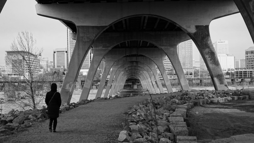
In one of his most well-known passages describing the Chesapeake bay, Captain John Smith’s words still resonate today. This is the largest estuary in the United States and home to an incredible ecosystem. There is no question that the a healthy bay benefits everyone, from a environmental and wildlife standpoint and of course economically. Unfortunately, not everyone shares this sentiment. The future of the bay is uncertain as a proposed budget, by President Trump would eliminate federal funding for the continuing cleanup of the Chesapeake Bay. The Environmental Protection Agency budget  for the Chesapeake cleanup was $73 million. With the new bill proposed, this amount would be $0. Organizations like The Chesapeake Bay Foundation have been fighting the battle to restore the bay for many years. Click here to sign a petition to urge congress to preserve funding for the bay: http://takeaction.cbf.org

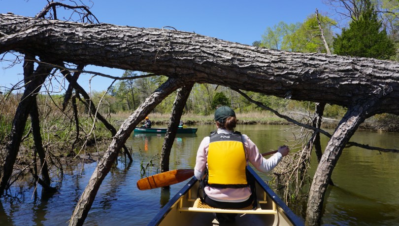
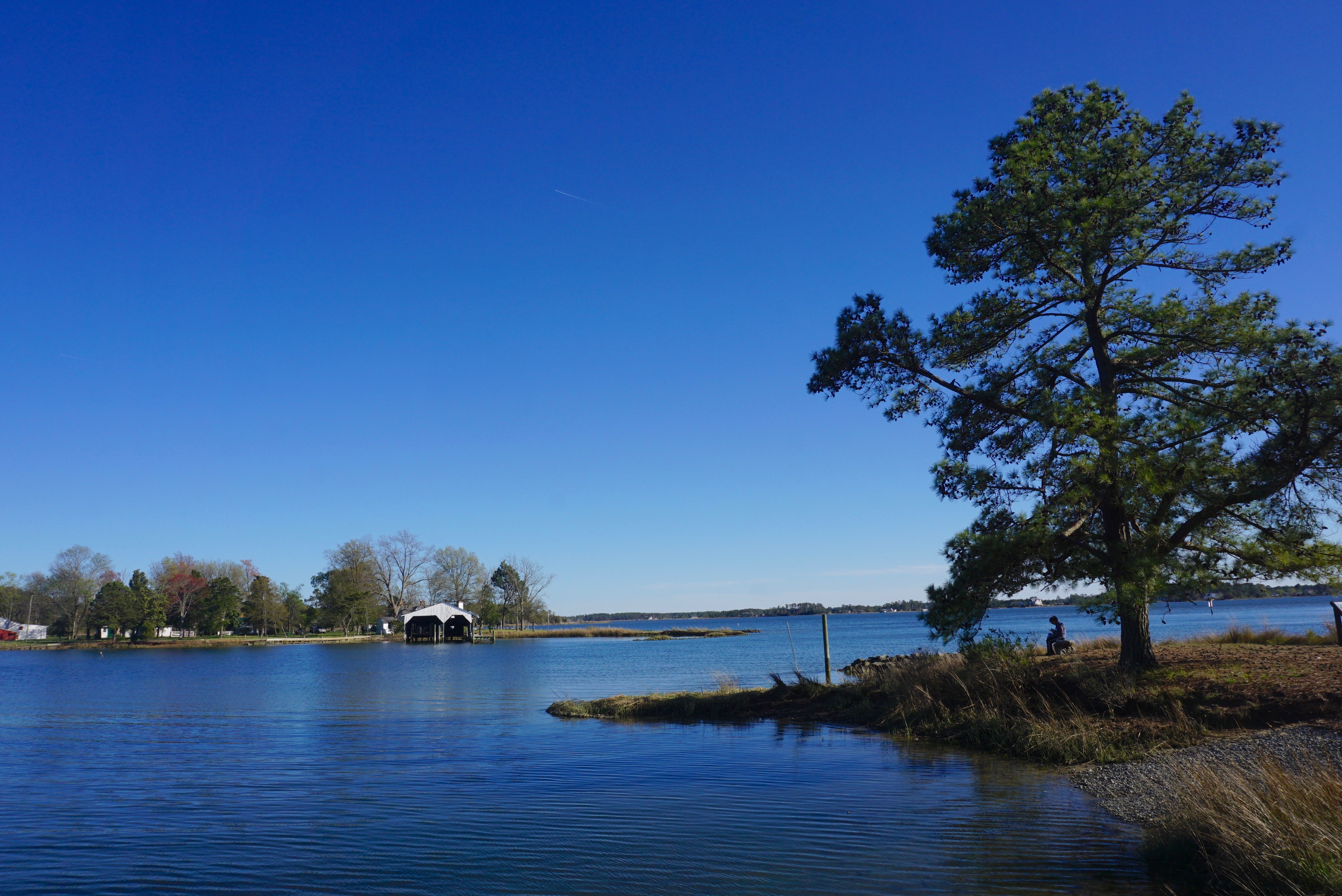
I used this golden spring weekend, to pull out the canoe from the basement and explore another part of the Chesapeake Bay and the Gloucester Blueways, this time, to John’s Point. We paddled the Ware River last year, but wanted to explore another of the 5 total blueways that exist in Gloucester County. John’s Point is very similar to Warehouse landing, the boat launch is very well kept with a nice clean beach as your launch site. It was a windy day, and the proposed trail totaled 8.8 miles along the Severn River toward Mobjack Bay and back was formidable. This might have been possible in a kayak, but we opted to head west instead of east to explore the inner waterways and the beaches in search of crabs and oysters. We took breaks from the wind as we hopped from island to island, and combed our way through the beaches. We saw several ospreys, one egret, one loon and a red tailed hawk. The water was very clear and all along the beach were oysters popping out of the sand. I came out here to feel once again how special the Chesapeake Bay is. What John Smith said about the bay in 1608, still holds today. It is truly a national treasure worth fighting to protect for future generations to come.

Map of John’s Point (8.8 mile loop), from http://www.gloucesterva.info

Help save the Chesapeake Bay here: Chesapeake Bay Foundation

First Snow in Richmond

The Winter Storm Helena arrived to Richmond, Virginia on January 7, 2017, making it the River City’s first official snowfall of the year. We received over 8 inches of snow and with temperature highs around 20s F, it created for the perfect winter wonderland. We spent the weekend playing and exploring this new landscape, blanketed in snow.

We first dominated the slopes of Forest Hill Park and somehow ended up on local TV. We were a little older than the average sledder by about 20 years but that didn’t stop us. We drank at the local craft brewery (Ardent) and hung out at cafes. Despite the condition of the roads, we all gathered to celebrate the wedding of some old friends. The snow made for some great pictures for them.

 Unlike your northern US cities, snow in Richmond falls maybe 3-5 times a year. The average US city accumulates 26 inches of snowfall per year. In Richmond, the yearly average is about 12 inches. The city is not really equipped to deal with it, and as a result, everything essentially shuts down. Everyone is in full relaxation mode – getting outside to build snowmen, sled down the hills or gather at breweries. I sure do miss snow.

dsc04224
The iced over Nickel Bridge
dsc04239
The James River, and Nickel Bridge in the background

Crabtree Falls/Spy Rock – Montebello, Virginia

screen-shot-2016-09-22-at-8-20-49-pm
Richmond to Montebello, Virginia

The changing of the seasons is always a special time in Virginia. Although the summers can be uncomfortably hot and humid, I’m always sad to see it go. Before the official end of summer, we traveled out to the Blue Ridge Mountains in George Washington National Forest to hike Spy Rock, near Montebello along Route VA 56 West. The hike is of moderate difficulty at 3.2 miles and we paired it with a quick run up Crabtree Falls, the tallest waterfall in Virginia.

In the mountains, the climate was noticeably different; it was at least 10 degrees cooler and the earliest hints of yellow and orange leaves signified that fall was already here. The trails at both hikes were packed filled with people as we expected on a pretty Saturday. We parked at the Montebello Trout Hatchery because the main parking lot was already full. This gave us a nice opportunity to examine the rainbows, browns and brook trouts that were being raised. While only the brook trout is native to Virginia, the browns and rainbows are a popular trout species to raise since they grow to massive sizes and promote a healthy fly fishing culture in the Virginia mountains.

dsc03589
Spy Rock at 3980ft provides a 360 degree view of the Blue Ridge Mountains

The hike up Spy Rock took us along a rocky road for the initial segment until it intersected with the Appalachian Trail to take us to the top of Spy Rock. The view atop is impressive, allowing a full 360 degree view of central Virginia. We ate a quick lunch and made our descent and back into the car along VA 56 to Crabtree Falls. We then ascended the first mile up Crab Tree Falls to view the lower falls. The water was slow flowing at the end of summer but still a magical sight. On the way home we visited the Albermarle Ciderworks for a cool drink and dinner in downtown Charlottesville. I am sad to see summer go but excited for all the things fall has to offer: camping, changing colors, harvests and of course the start of the holiday season. Cheers to Summer 2016.


Warehouse Landing, Gloucester VA

richmondtowareriver
The Chesapeake Bay is a short 1 hour drive away from Richmond, VA.

There is never a shortage of waterways to explore in Virginia. In a short 1 hour road trip from Richmond, one can reach the largest estuary in the United States; the Chesapeake Bay. Here, fresh water from over 150 rivers and streams of New York, West Virginia, Pennsylvania, Delaware, Maryland, District of Columbia and Virginia meet the Atlantic Ocean to create a brackish water ecosystem teeming with diverse wildlife and vegetation. There isn’t a better way to connect with this landscape than by canoe. We decided to paddled through the south arm of the Ware River, one of five canoe trails that make up the Gloucester Blueways. The county established these Blueways as a way to encourage visitors to the area and to encourage preservation of these precious lands.

DSC02021
Unloading at the Mobjack Bay

The population of bald eagles and osprey has been healthy in recent years and we had were within sight of them the second we reached the put in. The salty waters of the Mobjack bay was surprisingly clear and calm as we embarked on our excursion.

DSC02026
The launch

A sense of calm and stillness surrounded us as we approached the wetlands. We were protected from the wind by reeds and twists of and turns of the stream. I was stunned by the vast array of wildlife we encountered. From blue crabs, to herons and even a red-tailed hawk, each bend of the river presented a new surprise.

There is certainly something very special about the wetlands. For years the Chesapeake Bay Foundation has been fighting to protect these lands. These regions are especially important in preserving the clarity of the Chesapeake bay. It is the final stop for all of our river and stream runoff from land before it reaches the bay. The major pollutants of the bay are in the form of nitrogen and phosphorus. Such elements are crucial to life, however an overabundance can be detrimental. When these elements are in excess, they contribute to algae blooms which clouds the water and inhibits sunlight that is crucial to the growth of bay grasses. The decline in oxygen from dying plants can cause dramatic pH changes which can kill off crabs, fish and more plants. Today, 300 million pounds of polluting nitrogen reaches the bay each year, over 6 times the amount that reached the bay in the 1600s.

into the wetlands
into the wetlands

While the war effort in cleaning the bay is underway on many fronts. Many believe that the oyster will be the savior of the bay. The eastern oyster is an incredibly resilient species, although years of disease, pollution and over harvesting have caused numbers in the bay to decrease to less than 1% of what it once was. This shift in oyster population has also contributed to the decline in the health of the bay. Oysters are able to filter up to one gallon of water in one hour. They play a vital role in preserving the clarity and hence the habitat of the Chesapeake Bay. In the recent years, the news has been promising with oyster populations making a bounce back and with them, the blue crab population. Both iconic species of the Chesapeake Bay.

I had some time at the end of this trip to reflect on some tripping gear as well. This was my third outing on the prospector, and so far she has been handling like a dream. At only 52 lbs, she’s a breeze to load onto the car and take anywhere. She is responsive and feels comfortable on all different types of water. The comfortable yoke design also makes her almost a joy to portage…but i wouldn’t go that far. I’ve also been quite happy with the Sony a6000 mirrorless camera I’ve been shooting with. I’ve realized that I normally shooting in fairly wide angles at an average of 16mm. Although I haven’t used many other lenses other than my portrait 35mm, I can definitely see the utility in the zoom lenses >250mm in capturing wildlife. The eight bald eagle sightings on this trip convinced me to at least look into some of these lenses.

DSC02025
Mobjack Bay, Virginia

The scorching Virginia summers often steer our canoe trips to the cooler mountain lakes, however this is spring, and anything is fair game. It was actually a refreshing and chilly day as we paddled, at temperatures in the 50s F. Let’s see how long these cool temperatures last. With the north arm of the Ware River and four more routes to explore on the Gloucester Blueways, there’s still plenty to see. Long live the Chesapeake Bay.

Learn more about the blueways here: http://www.gloucesterblueways.org/

Help save the Chesapeake Bay here: Chesapeake Bay Foundation